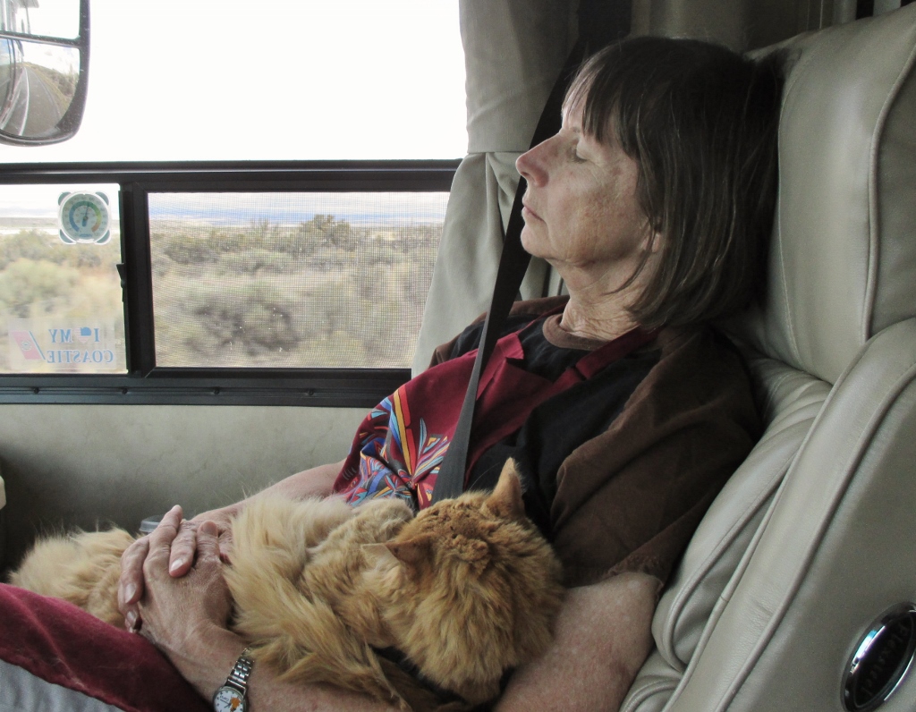
Since Salt Lake City we have been on the road for three days, 836 miles in almost a straight line up to Bellevue. We’ve traveled 4,023 miles in the past 11 weeks, done so much, seen so much. It’s been great. But once we get close to home at the end of one of our trips, we don’t want to stop, we just long to be home. Spike too.
Spike loves to travel because he gets lots of time on my lap while Patrick is driving and I’m navigating, reading aloud about the terrain we’re traveling through, and dozing. Unfortunately, he exudes fur as he sleeps so that by the end of a day on the road, we’re both covered with gold fur. I finally solved the problem while we were at Capitol Reef National Park: I bought a souvenir apron that I put on as soon as we start out each day – Spike climbs into my lap, and the apron gets all the fur. This is how we roll:Snoozers
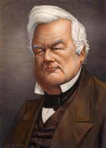
It took us two days to drive north from near the Arizona border up beyond Salt Lake City, where we are camped on Hill Air Force Base (no relation). We left the eroded sedimentary canyons behind and cruised up the Interstate in the Pahvent Valley between volcanic mountains on both sides. One item of note: we spent Friday night in the town of Fillmore, the county seat of Millard County – yes, that’s right: both named in 1851 after the sitting president, Millard Fillmore, the last Whig president who is usually regarded as little more than a giggle in history but in my opinion (after some reading about him) is probably underrated. Avoiding bad situations that could have turned out a lot worse is not such a bad legacy.Millard Fillmore, our 13th President
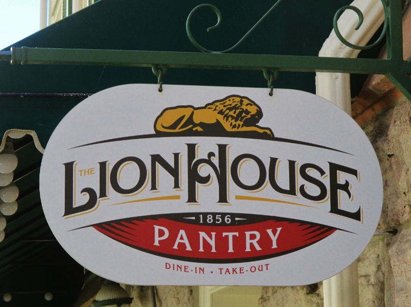
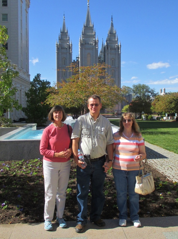
According to TripAdvisor, the best things to do in Salt Lake City are in Temple Square, and we are fortunate to have living near here my cousin John, who is a Mormon. He and his wife Tricia stopped by the base and picked us up this morning and we drove on down to Temple Square. First we ate lunch at The Pantry in The Lion House, built in 1856 as a home to accommodate Brigham Young’s – ahem – very large family, and now serving as a cafe. It was designed by Truman Angell, who also designed the Temple. Good food, good conversation.The Pantry at Brigham Young’s Lion House
John and Tricia led us around the 10-acre grounds of Temple Square,Carol, John, & Tricia in Temple Square
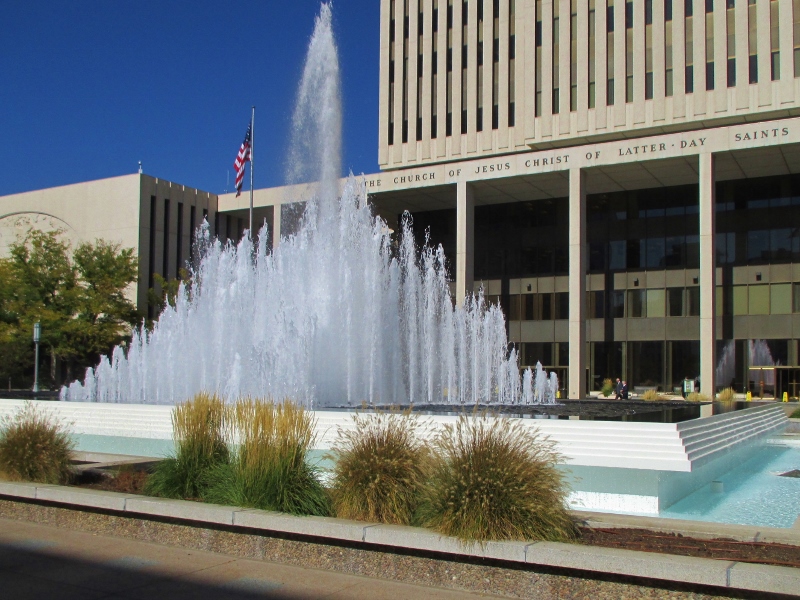
giving us background information about the meanings of the different buildings and how they are used. The 26-floor Church Office Building sits behind a beautiful fountain.Church Office Building fountain
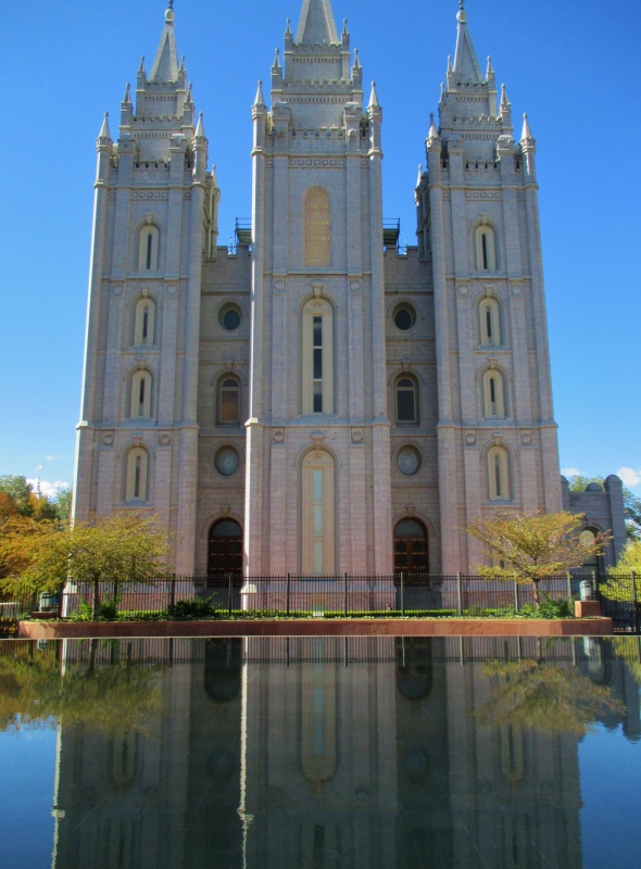
Brigham Young himself in 1847 designated where the temple would be built, although it took 40 years to complete. The Temple is not open to visitors and is not used for routine worship services; it is the place where the most holy sacraments of the church take place. The Temple, reflected in a beautiful pool
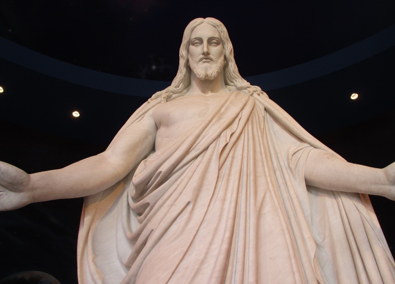
In the North Visitors’ Center, we saw a number of interesting exhibits about church history and current endeavors, which John and Tricia’s additional comments gave us great insight into, as well as an 11-foot marble replica of the beautiful Christus statue in Copenhagen sculpted by Bertel Thorvaldsen. It was presented to the church by LDS church leader Stephen L. Richards in the 1950s and is “intended to help visitors understand that Latter-day Saints (or Mormons) are Christians.”Replica Christus sculpture
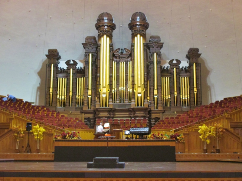
We entered the Tabernacle and were fortunate to find that an organist was rehearsing, so we got to hear gorgeous music played on that fabulous organ. At the same time, two men in work clothes were drilling and hammering up in the choir loft, and the acoustics in the building are so perfect that we were also able to clearly hear their conversation about the repair they were doing as well as every hammer blow and dropped nail.Tabernacle organ (workers in upper left)
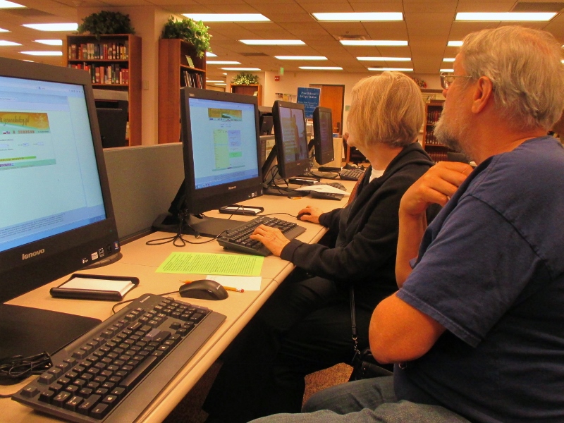
From there we went into the Family History Library.Family History Library
It is everything I’ve ever heard about it, and way more. Not only are there the extensive databases and links, there are also many, many dedicated, incredibly (almost aggressively) nice volunteers who will sit with you to assist and guide your research for as long as you’ll let them. A man was helping John look into information about his mother’s family, and I asked him an idle question about Patrick’s grandmother: his mom told him that her mother had come from Germany, her name sounds Polish, and the 1940 Census shows her country of origin to be Russia – would those discrepancies have been because of shifting borders in that region at that time? The man immediately went and found a Polish expert who came over and began calling up sites in Polish that would shed light on both his grandparents and their origins.The Polish expert assisting Patrick
On his father’s side, Patrick was interested in learning more about his great-great-great grandfather, Alexander Hill, who came west with Brigham Young in 1847. He already was aware that G-G-G-Grandpa had married three wives. The Polish expert led him to information that showed he actually had not three but five wives!List of Alexander Hill’s marriages
John and Tricia brought us back to our campsite, and we had a chance to sit and chat a little longer before they returned to their home in Logan, about an hour north. One of the best parts about the traveling we’ve done all over the country is seeing family and friends; while on the road I’ve visited with 12 of my 13 cousins! This was a wonderful time to reconnect with John and Tricia, to catch up on our families, and to gain an understanding of their faith.
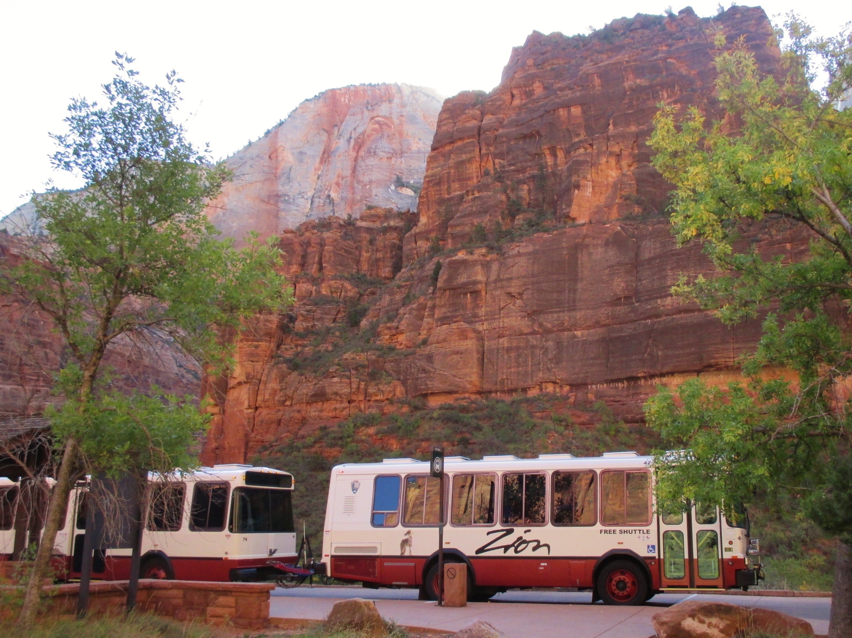
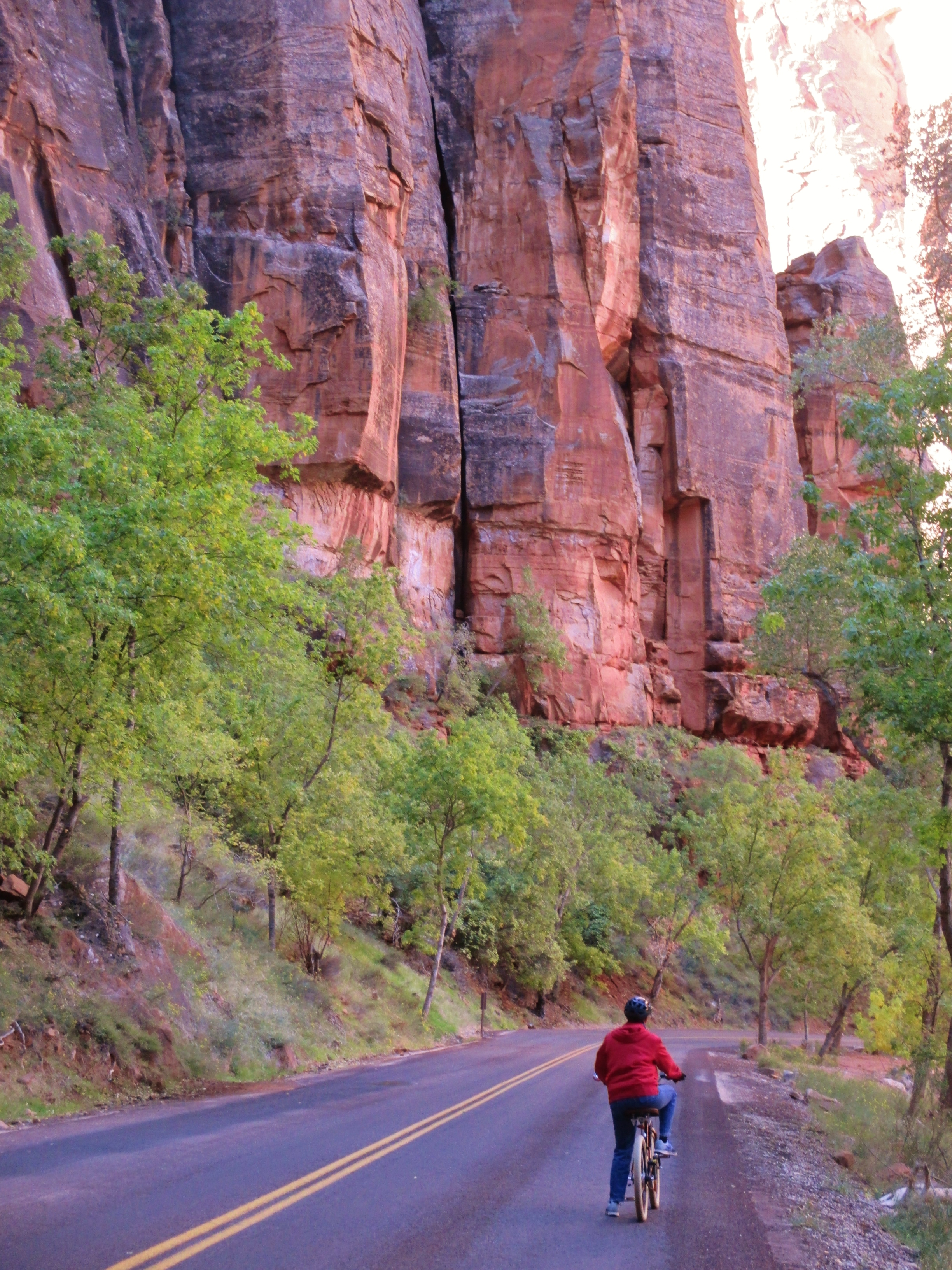
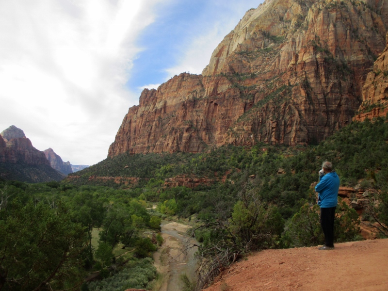
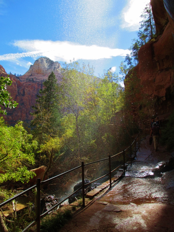
When we rode the shuttle yesterday, we figured out that each shuttle can carry two bicycles, and also that the end of the road, 8 miles north, is at a slightly higher elevation than the Visitor Center. Ergo, we could put our bikes on a shuttle, ride it to the end, hop off and ride our bikes back, mostly coasting. So we did.Canyon shuttle
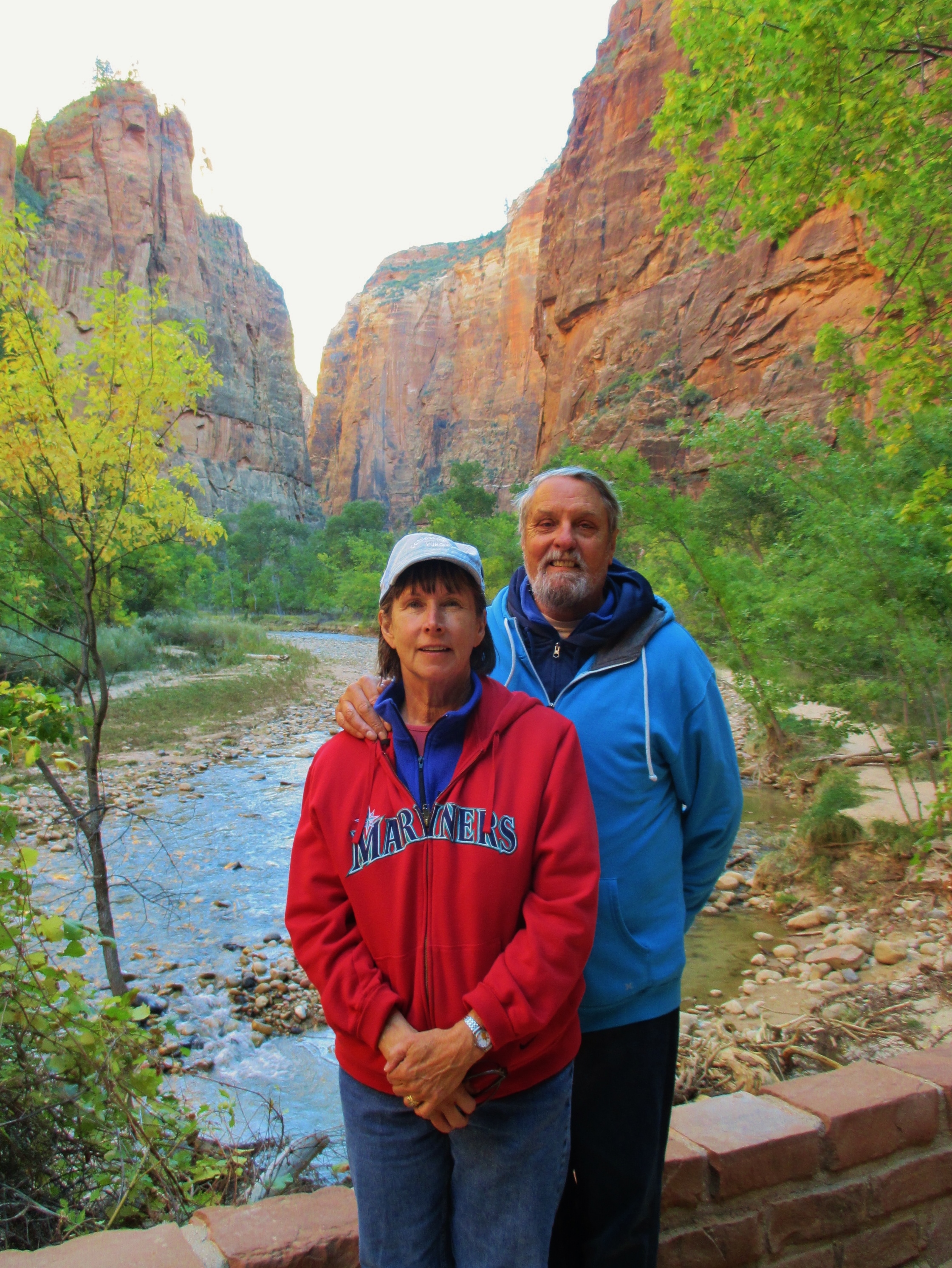
At the end of the road, we parked our bikes at the Temple of Sinawava and hiked a little ways toward The Narrows.At the Temple of Sinawava
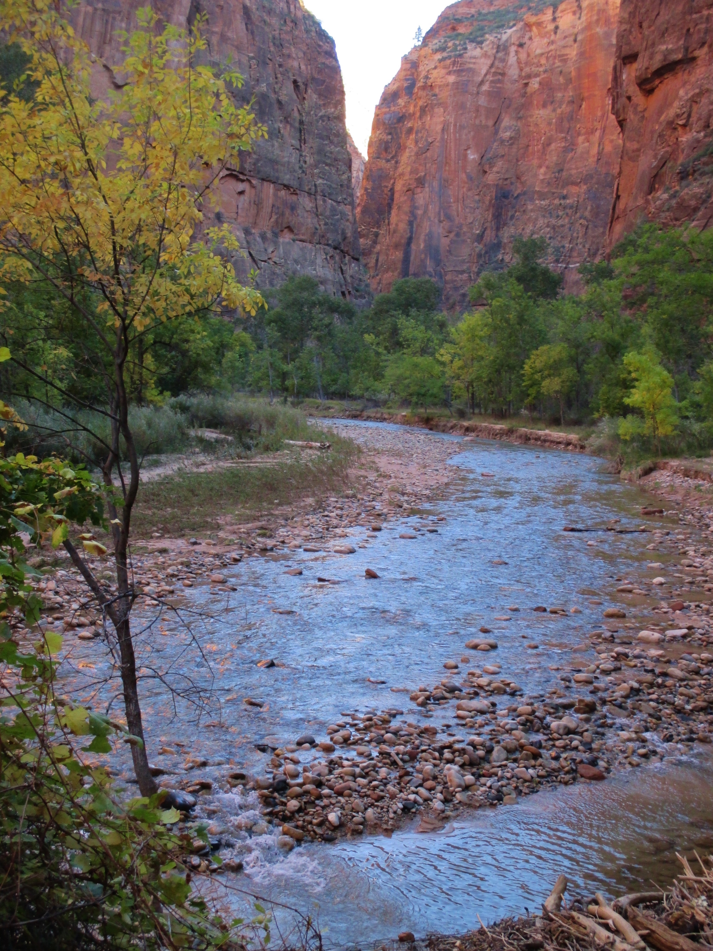
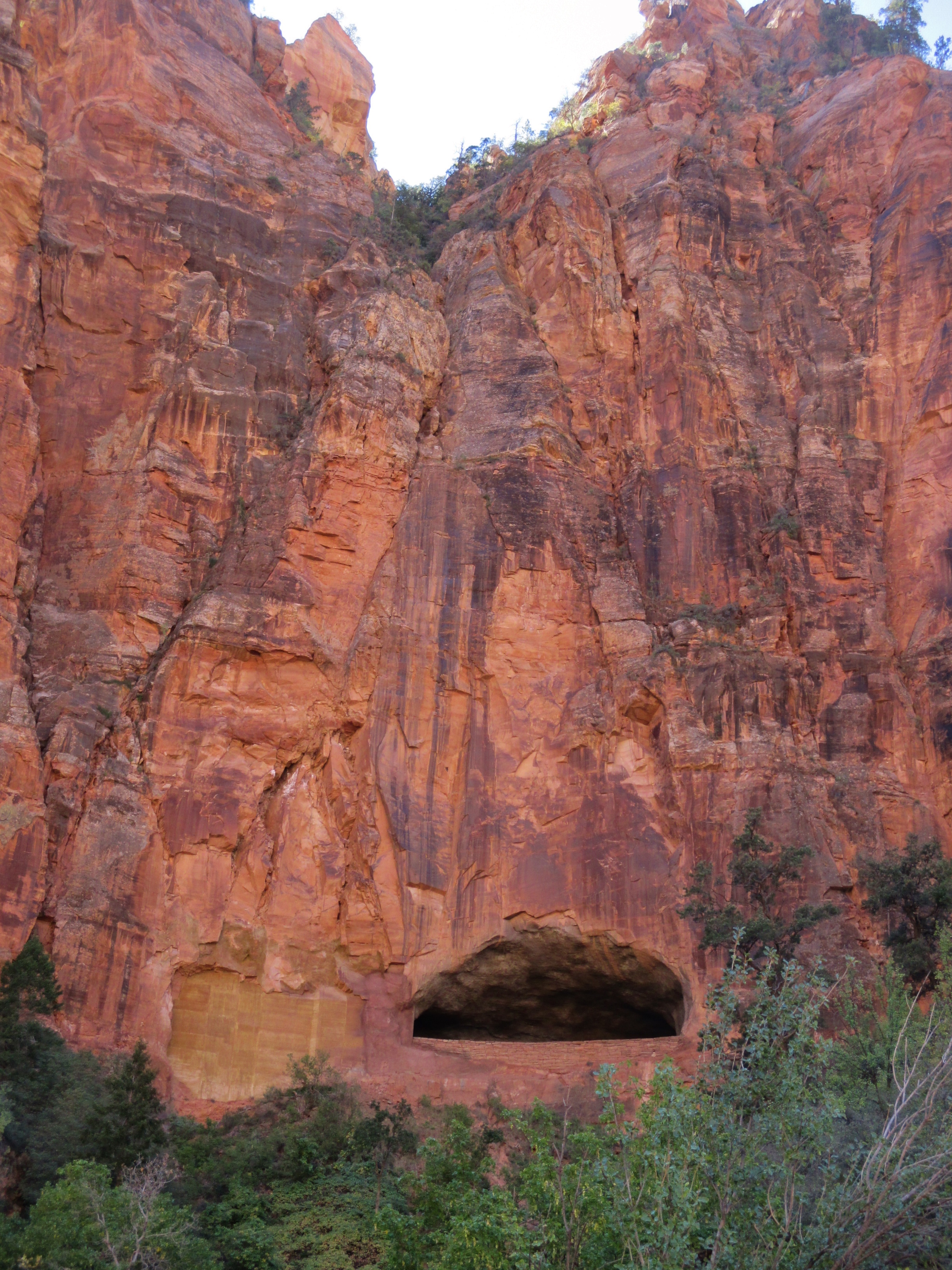
The Narrows is one of the most unusual hikes on the Colorado Plateau. Hiking is done largely in the Virgin River as, for a third of the route, the river runs canyon wall to canyon wall.Virgin River coming out of The Narrows
We didn’t go that far, but there were plenty of hikers on our shuttle who were geared up for the hike/wade/swim up into the sheer, vertical-walled canyon. We were told that hiking in the river is strenuous: the water is often murky, the bottom of the river is covered with round, basalt rocks about the size of bowling balls, and water levels can vary unpredictably – most hikers will wade at least waist-deep and many will swim a few short sections. Dangerous flash floods can of course occur, so hikers also have to keep an eye out for thunderstorms.The Narrows with the sun coming into the canyon
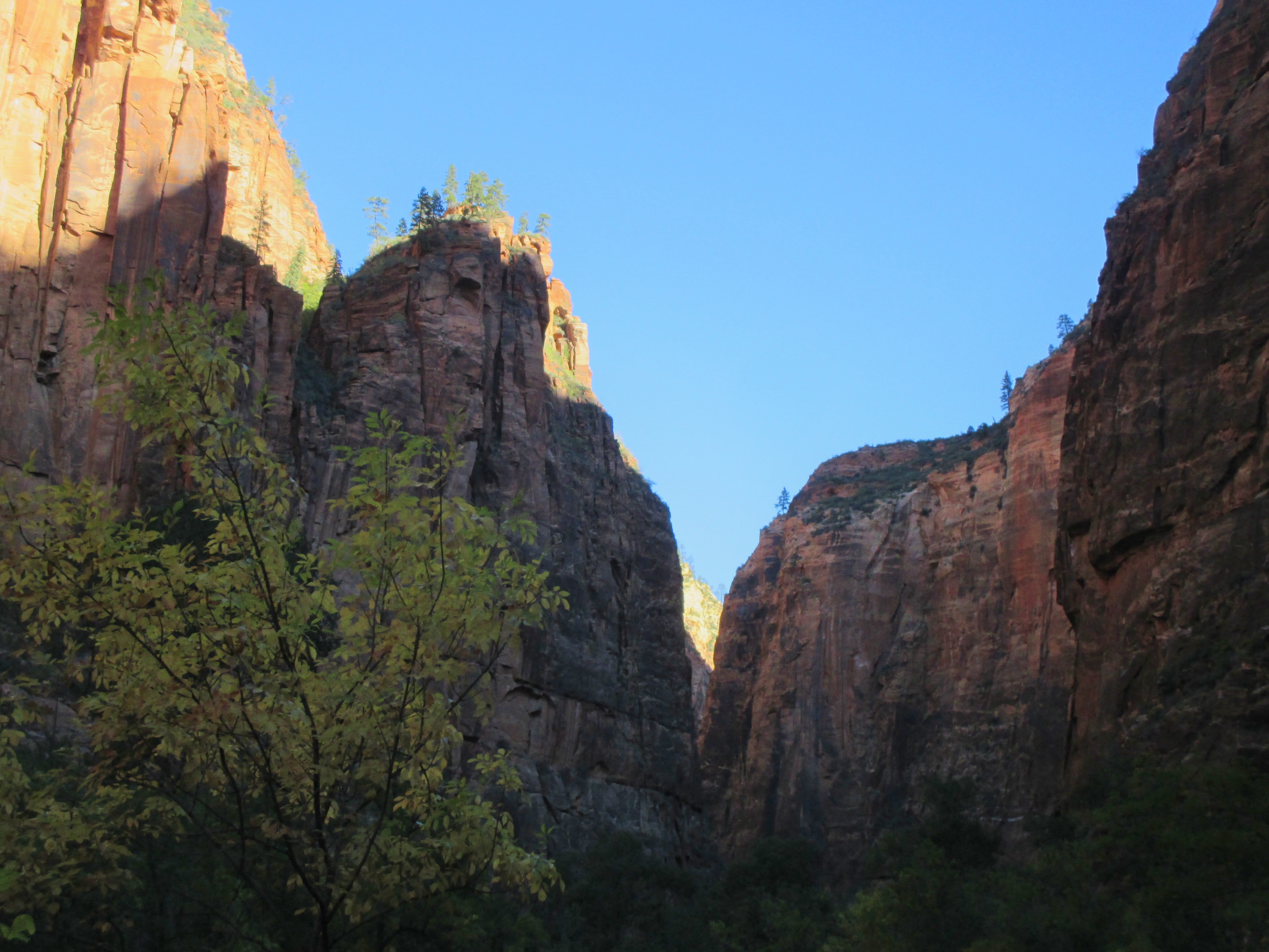
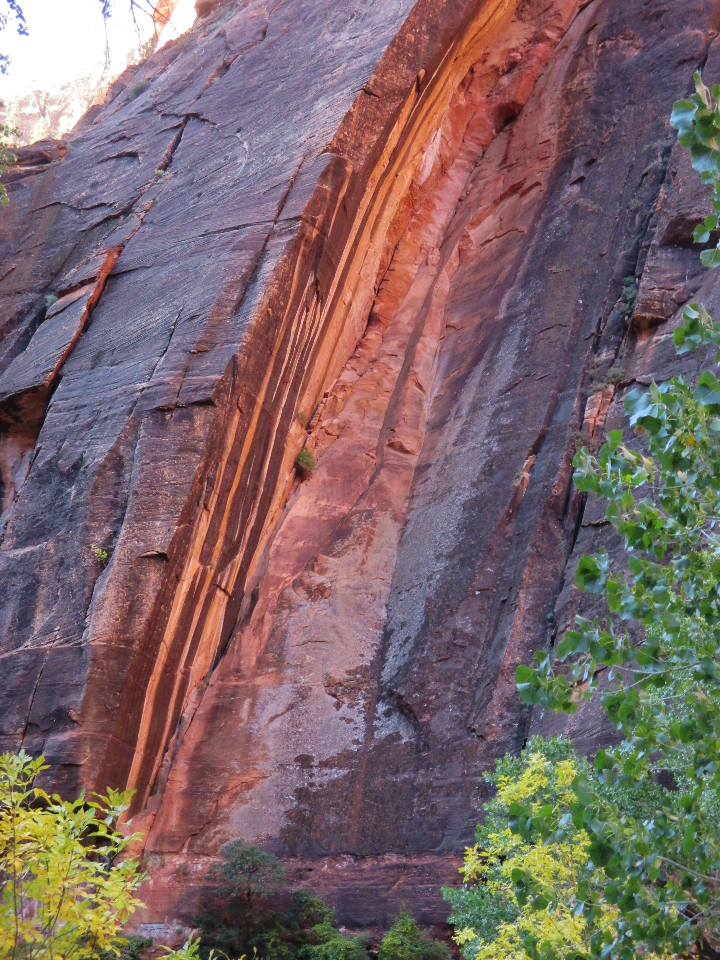
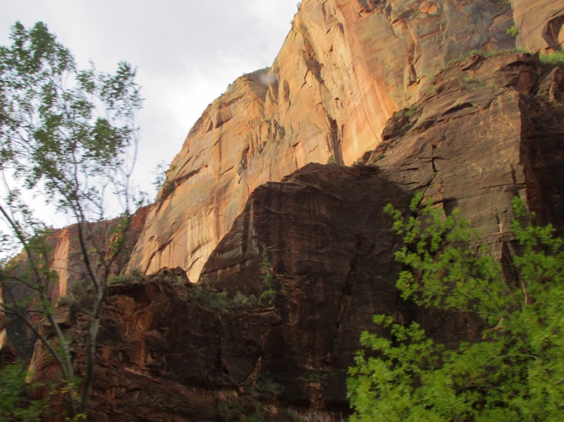
The morning was cool and crisp, so we bundled up a bit and then off we went. It was so fabulous! Best bike ride ever!Morning sun on the western cliffs
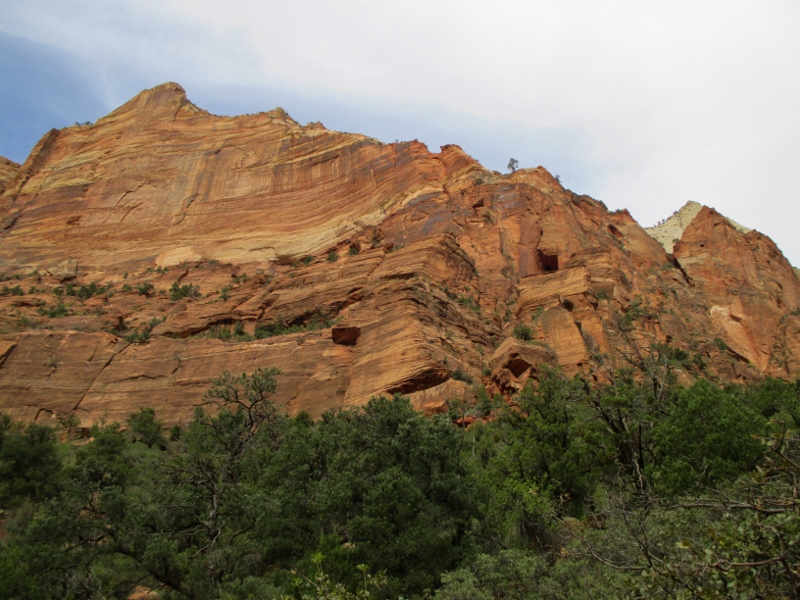
At bike speeds we were able to see all the beautiful formations so clearly,Gorgeous cliff
and to stop and spend time looking at anything we wanted to.“Desert varnish” on the rock
Because only park vehicles are allowed on this road, we were alone for almost the whole ride, and at an elevation of only around 5,000 feet (compared with the 7-9,000 feet we’ve lived at for the past several weeks), we felt as though we were flying.Biking alone in the canyon
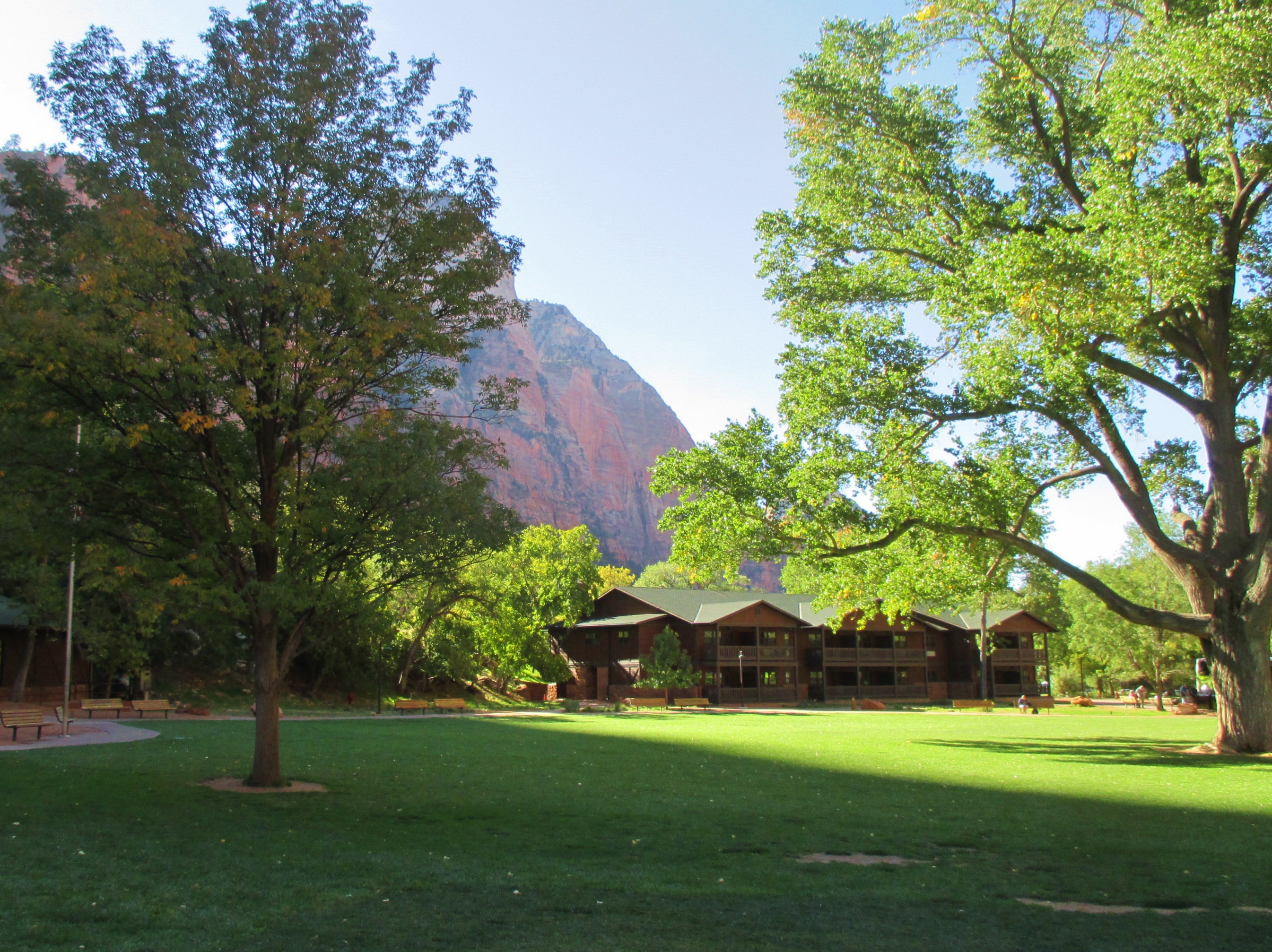
We stopped again at the lodge and sat outside for a while with a cup of coffee and a muffin, soaking in the view.Zion Lodge
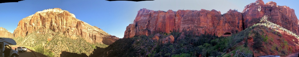
After we got back to the Visitor Center, we put the bikes on the car and drove back up the switchback road that we came in on Tuesday, stopped in places and took photos. We’ve been having fun with taking series of pictures and then “stitching” them into panoramas:Stitched panorama
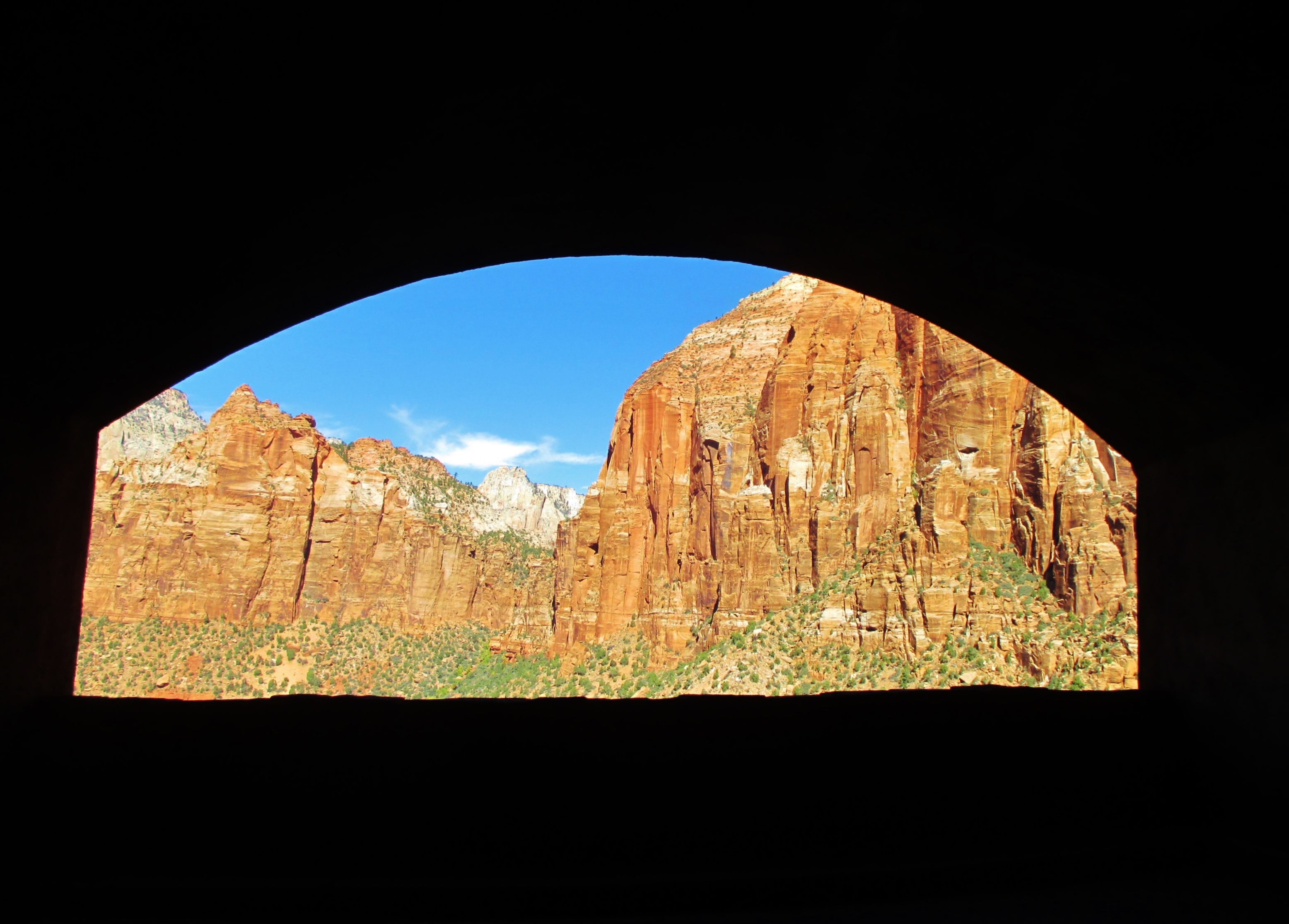
We could see the ventilation/ view port in the tunnel from the outside,Tunnel ventilation/ view port
and then we drove through the tunnel again and saw the view from inside:Ventilation/ view port
There is so much to do at Zion! We’re already thinking about coming back here again and spending a week, on a future trip we’re planning to New Mexico.
No cars are allowed into the main canyon, just shuttles every six minutes. We parked at the Visitor Center and climbed aboard the shuttle, which would take us to the end of the curving road, 8.2 miles north, with 8 stops along the way. We had a big window to see the morning light drawing across the massive canyon walls, each vista more awesome than the last.
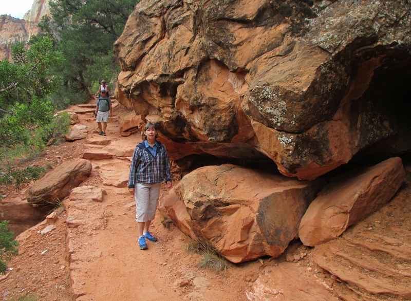
We rode the shuttle to the end of the road and then part-way back, getting off at a stop called The Grotto. We walked a footbridge across the Virgin River, named for Thomas Virgin, a member of the first American party to see it in 1826 (no information on whether he was one or not). The river was the major force in cutting the canyon, mostly by flash floods. Then we started hiking a couple of miles up and along a trail in the rock called the Kayenta Trail. So pretty! The trail itself was a fun hike,Carol & big rocks!
and the views of the river and the canyon were incomparable.Patrick & the Virgin River view
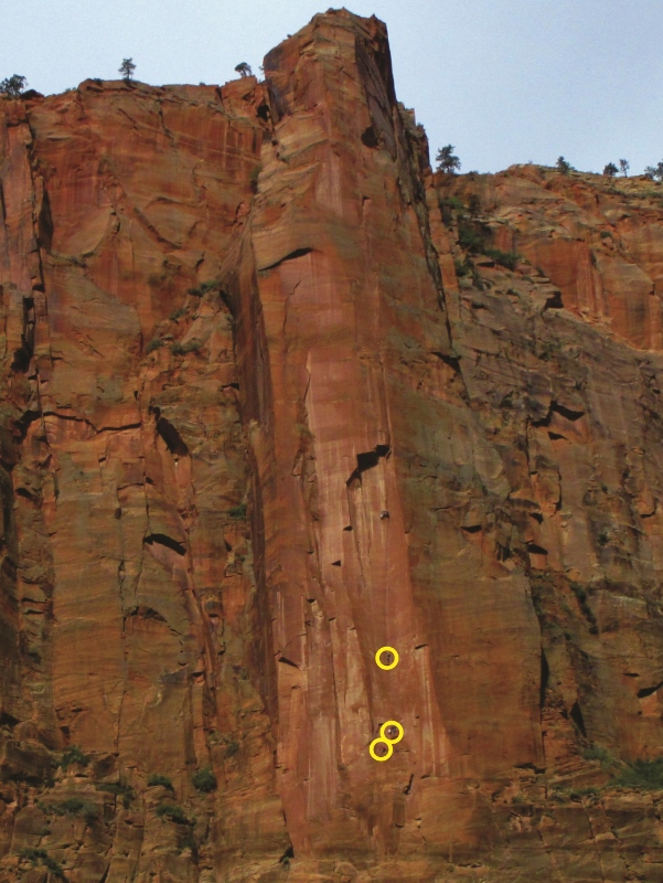
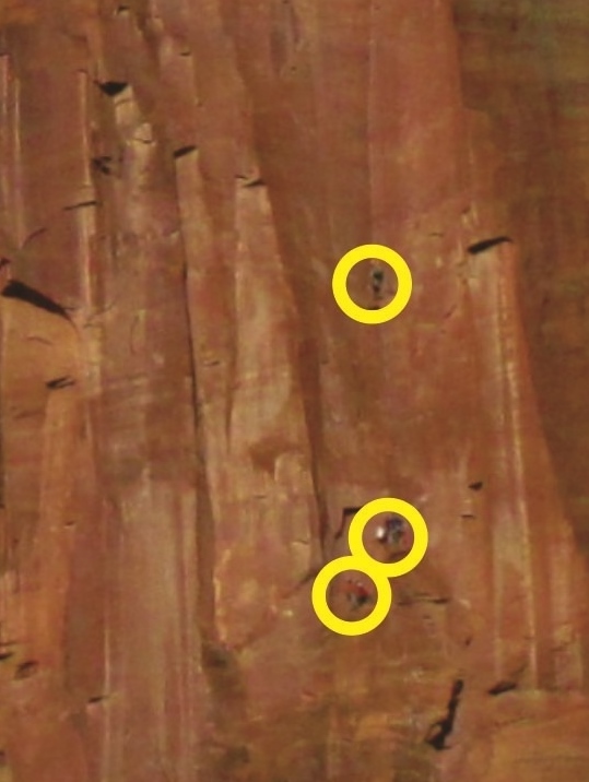
On several of the formations we saw climbers hoisting themselves up the sheer rock faces as much as nearly 3,000 feet high – amazing!Rock climbers on the rock face
Close-up of rock climbers
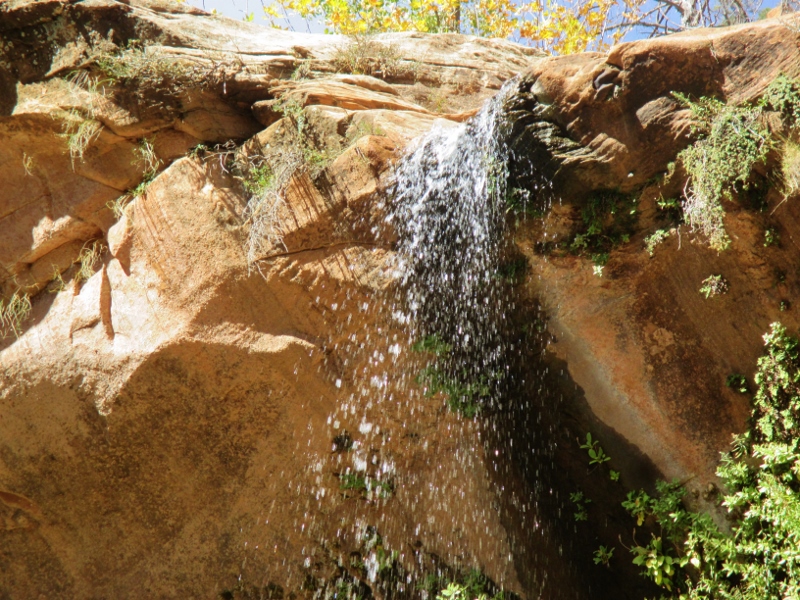
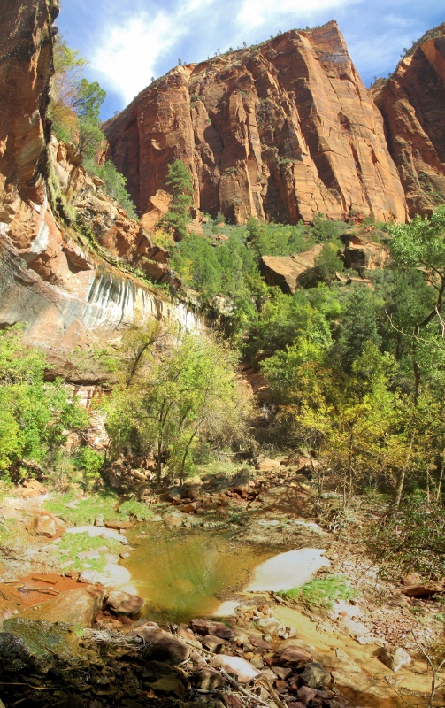
Our trail took us to the Emerald Pools, a stair-step of three pools that create an oasis in the desert environment. Above the lower pool there is a shale edge (Chinle Formation, maybe?) that is more resistant to erosion than the softer sandstone, so it hasn’t eroded as much and causes lovely water sprays into the pool below.Water spraying from above
You walk under the edge and the waterWalking under the falling water
around to a beautiful view of the cliff, the falling water, and the pool.Lower Emerald Pool
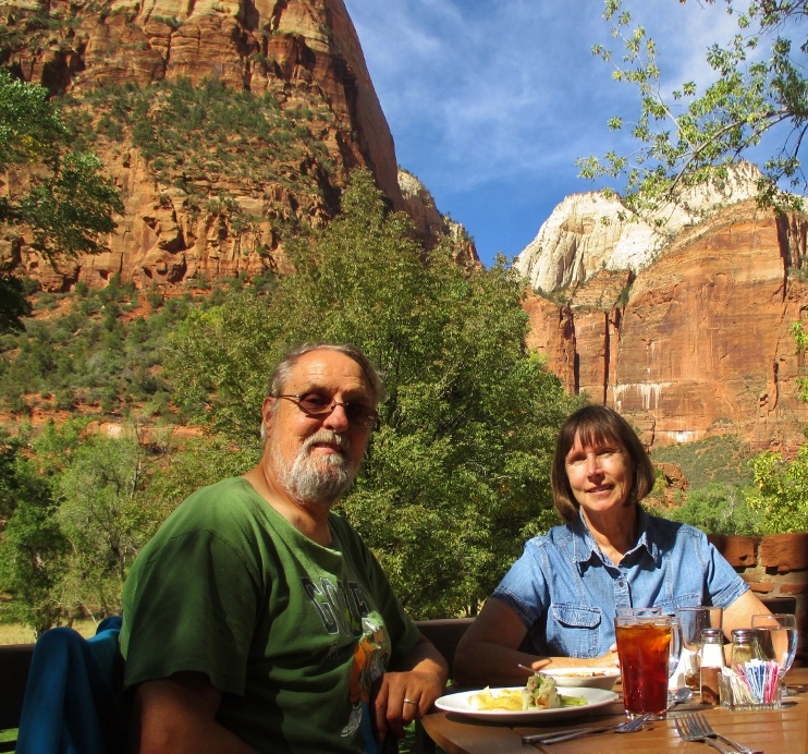
From there we followed the trail out to the road and the Zion Canyon Lodge, where we had a super lunch out on the patio in sight of the most gorgeous scenery imaginable. From now on, a restaurant that claims to have a view is going to have to work really hard to impress me!Lunch at the Lodge
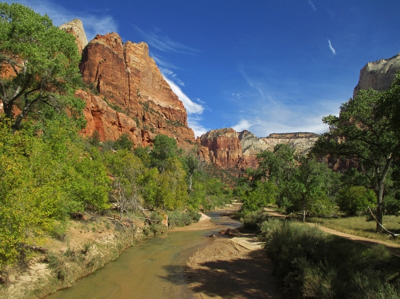
This canyon is truly indescribably beautiful. We’re glad to have another day to explore it tomorrow. Zion Canyon, Virgin River
Even our campground, just outside the national park, sits under a spectacular rock formation. Patrick grilled dinner outside in the warm twilight, and we watched the sun fade from the cliffs.Dinner below the cliffs
Leaving the kingdom of Ruby’s Inn headed westward, for a while we continued to see pink Claron Formation beds and a few hoodoos. We turned south on US 89 and came into some geology we haven’t seen for a while, volcanics. There’s a basalt flow near Hatch and further west from us the huge Marysvale Volcanic Field, which was explosive about 66 million years ago.
We were following the Sevier River down its pretty little valley and saw several billboards advertising the best “Ho-Made Pies” ever at Mt. Carmel Junction. It was just about mid-morning coffee & snack time when we got there, so we pulled in. I’m always a bit skeptical concerning claims for exceptional pie, but willing to make an assessment. There were only two kinds, Hot Apple with Rum Sauce and Strawberry-Rhubarb (not counting creams and chiffons, which I don’t count because I don’t like them), so we split a piece of apple. So good! – outstanding crust, perfectly cooked filling, not too sweet. Just to make sure the apple wasn’t a fluke, I got a piece of Strawberry-Rhubarb to go.Great apple pie!
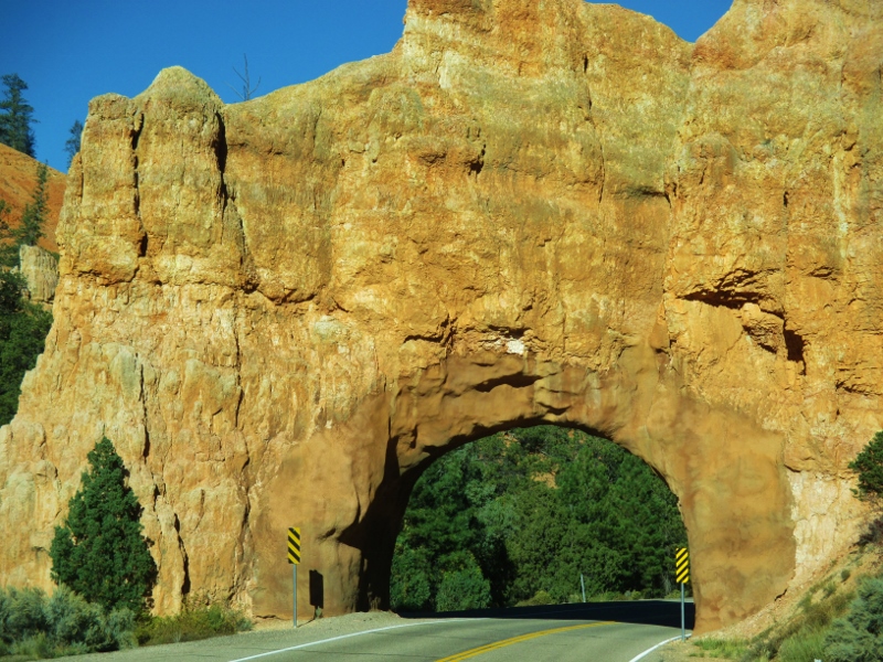
Turning west, we passed through several short tunnels that looked like arches: holes had been dug through the rock, then reinforced with concrete for stabilization to look like arches – clever!“Arch” tunnel
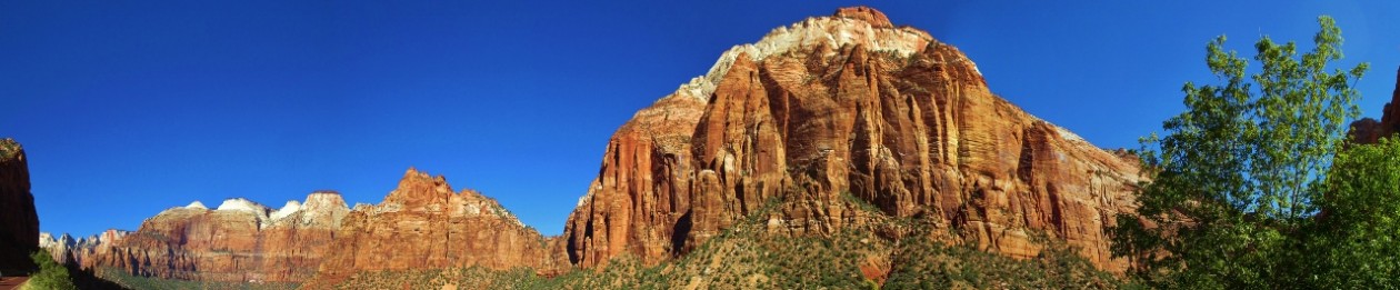
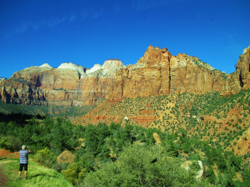
We entered the national parkCarol & Patrick at the entrance to Zion National Park
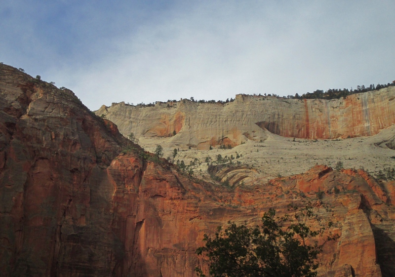
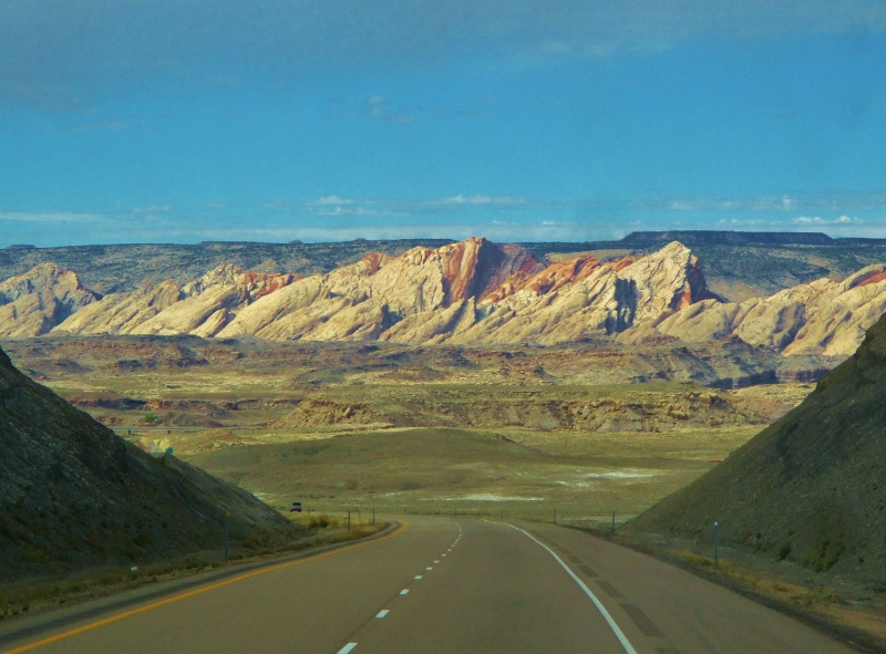
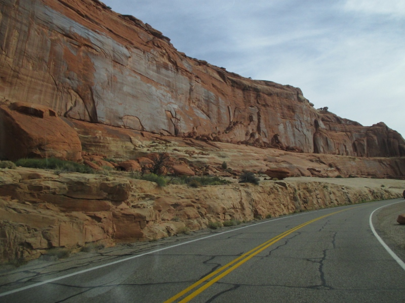
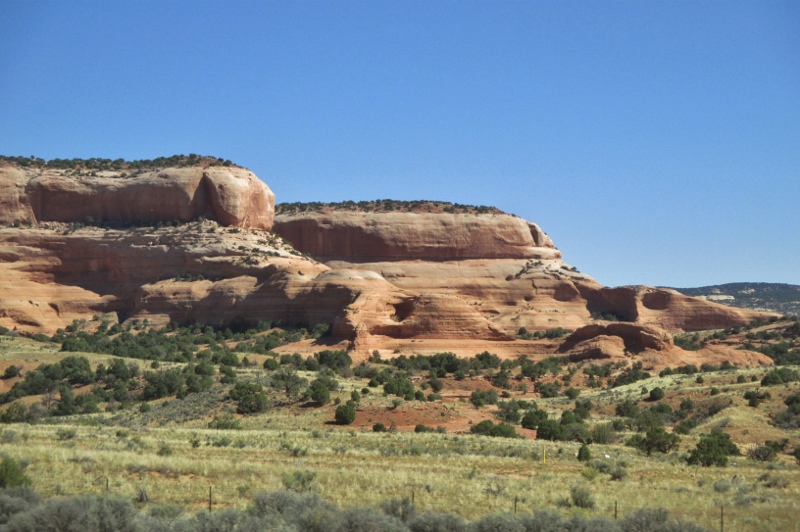
and immediately came to one of its landmarks, Checkerboard Mesa. The criss-crossed mountain towers 900 feet above the Zion-Mt. Carmel Highway and resembles a giant, extended checkerboard. The horizontal fissures (crossbedding) are due to a north-to-south wind direction during sedimentation, while the unusual vertical cracks are a result of cycles of freezing and thawing.Checkerboard Mesa
Immediately west of Checkerboard Mesa is Crazy Quilt Mesa, where the striations in the rock go different directions depending on long-ago prevailing winds and erosion continuing today.Crazy Quilt Mesa
Crazy graining!
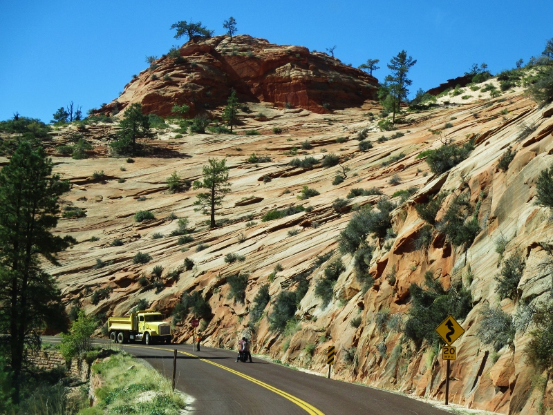
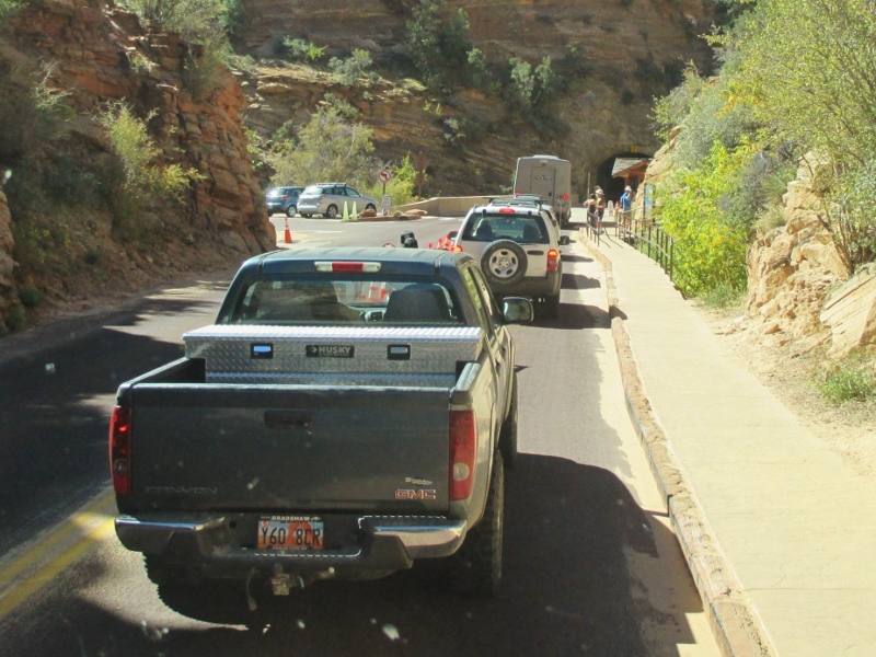
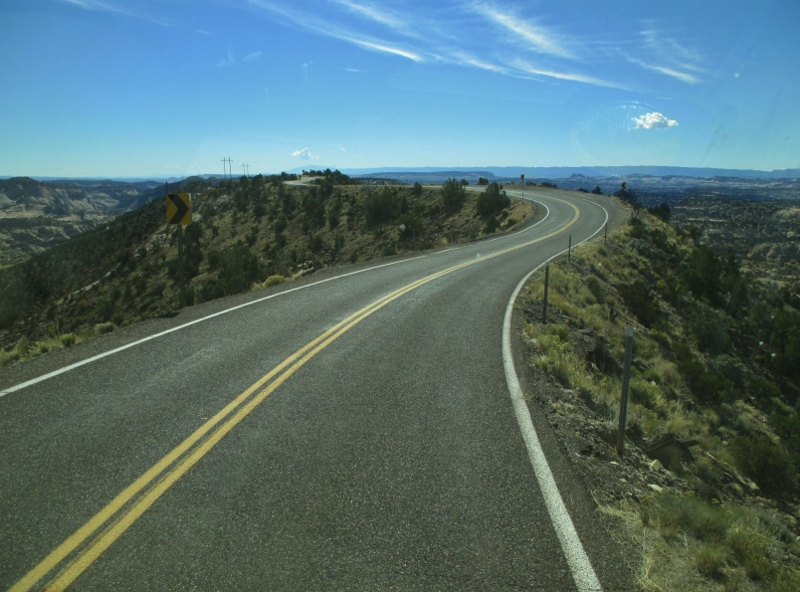
Next we came to the mile-long tunnel, built in 1927-30 using mining techniques rather than traditional tunneling techniques. The tunnel allows two-way traffic until a vehicle over 11.33 feet high or 7.83 feet wide (like our RV) comes along; then traffic is halted so that that vehicle (and cars that have accumulated behind it) can drive through down the middle. We paid $15 for the privilege, and the system seems to work well with few significant delays.Waiting for the tunnel
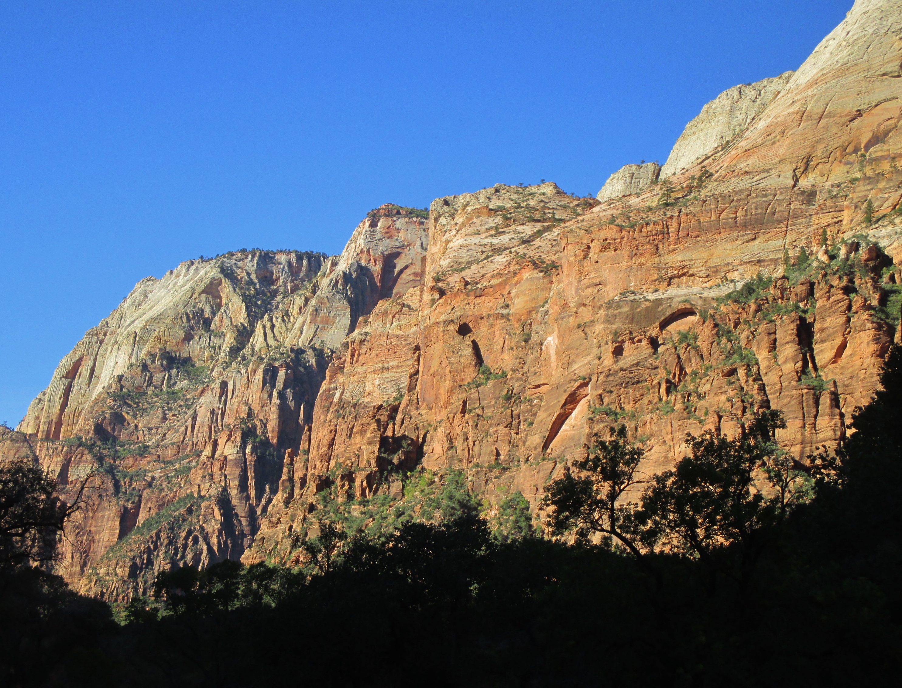
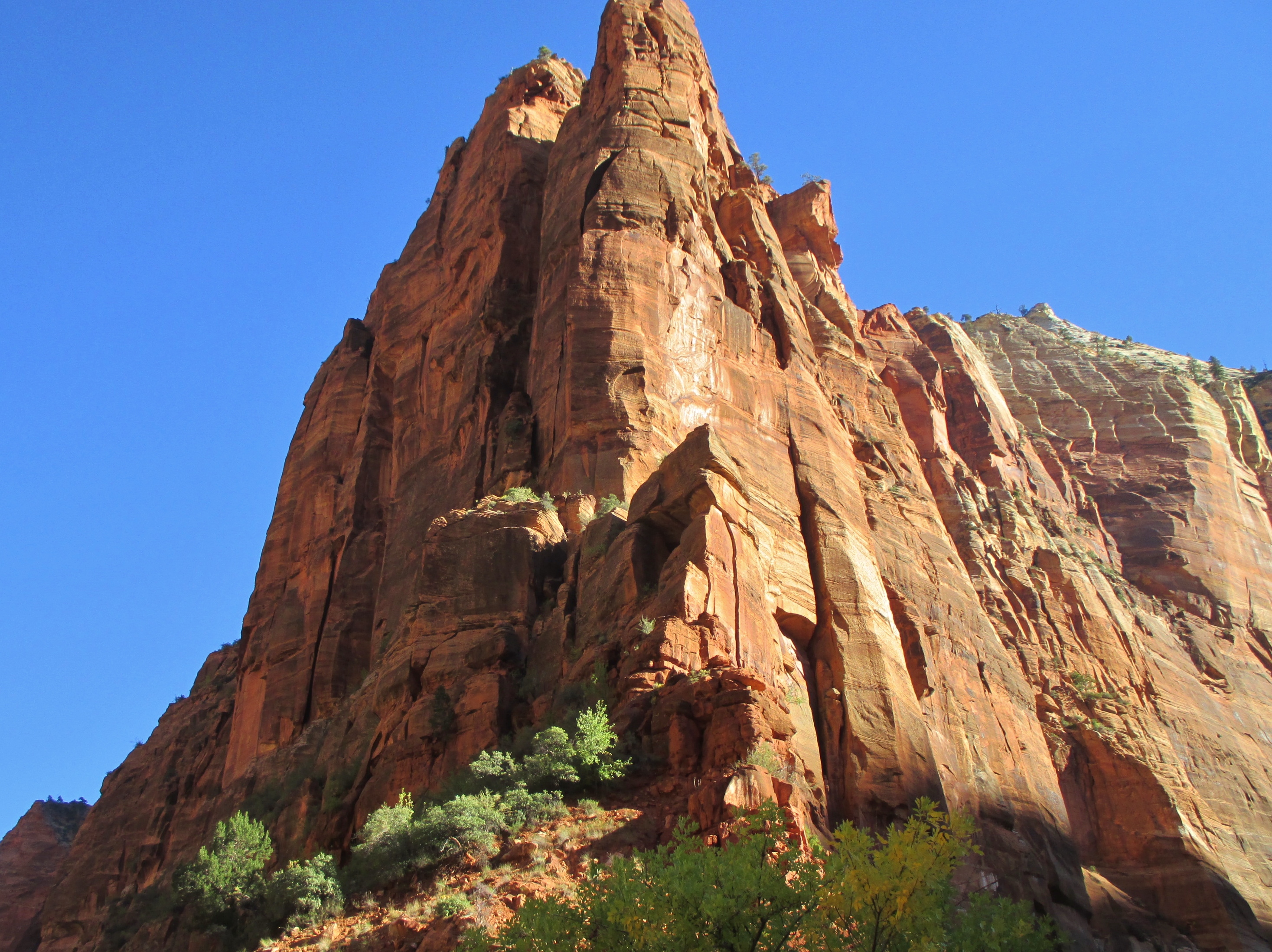
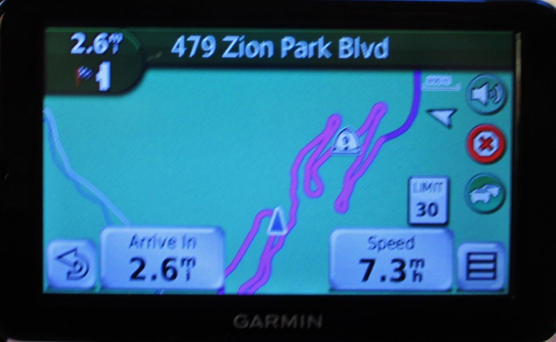
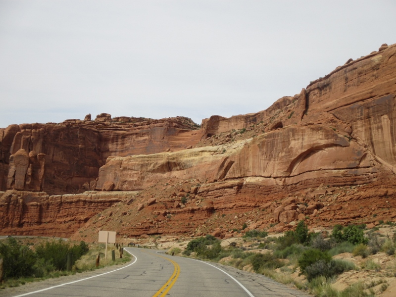
We came out on the other side: Wowie-zowie! Before us was a series of switchbacksThe GPS shows the road
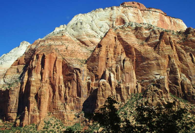
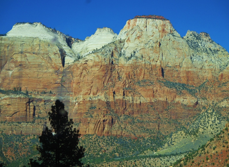
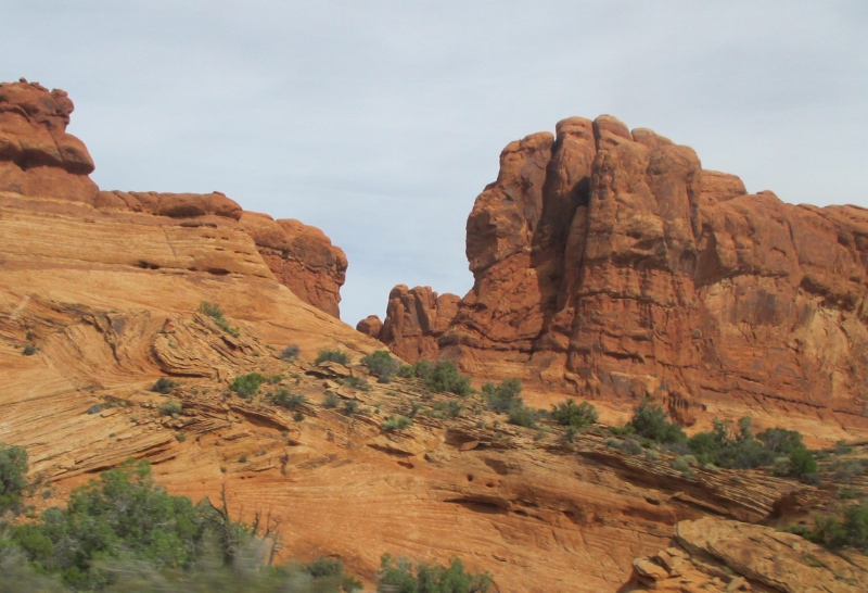
that led us back and forth beholding the breath-taking, ginormous, spectacular Triassic and Jurassic cliffs.The East Temple
Towers of the Virgen
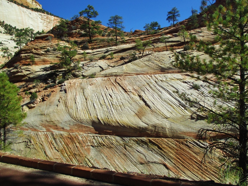
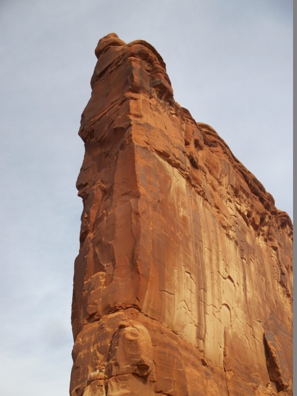
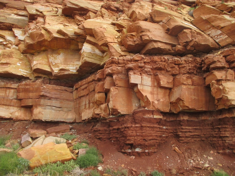
We saw familiar layers of sandstone, old friends now: at the top the 200+ million-year-old white crossbedded Navajo Sandstone, with the red ledge-forming Kayenta Formation interlayered sandstone and siltstone beneath it; the dark red Wingate Sandstone below; then beneath those, more red stone of the Chinle Formation with a band of Shinarump Member below that; and then the 248 MYO Moenkopi Formation under that, red with streaks of limestone.Layers of sandstoe
We’re so excited to begin exploring this beautiful country!
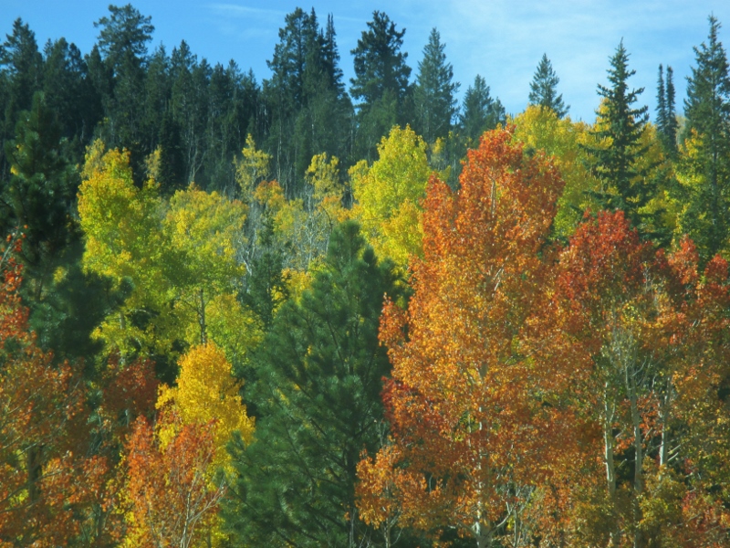
Our next two national parks have us stair-stepping down through southwest Utah. Scenic Highway 12 south from Capitol Reef to Bryce Canyon goes up, up, up and over Boulder Mountain (from whence came the lava rocks we saw in Capitol Reef). Before long we were in trees, mostly pine but with some deciduous trees shifting into their Fall colors,Trees in fall color
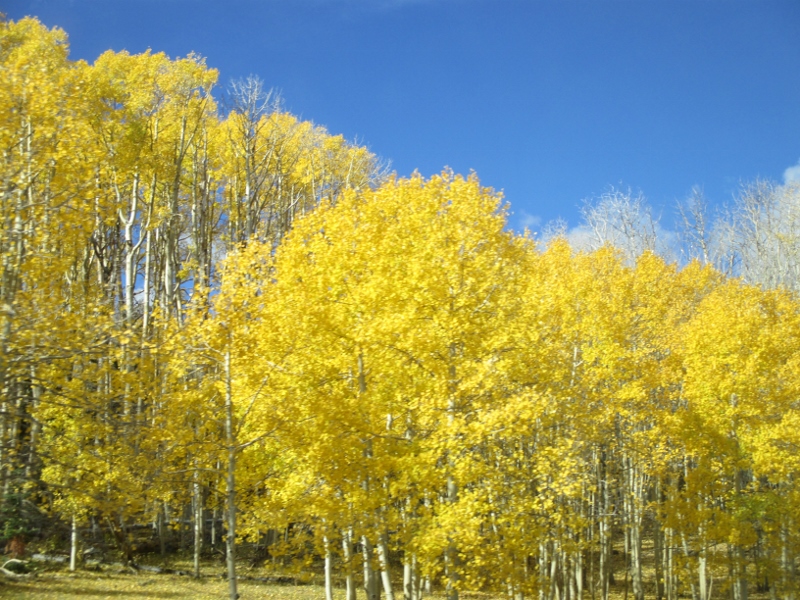
and then startling groves of gorgeous aspens, turned neon yellow.Grove of aspen
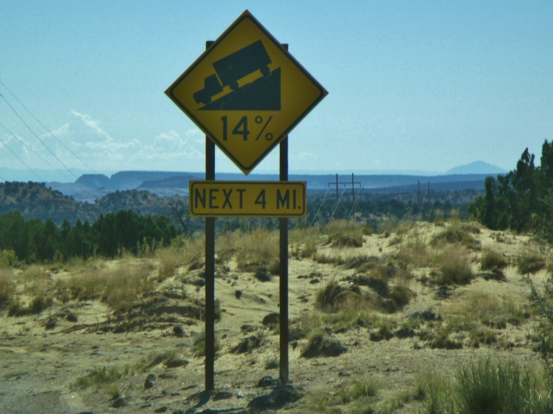
Usually roads look for mountain passes to cross through, but this one really does go almost over the top of Boulder Mountain (el. 11,124 feet), probably because of rock and flash floods below. At our summit (9,600 feet) the mountainside fell away to both sides, and Patrick threaded the motorhome along a narrow plateau, while I assisted by shutting my eyes and not grabbing his sleeve.Highway 12 on Boulder Mountain
Then we went down, down, down,14% down grade!
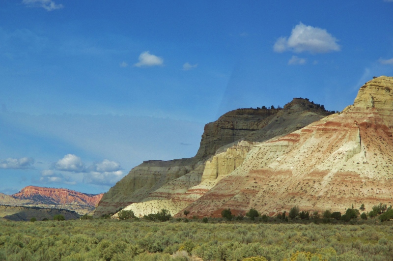
through a vast ocean of Navajo sandstone, then turned west to find ourselves in a pleasant agricultural valley from which we caught a glimpse of “The Blues”: the gray badlands that are composed of upper Cretaceous Kaiparowits Formation, thick layers of muddy sandstone containing one of the richest deposits in the country of fossils of sharks, crocodiles, lizards, turtles, mammals, and dinosaurs.Seen from the road
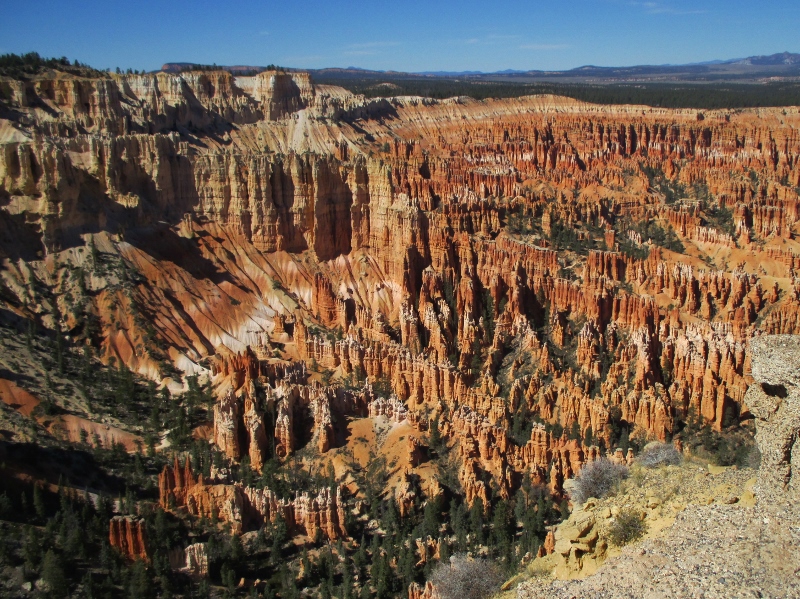
Yesterday we took a narrated National Parks shuttle ride to some of the outstanding view points in Bryce Canyon – which is not actually a canyon (because it was not formed from erosion initiated from a central stream), but rather is a collection of giant amphitheaters stretching 20 miles along the eastern side of the 7-9,000-foot-high Paunsaugunt (PAWN-sa-gunt) Plateau.
The rock layers exposed here are much younger than the ones at Capitol Reef. Whereas the oldest layers there were Permian White Rim Sandstone (laid down 290 million years ago) up to Cretaceous Mesaverde Formation (65 MYA), the oldest rock here is Dakota Sandstone (120 MYA) and most of what you see is Claron Formation, from a mere 40-65 MYA. The top layer of the Claron is white limestone,Eroded white limestone
and below that is pink siltstone and sandstone.Eroded sandstone
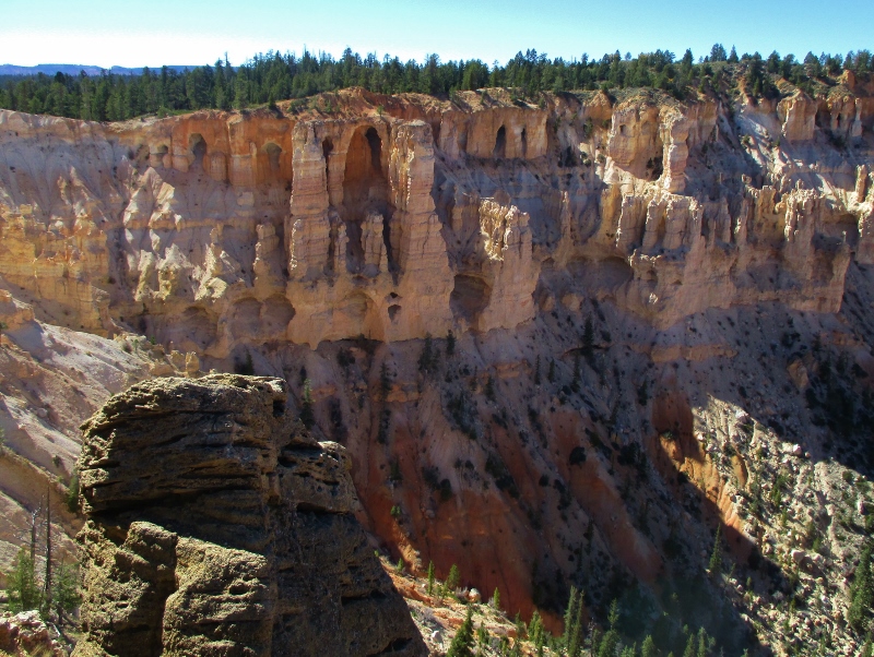
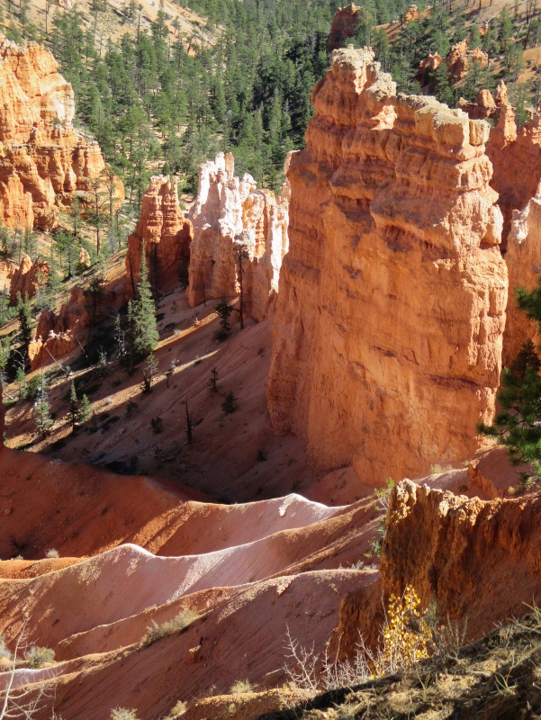
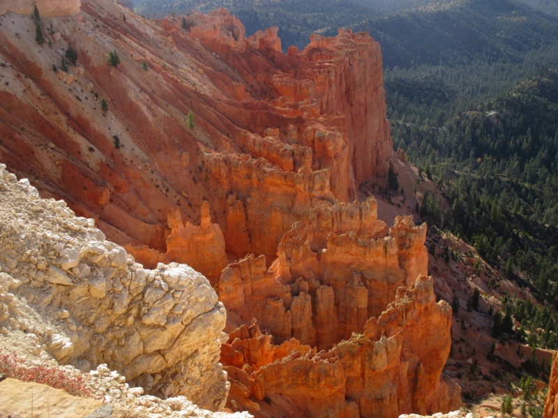
The amphitheaters were excavated by the same kind of erosion that we’ve seen in the other parks of the uplifted Colorado Plateau.Bryce Amphitheater
The uplift created vertical joints which over time were preferentially eroded, and the soft sandstone and siltstone winnowed into the delicate and colorful freestanding pinnacles called “hoodoos” that Bryce Canyon is famous for. The primary weathering force at Bryce Canyon is frost wedging. These hoodoos experience over 200 freeze/ thaw cycles each year. In the winter, melting snow seeps into the cracks and then freezes at night, prying open the cracks bit by bit, making them even wider, much like the way a pothole forms in a paved road. In addition to frost wedging, slightly acidic rainwater also sculpts by slowly dissolving limestone grain by grain, giving the hoodoos their lumpy and bulging profiles.Hoodoos
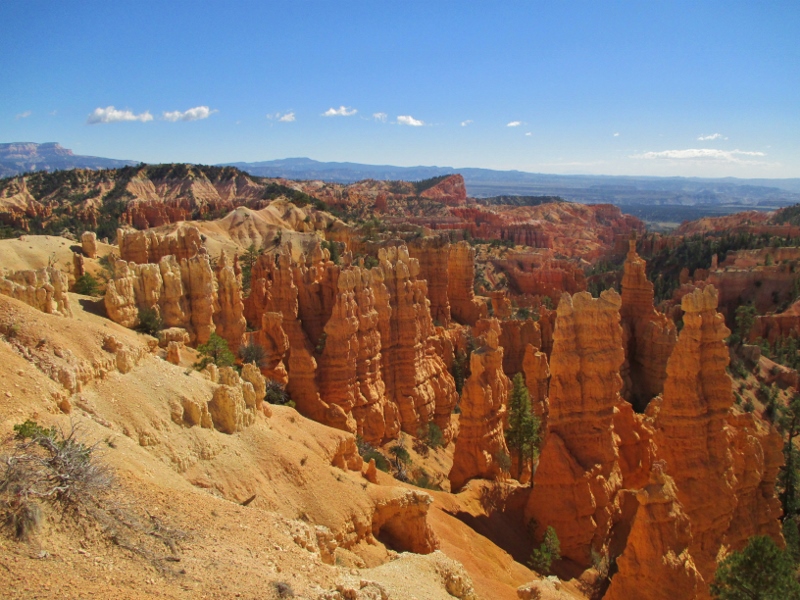
We stopped at several different lookouts along the 9,000-foot-high canyon rim and saw the lovely formations, ranging in size from human scale to as much as 200 feet, from different angles.Erodes shapes
They were especially beautiful with the sun glowing on them.Hoodoo circle
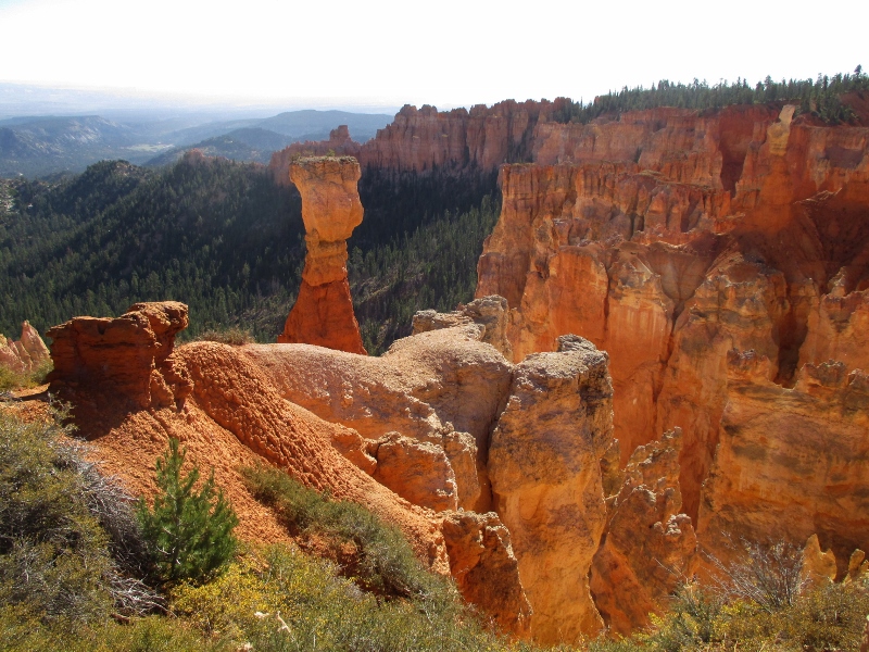
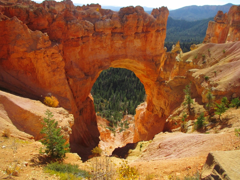
“Natural Bridge” is actually not a bridge but an arch, for technical reasons. Those geologists are so persnickety!Natural Bridge
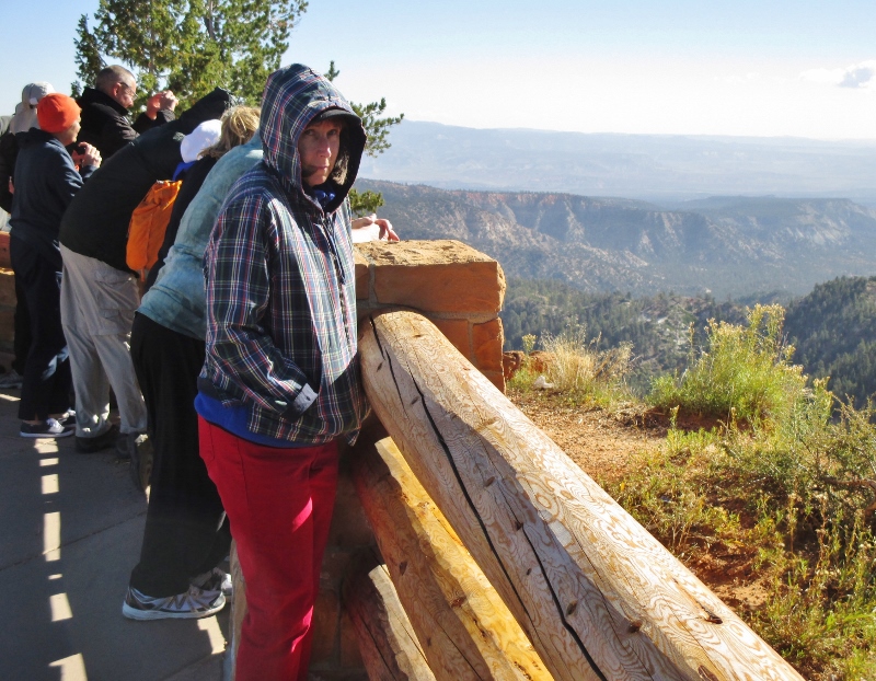
Unfortunately for our tour, there was a storm front moving in up around Salt Lake City, the effect of which for us was a ferocious freezing wind at every viewpoint stop. So we jumped out, snapped photos, then bundled back into the bus. The driver said we were the quickest tour he’s ever driven!It was really cold!
This park also has a 7.4 magnitude night sky, making it one of the darkest in North America, and on certain nights park rangers host evening programs on astronomy, nocturnal animals, and night sky protection. However, we aren’t here on a day when there’s a program, and honestly, it’s so cold we probably wouldn’t do it anyway. The first night we were here our water pipe froze a little, so last night Patrick disconnected it before we went to bed.
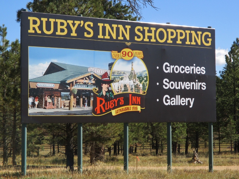
I have to describe the place we’re staying, Bryce Canyon City. It’s a commercial district just outside the park, at 7,000 feet, all of which is owned by Ruby’s Inn: in 1916, Reuben C. “Ruby” Syrett built a lodge and cabins at this location that has expanded over the years to include several restaurants, many hotel rooms for busloads of tourists from Las Vegas, an ATV rental place, a rock shop, a Subway, a gas station, and of course an RV park. Seven years ago the Utah legislature passed a law that allowed the descendants of Ruby Syrett to incorporate the location as “Bryce Canyon City”; soon after, the law was rescinded, but the “town” remains. At incorporation, the population was 138. A majority of the residents are members of the Syrett family, and nearly all of the adults are employees of Ruby’s Inn. Now “Bryce Canyon City,” consisting solely of the property of Ruby’s Inn and the Syrett family, gets 10 percent of the county budget. Rod Syrett, the company’s board president, is the mayor.Ruby’s Inn
Bryce Canyon is beautiful in its way, but I have to say I’ve found it not as interesting as the other parks we’ve been to in the past several weeks: the rock is all kind of the same, so each viewpoint is pretty much a variation on a theme that doesn’t alter much. Also, we’ve been no lower than 5,000 feet for several weeks now, and we’re getting tired of it. There are trails along the rim of the canyon, but even today when it wasn’t windy, we didn’t hike because even walking on level ground at this elevation is somewhat strenuous. As Patrick says, just being alive is enough at 7,000 feet.
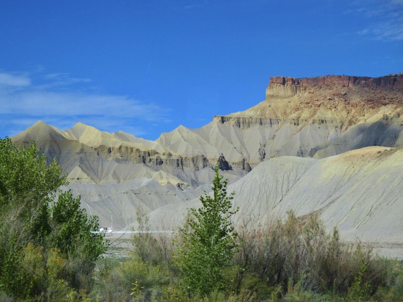
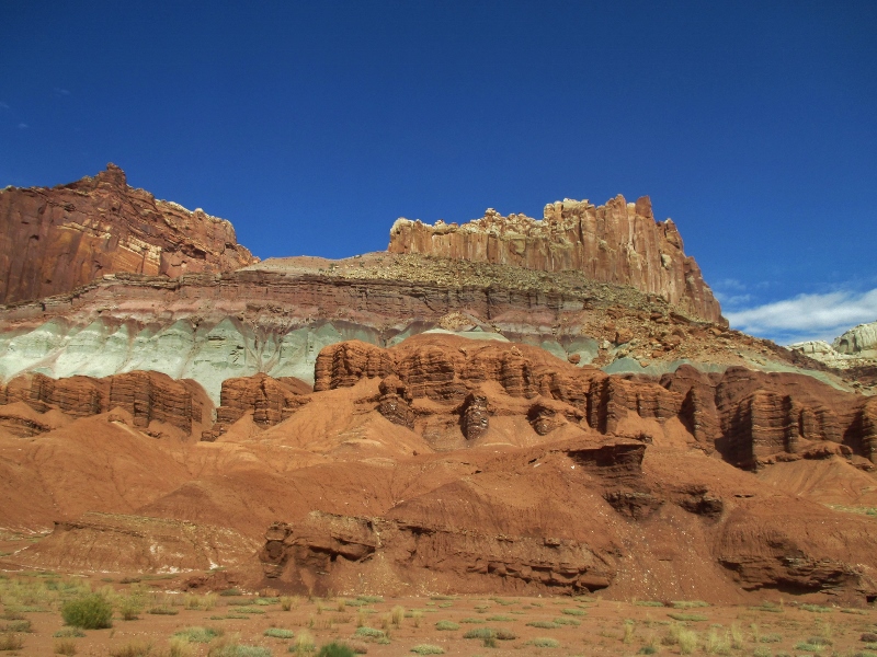
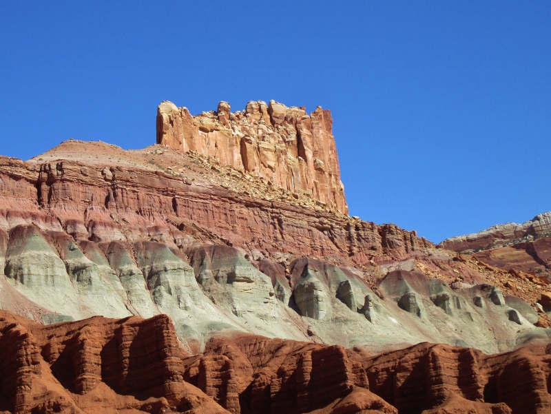
From Moab we drove north, then west about 35 miles on Interstate 70, then south and then west on scenic Utah Hwy 24 to Capitol Reef National Park. I had never heard of Capitol Reef until we started researching the national parks for this trip, but it’s one of the “Big 5” (which is actually a Utah marketing slogan to get people to visit the parks and spend $$).
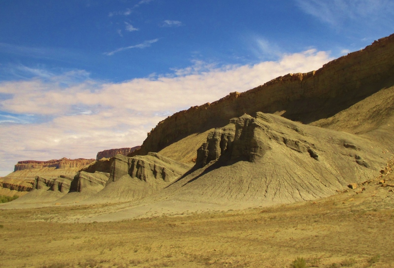
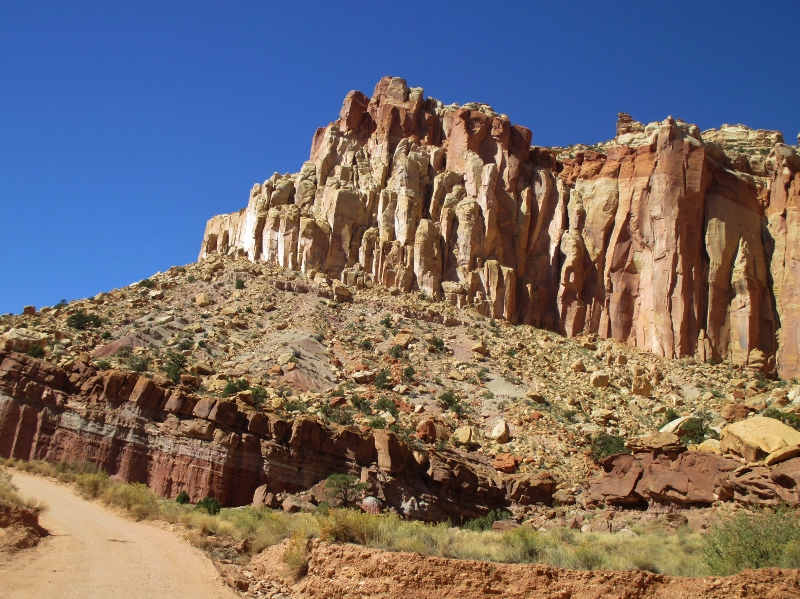
But we’re so glad we came here. This park is just staggeringly awesome if you like geology, which obviously we do. On Hwy 24 we approached the San Rafael Reef, the distinctive and seemingly impassible eastern edge of the San Rafael Swell, a section of crust that was pushed up with the Rockies around 60 million years ago.San Rafael Reef
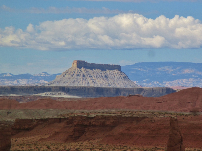
Beyond the reef we began seeing shapes and colors that we had not seen before in Arches and Canyonlands: Factory Butte, with its hogback ridge created by differential erosion of outcroppingFactory Butte
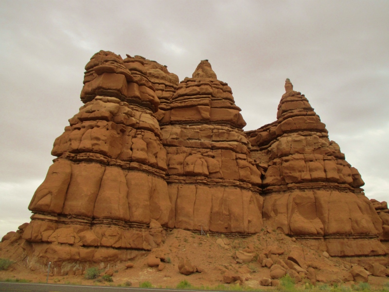
and weird shapes of Entrada Sandstone in Goblin Valley.Goblins
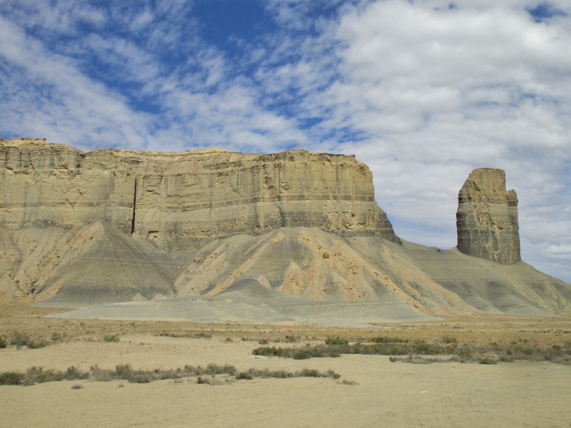
We drove through more and more fascinating eroded formations:
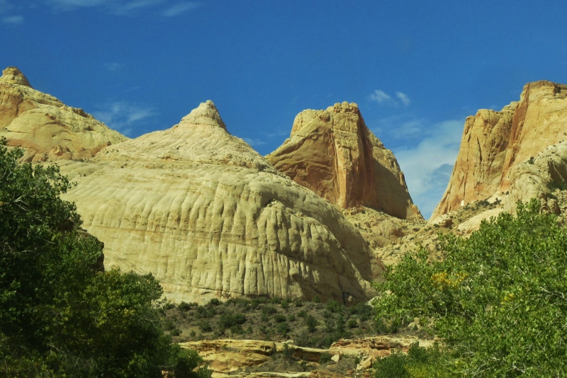
and began to see the white domes of Navajo sandstone that look like the old dome of the U.S. Capitol building, for which the park was named. (“Reef” around here means a rocky barrier to travel.)Like the Capitol Dome
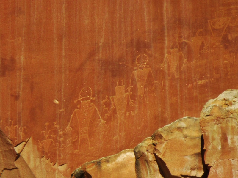
As we approached the park, we came to some petroglyphs carved by what archeologists call the Fremont people who lived in this area from about 700 to 1300 AD, roughly contemporaneous with and possibly a splinter group of the Ancestral Puebloan people.Fremont people petroglyphs
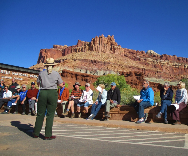
This morning we went to the Visitor Center for a ranger lecture that was extremely valuable in opening our eyes to what we would be seeing. Ranger’s geology talk
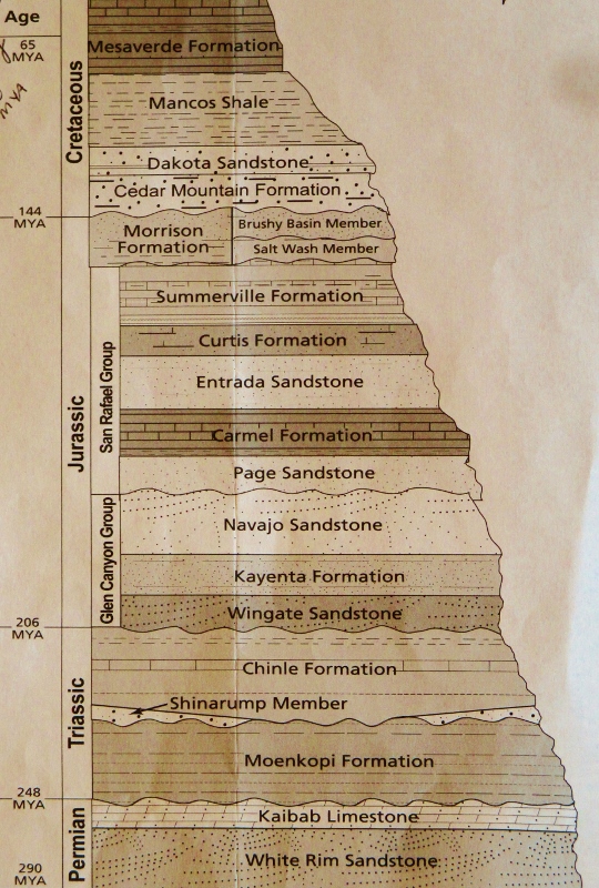
She described how for about 250 million years, during the time all the continents were joined in Pangaea, “deposition” took place; that is, inland seas came and went again and again and each time left behind layers of fossils, minerals, soils, that created a very thick blanket of surface materials. She gave us a handout that showed all the different layers of deposition and their dates:Layers of sedimentation deposits
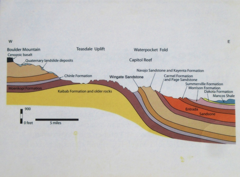
Then about 70-80 million years ago, lots of movement started happening: the continents moved apart as tectonic plates collided and subducted; the Kula and Fallalon Plates slid shallowly under the North American plate, which caused the Laramide Orogeny (mountain-building) that created the Rocky Mountains and the major land feature of Capitol Reef, the 100-mile-long Waterpocket Fold that forms the monocline backbone of the long, skinny park.
10-15 million years ago the entire region was uplifted several thousand more feet by the creation of the Colorado Plateau (southeastern UT, northeastern AZ, southwestern CO, and northwestern NM). The rock layers on the west side of the Waterpocket Fold have been lifted more than 7,000 feet higher than the layers on the east, and now erosion has exposed the older rocks on the western side of the fold. A total of 7,000 feet of overlying Mesozoic and Cenozoic sediment has been removed by erosion, which is still taking place today. Even in this desert climate, it is water that is most responsible for the carving of the landscape: infrequent but slightly acidic and occasionally torrential rain, water leaking into cracks and then freezing and thawing, breaking apart the rock. So the story here is: deposition-uplift-erosion.
The ranger showed us a schematic of how the layers have been exposed by erosion
Schematic showing how erosion has revealed the layers
and then, pointing to the cliffs right behind us, pointed out layer by layer what we were looking at. It’s the first time I’ve really grasped the passage of time in the rock layers. We could just turn around and look at the Moenkopi Formation on the bottom (dark red, sort of furry-looking iron-rich siltstone), up through the Chinle (CHEEN-lay) Formation (light greenish sandstone because the iron was less oxidized at the time of deposition), the whitish-grey Navajo Sandstone, the ledge of red Page Sandstone, then Entrada Sandstone & gypsum mixed, the Morrison Formation, then the Dakota Sandstone (tan with oyster shell fossils), Mancos shale (dark grey), and Mesaverde Formation at the top. Seeing the schematic and having the list of layers was like having a Rosetta Stone to the language of the rock!
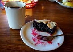
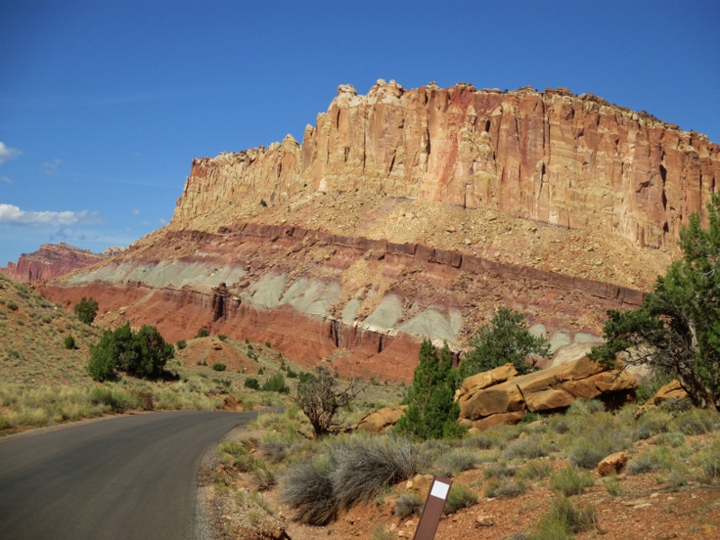
After the lecture we drove south into the park, which includes a historic district of the town of Fruita, settled by Mormon pioneers. The major attraction there is the Gifford Farmhouse that now sells homey items such as preserves and pies, of which we gladly partook.
Pie!
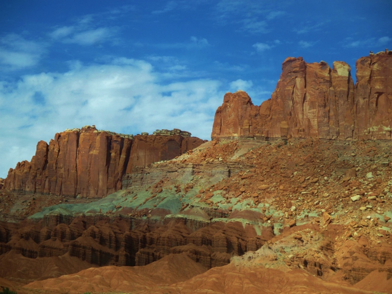
We drove down the only 8 miles of road into the 241,904-acre park. Our experience of this area is that it’s incredibly raw, massive, and overwhelming. Every turn of the road revealed another colossal multi-layered wall of rock
made comprehensible to us only by our understanding of the deposition-uplift-erosion story.
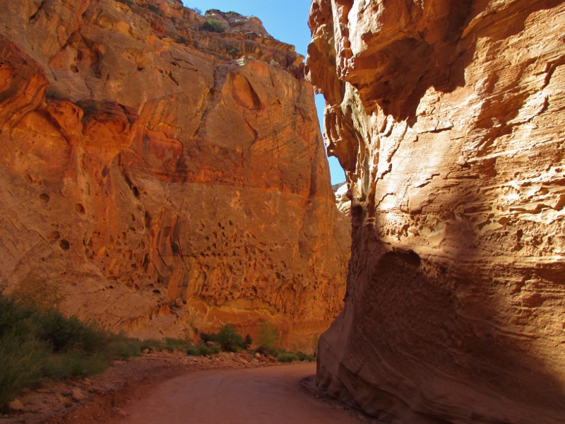
The road narrowed,Narrower and narrower!
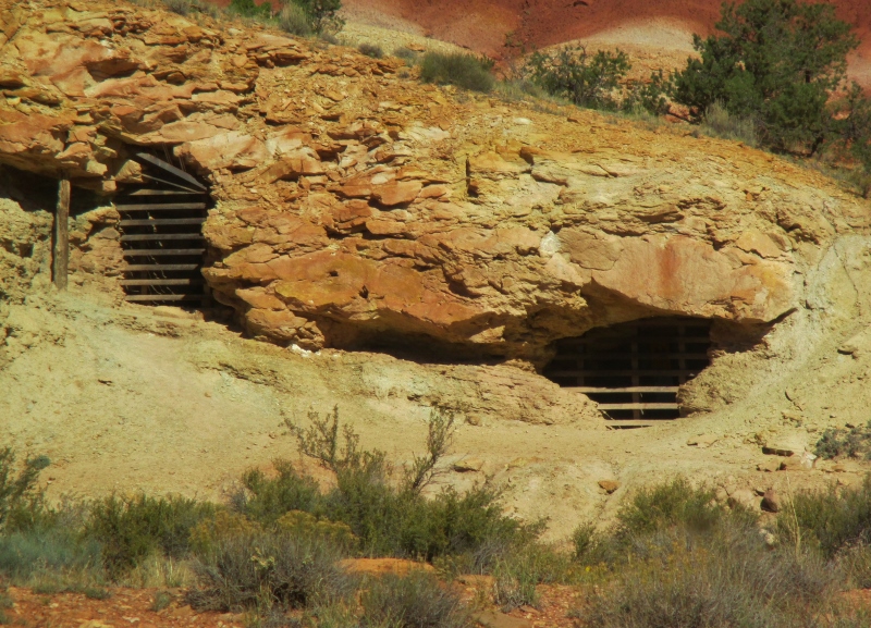
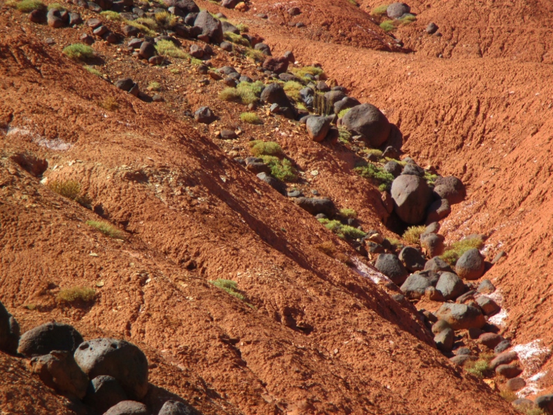
and several times we turned off onto rough gravel roads (sorry, little Smart car!), on one of which we found a disused uranium mine; uranium was deposited in the Chinle Formation layer, which extends from here east and accounts for the many uranium mines in Utah.Defunct uranium mine
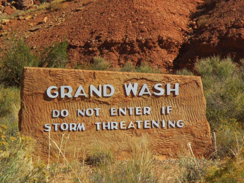
We also hiked from the end of the gravel roads into the washes that extended on beyond. These narrow washes become death traps in storms, as water 20 feet high can rush through – fortunately, we had a clear, cool, sunny day.
At the entrance to Grand Wash
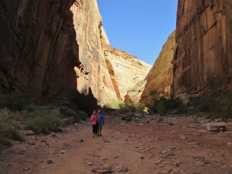
Walking down the washes is kind of eerie, with towering cliffs on both sides and massive boulder wanna-be’s just waiting to crash down and squash you.
In the Grand Wash
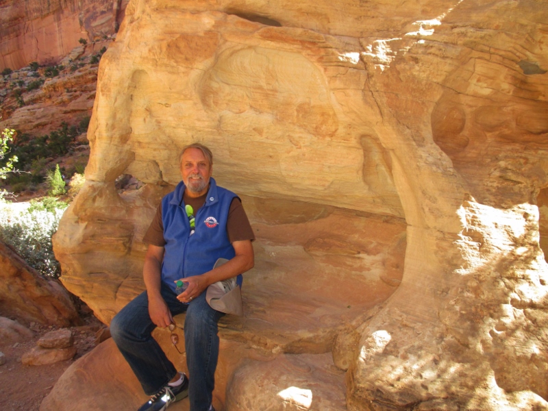
I had a very intense, emotional reaction to being here. Nothing in this park is human scale. If the rock weren’t so dazzlingly beautiful, it would feel menacing. It’s impossible to forget that every rock you see by the side of the path would have crushed you like a bug if you had been here when it fell, which of course they do.
This rock would be nice in our garden! On the drive back north, the uplift of the layers could clearly be seen.
Evidence of the monocline uplift
We thought we had seen everything it is possible to see in different kinds of rock here – but wait, there’s more! At the side of the road near the Visitor Center are piles of black volcanic boulders! Everything else around here is sedimentary; where did these lava rocks come from? Turns out the two mountains in the area, Boulder Mountain (aptly named) and Thousand Lake Mountain, were formed by magma buildups that never erupted but at times oozed magma from their tops that formed these boulders that rain, wind, and small earthquakes have sent down into the plateaus below.
Lava boulders
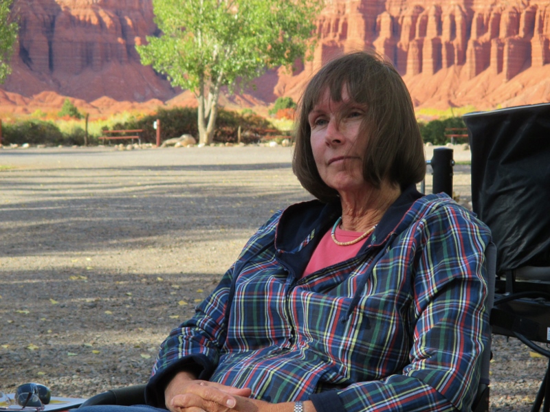
After our dizzying day among the rock behemoths, we returned to our RV park at the base of some Moenkopi Formation cliffs and started a little campfire. Our elevation is only around 5,000 feet now, and the weather is a little cooler as we get further into autumn. A neighbor to the west stopped to chat, and our neighbors to the south (a couple from the Bay Area) brought over some wine and cheese & crackers and chairs, and we chatted until dinnertime.
Relaxing by the campfire, the setting sun lighting the sandstone cliffs
We went for the “cowboy dinner” that the RV park offered, then came back to our campsite and revived the fire. Our Bay Area neighbors returned, and two fishermen from Salt Lake City joined our group as well. As night fell we sat out under the Milky Way, clearly visible, and swapped stories until late in the evening.
Now we know why Arches is one of the most popular of the national parks, visited each year by 700,000 tourists. Just inside the park are massive sandstone wallsSandstone wall
that are difficult to comprehend even being right up next to them.Stone like tall buildings
There were all sorts of interesting formations, such as crossbedding (fine diagonal layering within larger, originally horizontal layers).Crossbedding
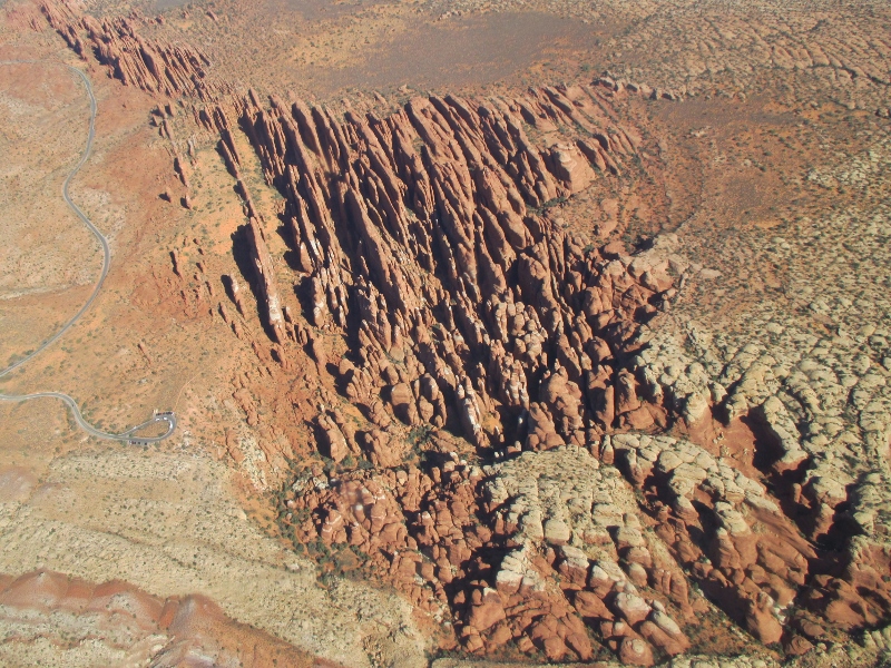
We saw the “fins” we have heard so much about, the narrow slabs that give rise to the arches,Fin
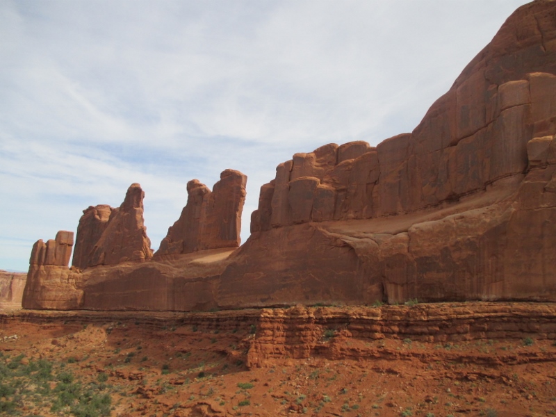
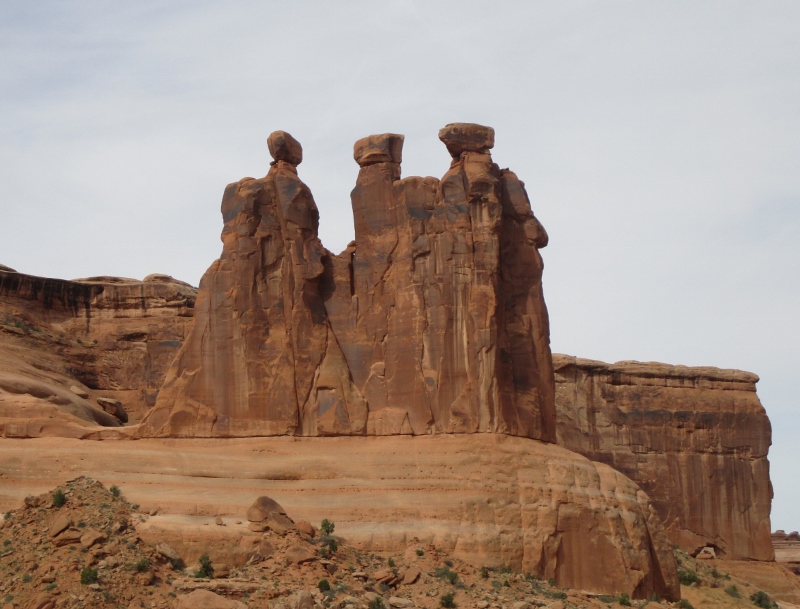
a line of which forms a formation called Park Avenue.Park Avenue
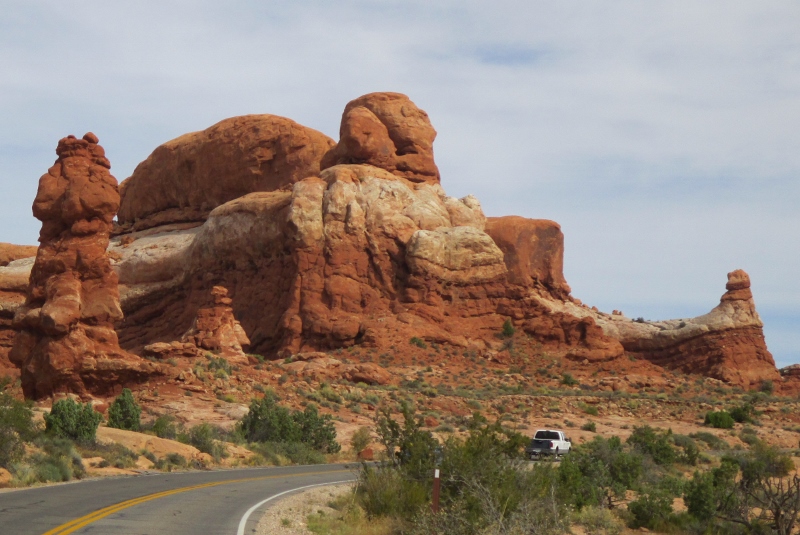
There were so many unusual things to look at in all directions.So many weird rock formations
Some of them looked like people.Sandstone people
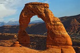
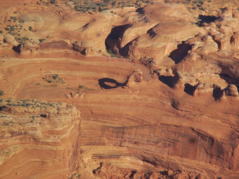
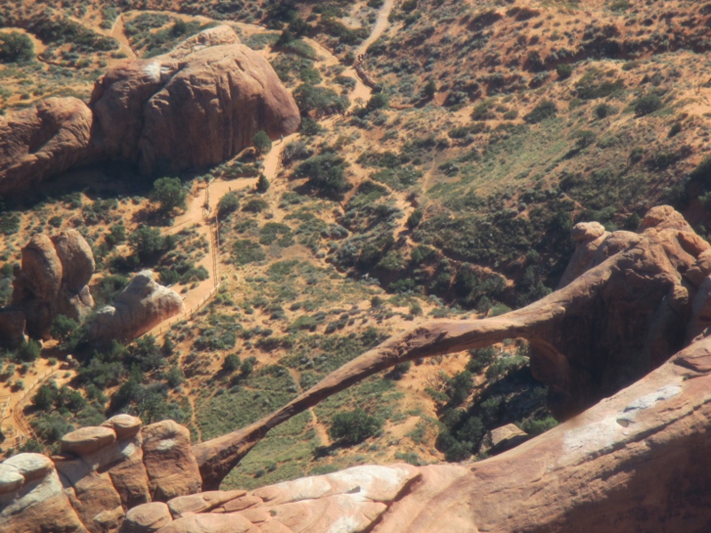
Then we started seeing the arches: Delicate Arch,Delicate Arch
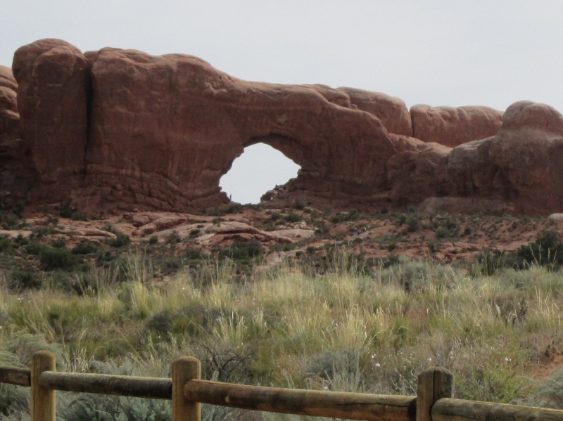
North Window Arch,North Window Arch
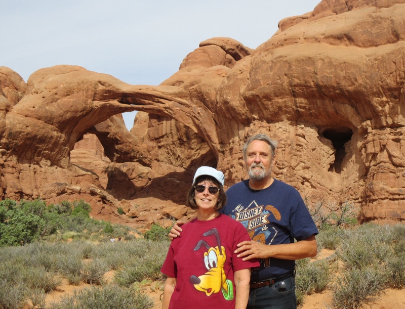
and Double Arch, which is much huger than it looks in this perspective – there are tiny people walking around underneath it that you can’t see.Carol & Patrick at Double Arch
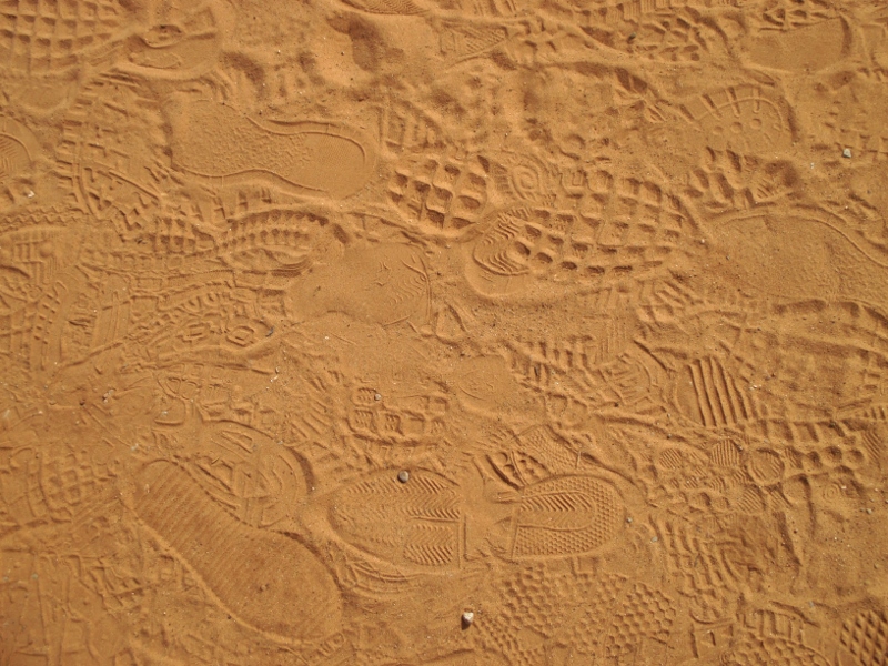
We even saw some fascinating footprint fossils on the ground near Double Arch; I’m sure I could identify a Reebok, and a Nike …Sand footprint fossils
Later we went back and got our bikes. We haven’t been able to ride lately because we’ve been camped on gravel. Every second vehicle in Moab has a bike rack & bikes on it, especially mountain bikes – the local “sliprock” is a mountain-biking delight – and also dirt bikes.
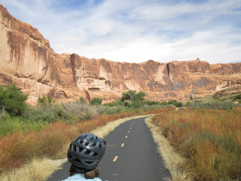
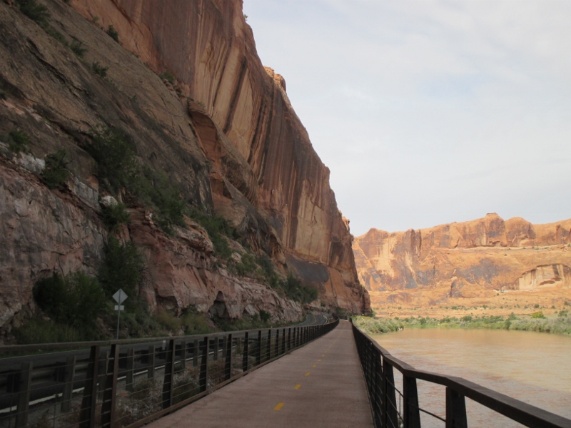
There is also a super amenity for street-bike riders: the Moab Canyon Pathway, over 100 miles of paved smooth blacktop bike path that goes from the north edge of town out several directions into the rock formations. We parked the Smart car and hopped on our bikes and rode toward Arches N. P. When we got to the Colorado River, a couple of miles north, we turned east and rode along the river, skirting the southern border of the park.Bike path along the Colorado River
At first the trail went next to a road; then it veered off away from the road, next to some towering cliffs.Down the path
We saw lots of interesting rock formations close up,Rock up close
including some baby arches in the making.Incipient arches
Coming back, we were between the river and a gorgeous sheer rock wall.Overwhelming sheer wall
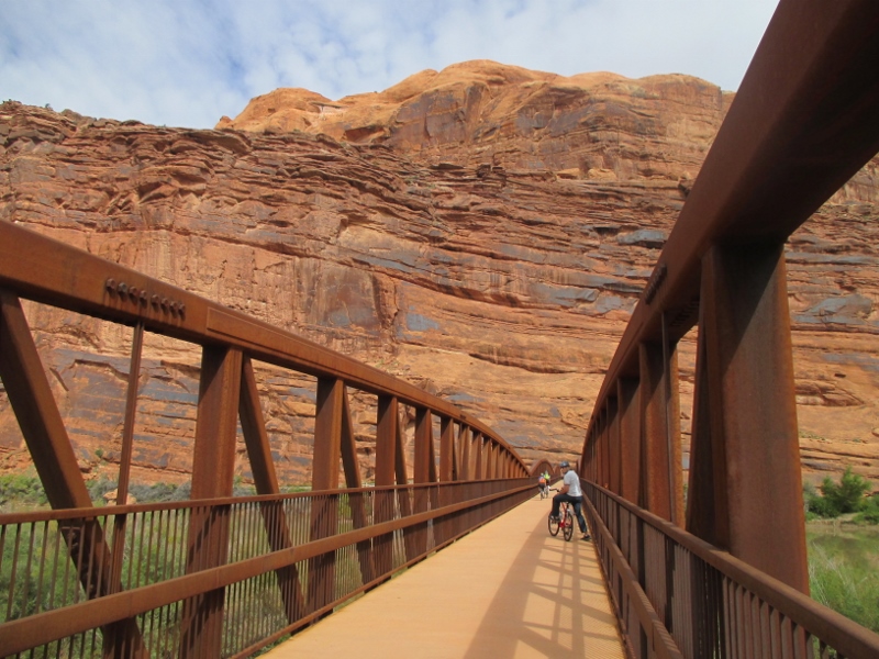
Then we rode across a bridge over the reddish, silt-filled riverBike bridge over the Colorado
and up the path north some more before turning around and heading back to the car. What a fabulous bike ride! As memorable as the airplane ride over Canyonlands, in a completely different way.
The drive from Colorado into Utah was – to again employ a word I am overusing to the point of exhaustion – spectacular.
Highway 191 crosses the Paradox Basin, which during Pennsylvanian time (around 300 million years ago, when all the continents were still joined as Pangaea) was a shallow, nearly landlocked sea. As we came north on Highway 191, we started seeing beautiful and weird sandstone formations Sandstone formations
and some arches.Wilson Arch
Here’s the story about the strange and wonderful rock and arches of this area: This sea filled, was cut off from the ocean, and evaporated 29 different times (how do they know it was 29, not 28 or 30?!), leaving behind evaporate deposits (salts: gypsum, halite (table salt), and potash) as much as 4,000 feet thick. Sand blew in, the ancient Rocky Mountains eroded, and the salts became covered by rock. Salts weigh less than most rock and can liquefy and flow, which they did when crushed under the weight of the rock above. The flowing salts ran into a fault and started piling up, forming huge domes underneath the overlying rock and causing the rock to crack in long lines.
Over time, water seeped into the surface cracks, joints, and folds of the layers. Ice formed in the fissures, expanding and putting pressure on surrounding rock, breaking off bits and pieces. Winds later cleaned out the loose particles. A series of free-standing sandstone fins, distributed in long, narrow lines, remained. Wind and water attacked these fins until, in some, the cementing material gave way and chunks of rock tumbled out. Many damaged fins collapsed. Others, with the right degree of hardness and balance, survived despite their missing sections. These became the famous arches of Arches National Park.
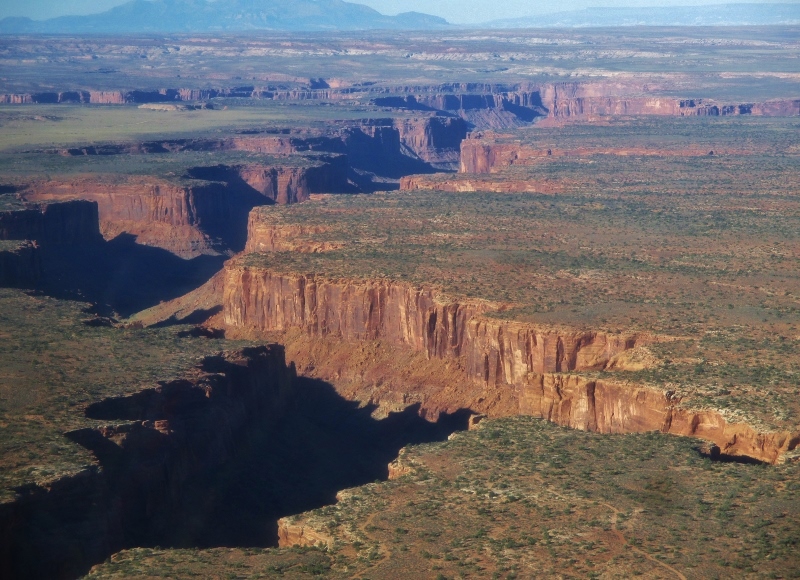
Near Arches is Canyonlands National Park, a colorful landscape eroded into countless canyons, mesas, and buttes by the Colorado River, the Green River, and their respective tributaries.
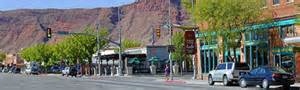
Both parks are visited from the town of Moab, our first destination in Utah.Hiking/biking/rafting town of Moab
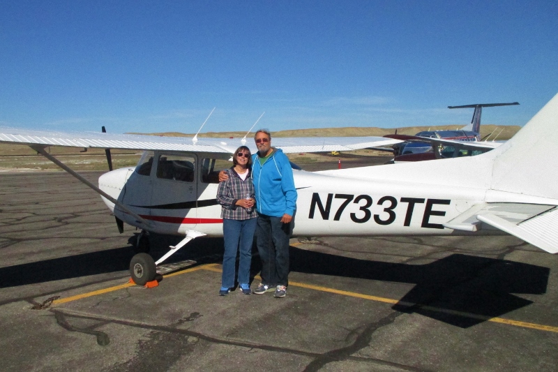
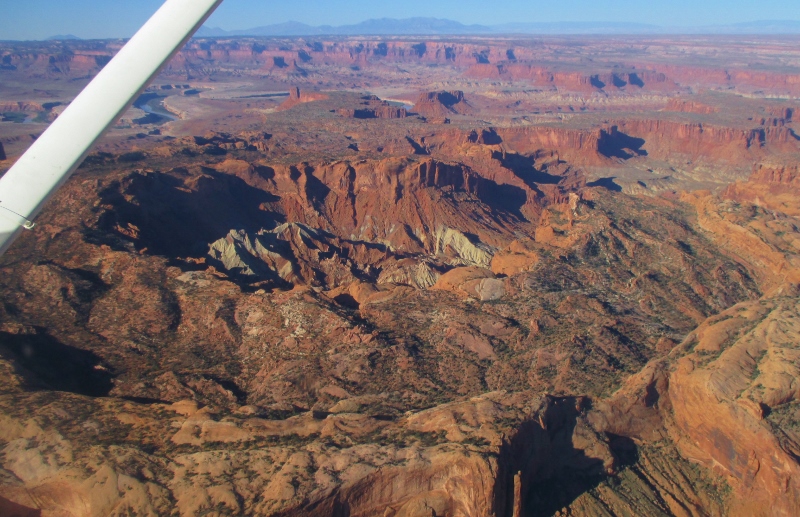
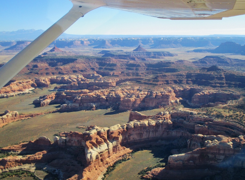
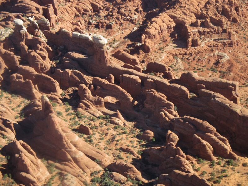
With a little research, we figured out that Canyonlands would be difficult to see from the ground. The park has only two paved main routes into (not through) its 260,000 acres (plus 192 miles of road for four-wheel driving and mountain biking), with 75% of the land area managed as wilderness. It’s a backpacker’s and river-rafter’s paradise, but we’re not going to be backpacking or rafting and the only way to grasp the expanse of it would be from the air. So we booked a flight on a 4-seater Cessna 172 Skyhawk to fly us for 90 minutes mostly over Canyonlands, with a little time over Arches as well.Carol, Patrick, & the Cessna Skyhawk
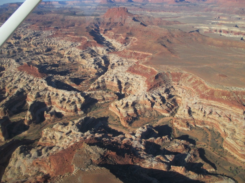
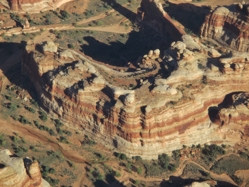
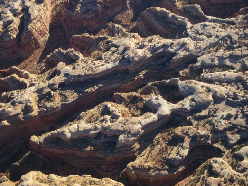
From the air we could see so much: the rivers, layers of rock, canyons where cattle used to graze before the National Park was established, amazing formations:
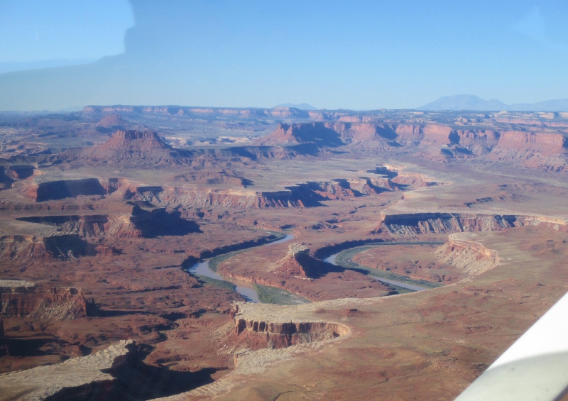
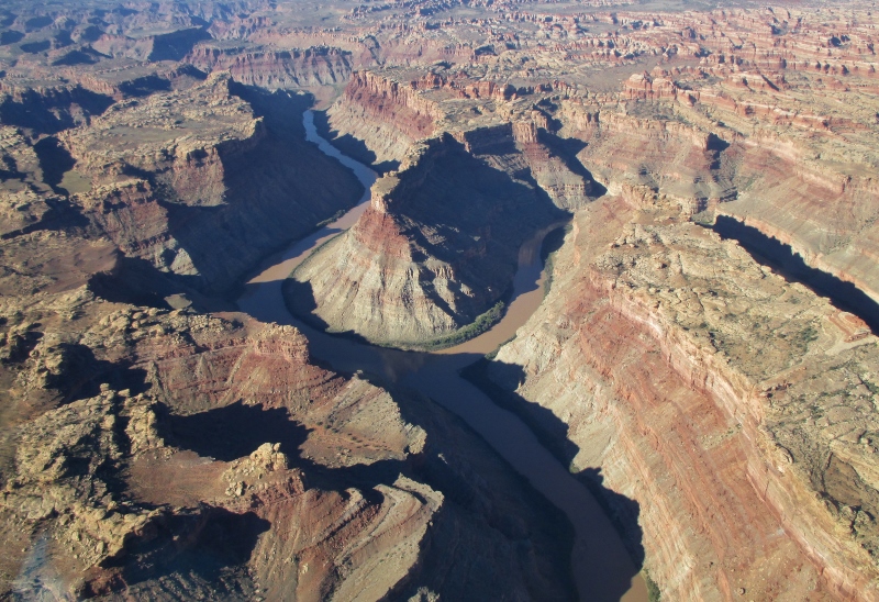
We saw the confluence where the Green River flows into the Colorado; it’s calm there, rapids beginning a couple of miles below.Confluence of the Colorado (left) and Green Rivers
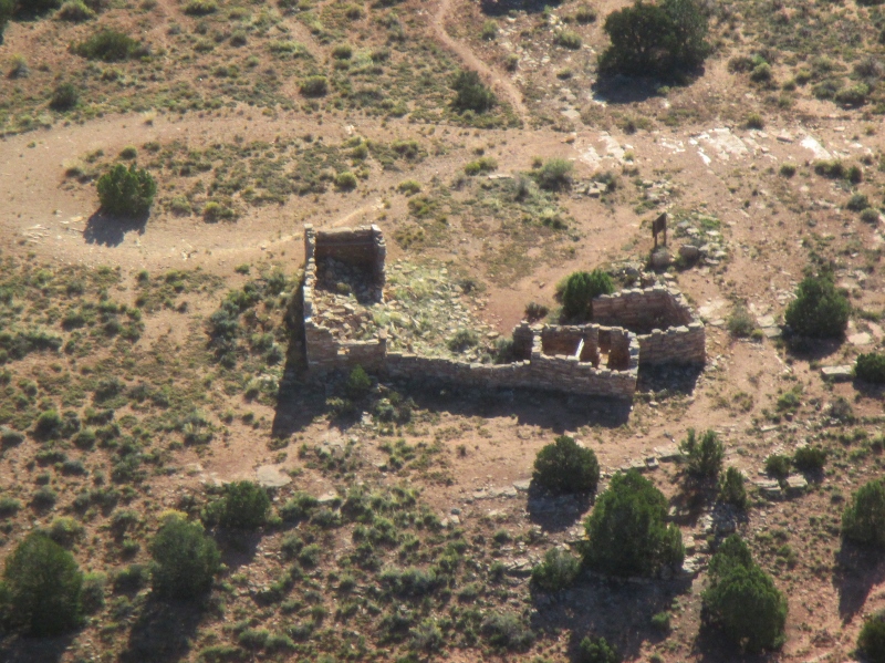
The weather was perfect, clear and cloudless, and our pilot was just super, both engaging and knowledgeable. He flew over ruins that he said were Anasazi. We have heard that “Anasazi” is another name for the group to which the Ancestral Puebloans of Mesa Verde belonged, and also that they were a different group who migrated over the land bridge from Asia at a different time; I don’t know which is true. The architecture here looks a little different from what we saw at Mesa Verde:Anasazi ruin
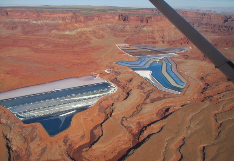
On the way to Arches, we flew over the Kane Creek potash mine and processing facility on the Colorado River that recovers some of the abundant salts from the Paradox Basin. USGS estimates the Basin contains up to 2 billion tons of potash. The system here combines solution mining and solar evaporation: river water is pumped into the mine and dissolves the potash, after which the brine solution is pumped to the colorful evaporation ponds that we could see from the air.Potash evaporation ponds
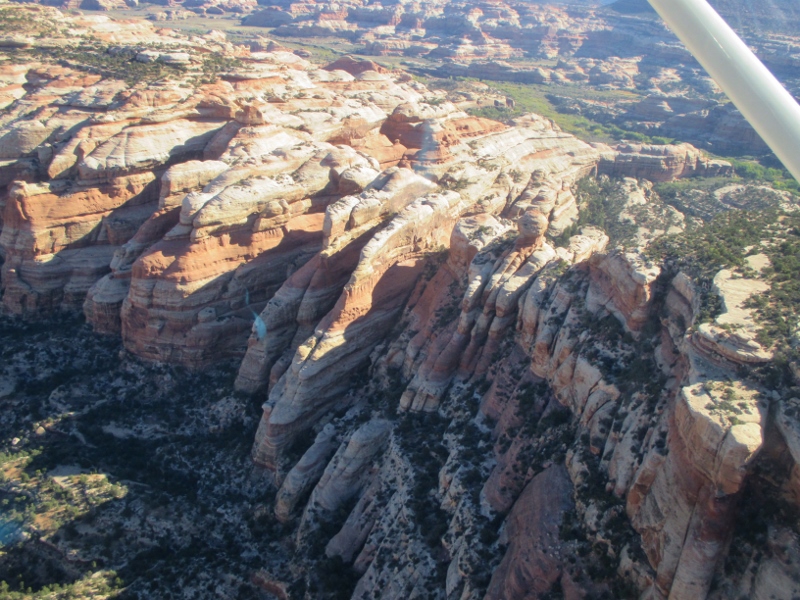
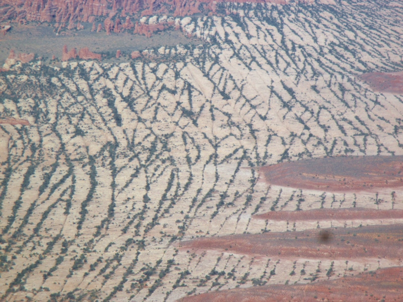
As we flew over Arches, we could see both the “fins” of which we have heard so much
Sandstone fins
and the parallel rock crack lines from which the fins derive.Lines of cracks in the rock
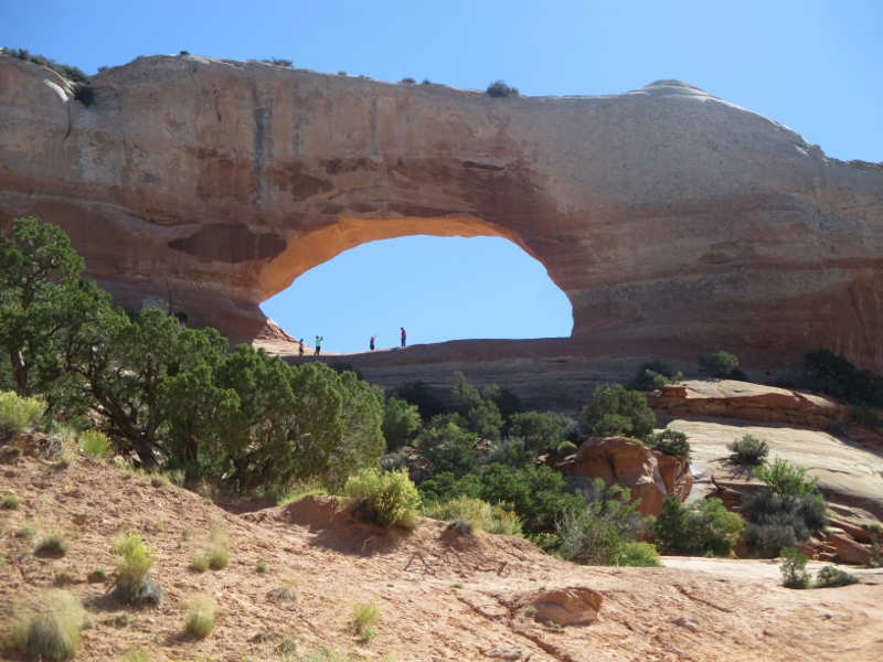
Then we started seeing some of the famous arches: Delicate Arch,Delicate Arch
Landscape Arch,Landscape Archand others
Don’t know the name of this arch – there are over 2,000 arches in the park!
This was an unforgettable flight over an extraordinary place on the earth. We could never have seen so much or gotten such comprehension of and appreciation for Canyonlands in any other way.
We had planned to leave today for Moab UT, but all the RV parks I called there were booked. Things are busier than usual in this part of the country for this time of the year. Good weather? Improving economy? Tourists avoiding California because of the drought there?
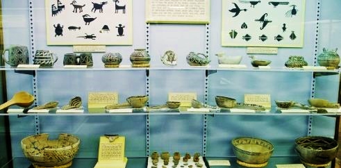
Whatever the reason, we have another day here, so we went back up to “Cuesta” Verde to see some things we didn’t have time for on Wednesday, starting with the Chapin Mesa Archeological Museum. There were exhibits of prehistoric artifactsArtifacts displayed
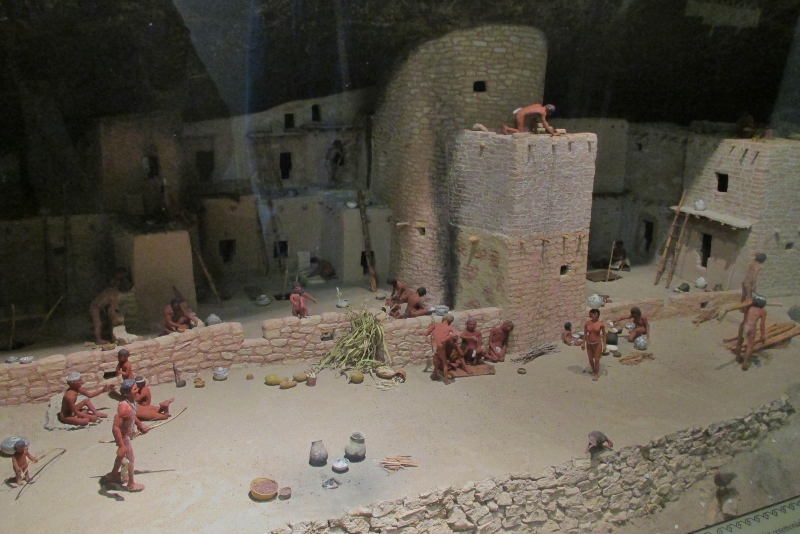
and a film on the development of the Ancestral Puebloan culture, but the most interesting thing to me was a series of dioramas illustrating the changes in the lifestyles of the people over the 700 years they lived in this area, during which time epic advancements took place.Diorama of the “Modified Basketmaker” period – note the innovation of pottery
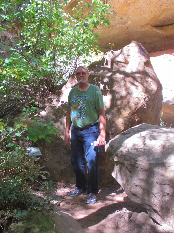
Then we went outside to hike down a trail Patrick on the hike to Spruce Tree House
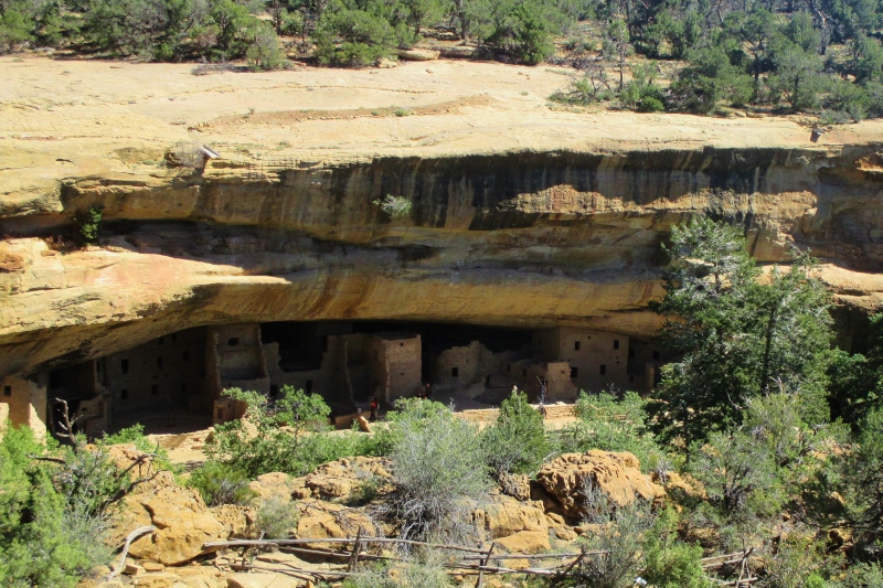
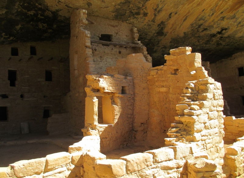
that led us to Spruce Tree House, the third largest cliff dwelling. Spruce Tree House
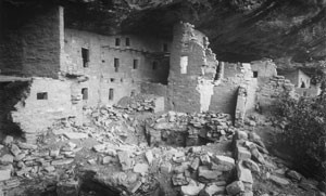
While of course the descendants of the Puebloans never forgot that the cliff dwellings of their ancestors were here, this one was first discovered by settlers in 1888, when two local ranchers chanced upon it while searching for stray cattle. This is what it looked like when Dr. Jesse Walter Fewkes of the Smithsonian Institution came to study, excavate, and preserve it:Spruce Tree House in 1908
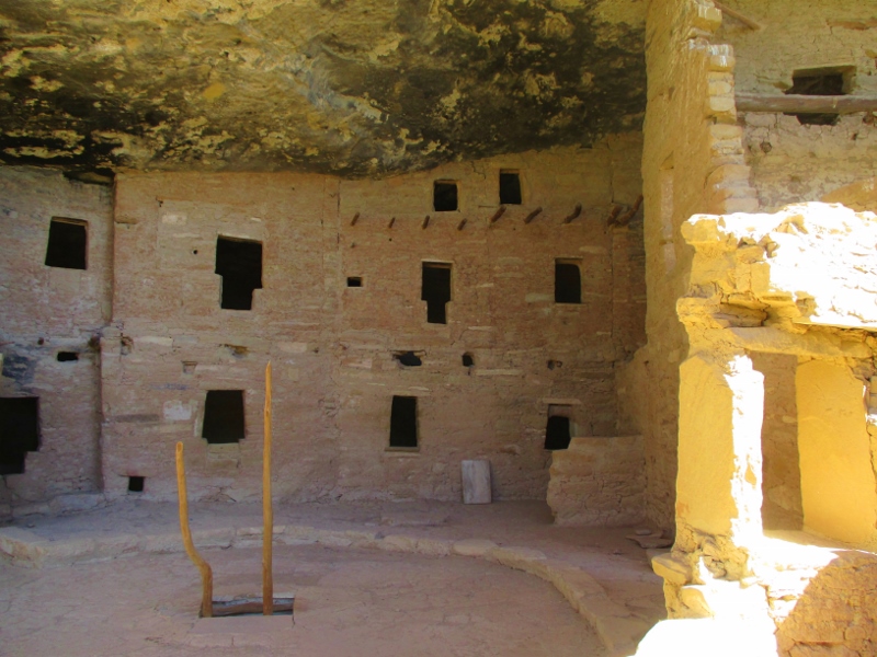
Dr. Fewkes removed the debris of fallen walls and roofs, stabilized the remaining walls,Multi-level walls
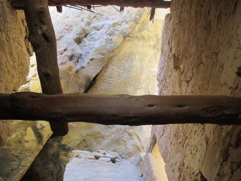
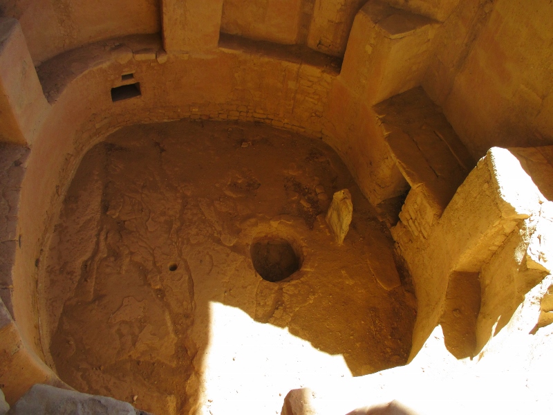
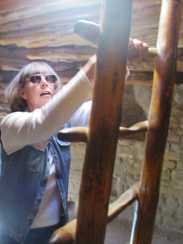
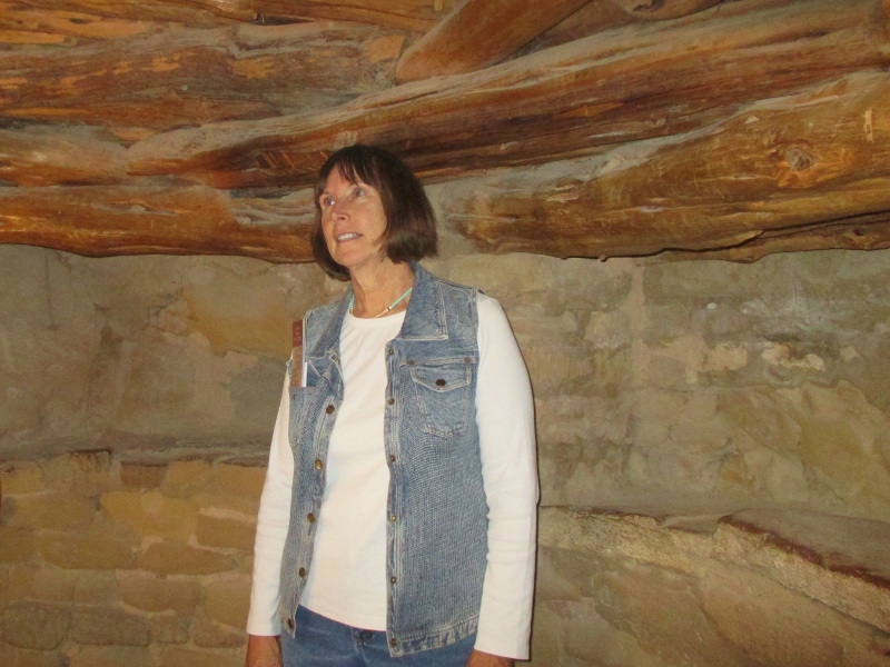
and rebuilt a stone kiva roof that had fallen in so that visitors can climb down into the kiva. For some reason we were allowed to climb around in this cliff dwelling much more than at Cliff House, and we did. This is looking up through one of the towers (a floor would have been where you see the wood):Looking up
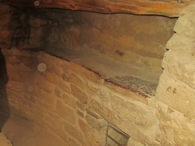
As at Cliff House, the stone masonry blocks are expertly chiseled and mortared.Masonry walls
We were able to look down into one of the eight kivas,Kiva
and then to climb down into the one with the restored stone roof. Climbing down into the kiva
It had a wonderful ambiance, no doubt cool in summer and warm in winter with a small fire and the thermal mass of the rock to keep in the heat. These rooms were where sacred ceremonies took place, but they weren’t reserved only for those; they were also kind of like family rooms, where people gathered for various purposes. We saw some of the features that were present since the days of the pit houses: a fire circle in the middle, chimney and deflector to direct the air, a stacked wood ceiling and a shelf all around.
In the kiva
Also a rectangular recess that they always had, purpose unknown; Patrick says it was for the flat-screen TV.