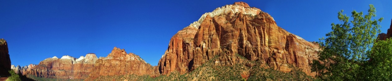
The drive from Colorado into Utah was – to again employ a word I am overusing to the point of exhaustion – spectacular.
Highway 191 crosses the Paradox Basin, which during Pennsylvanian time (around 300 million years ago, when all the continents were still joined as Pangaea) was a shallow, nearly landlocked sea. As we came north on Highway 191, we started seeing beautiful and weird sandstone formations 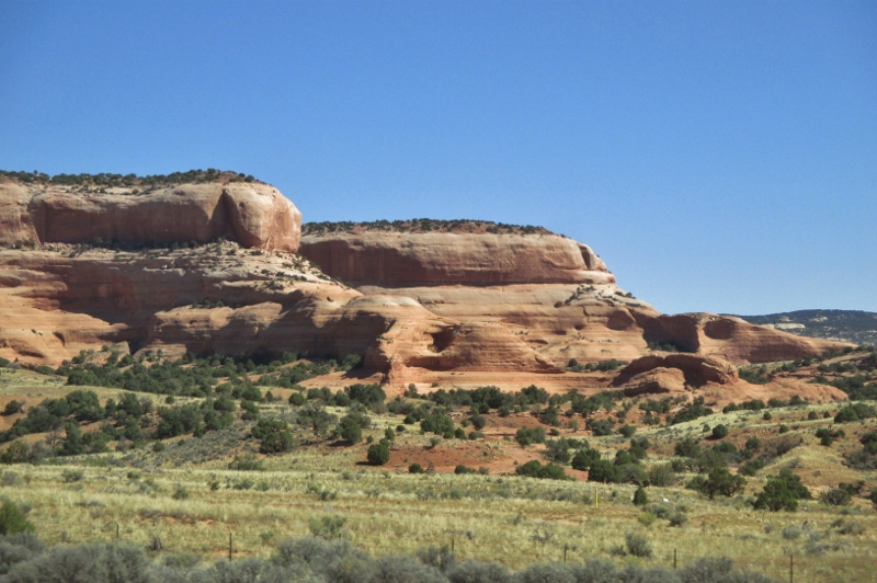
and some arches.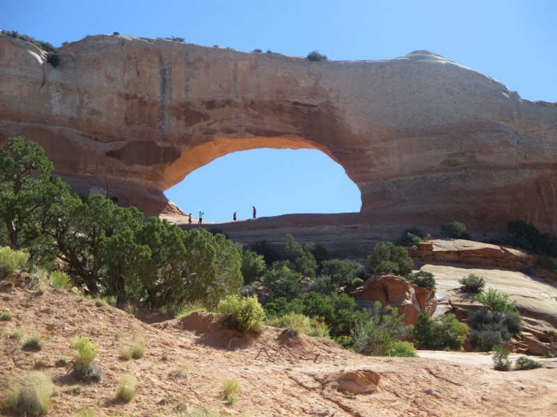
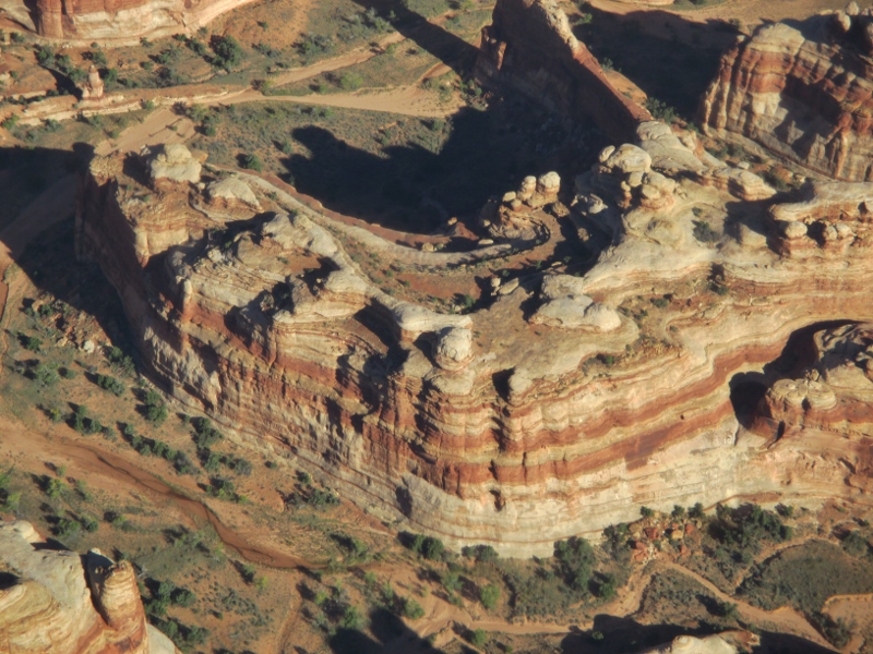
Here’s the story about the strange and wonderful rock and arches of this area: This sea filled, was cut off from the ocean, and evaporated 29 different times (how do they know it was 29, not 28 or 30?!), leaving behind evaporate deposits (salts: gypsum, halite (table salt), and potash) as much as 4,000 feet thick. Sand blew in, the ancient Rocky Mountains eroded, and the salts became covered by rock. Salts weigh less than most rock and can liquefy and flow, which they did when crushed under the weight of the rock above. The flowing salts ran into a fault and started piling up, forming huge domes underneath the overlying rock and causing the rock to crack in long lines.
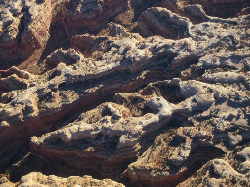
Over time, water seeped into the surface cracks, joints, and folds of the layers. Ice formed in the fissures, expanding and putting pressure on surrounding rock, breaking off bits and pieces. Winds later cleaned out the loose particles. A series of free-standing sandstone fins, distributed in long, narrow lines, remained. Wind and water attacked these fins until, in some, the cementing material gave way and chunks of rock tumbled out. Many damaged fins collapsed. Others, with the right degree of hardness and balance, survived despite their missing sections. These became the famous arches of Arches National Park.
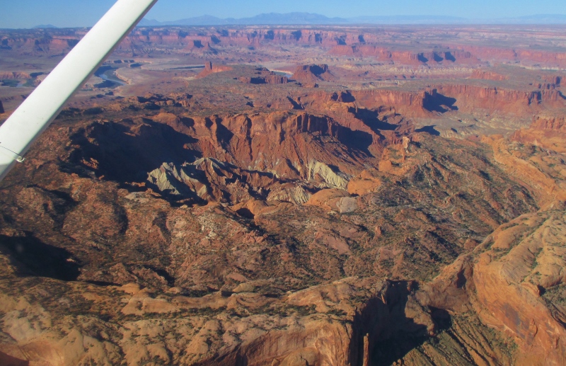
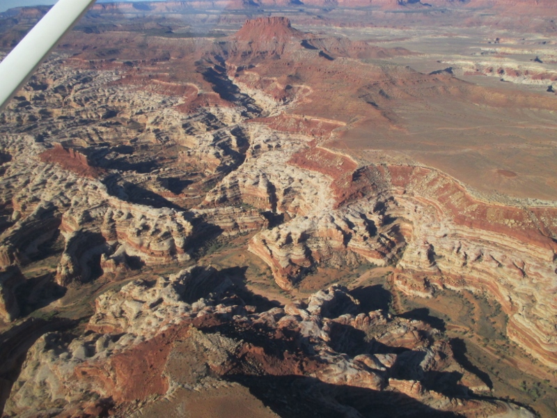
Near Arches is Canyonlands National Park, a colorful landscape eroded into countless canyons, mesas, and buttes by the Colorado River, the Green River, and their respective tributaries.
Both parks are visited from the town of Moab, our first destination in Utah.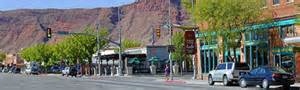
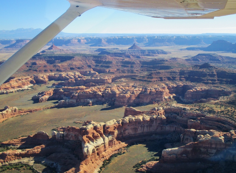
With a little research, we figured out that Canyonlands would be difficult to see from the ground. The park has only two paved main routes into (not through) its 260,000 acres (plus 192 miles of road for four-wheel driving and mountain biking), with 75% of the land area managed as wilderness. It’s a backpacker’s and river-rafter’s paradise, but we’re not going to be backpacking or rafting and the only way to grasp the expanse of it would be from the air. So we booked a flight on a 4-seater Cessna 172 Skyhawk to fly us for 90 minutes mostly over Canyonlands, with a little time over Arches as well.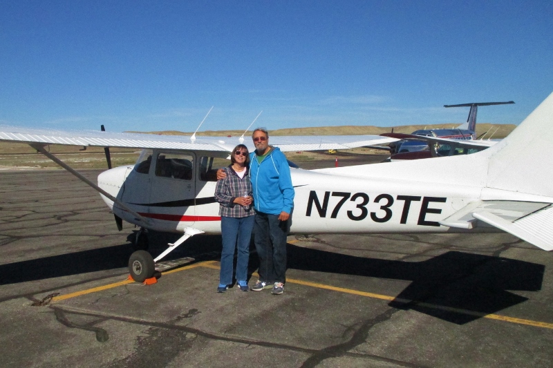
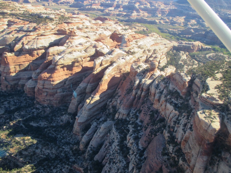
From the air we could see so much: the rivers, layers of rock, canyons where cattle used to graze before the National Park was established, amazing formations:
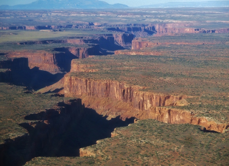
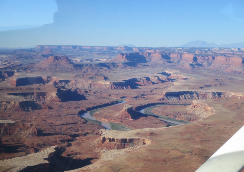
We saw the confluence where the Green River flows into the Colorado; it’s calm there, rapids beginning a couple of miles below.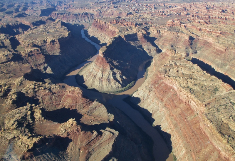
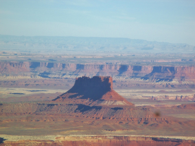
The weather was perfect, clear and cloudless, and our pilot was just super, both engaging and knowledgeable. He flew over ruins that he said were Anasazi. We have heard that “Anasazi” is another name for the group to which the Ancestral Puebloans of Mesa Verde belonged, and also that they were a different group who migrated over the land bridge from Asia at a different time; I don’t know which is true. The architecture here looks a little different from what we saw at Mesa Verde: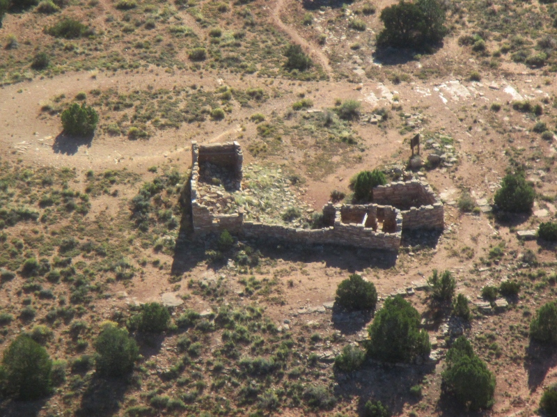
On the way to Arches, we flew over the Kane Creek potash mine and processing facility on the Colorado River that recovers some of the abundant salts from the Paradox Basin. USGS estimates the Basin contains up to 2 billion tons of potash. The system here combines solution mining and solar evaporation: river water is pumped into the mine and dissolves the potash, after which the brine solution is pumped to the colorful evaporation ponds that we could see from the air.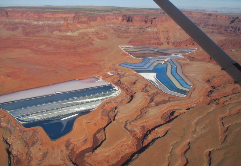
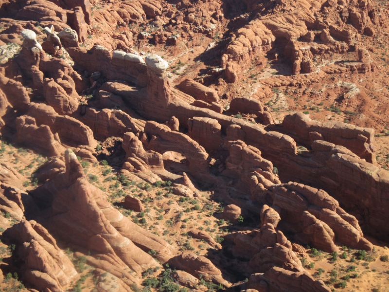
As we flew over Arches, we could see both the “fins” of which we have heard so much
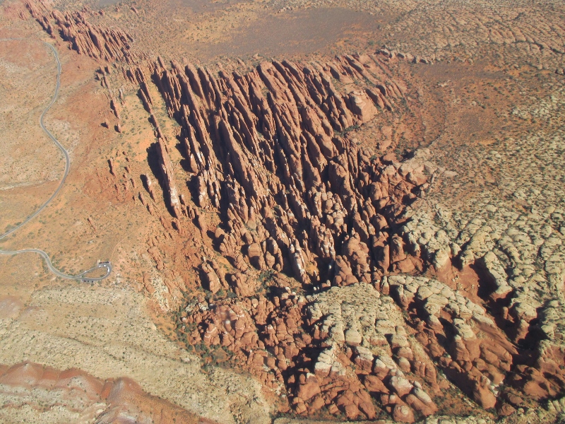
and the parallel rock crack lines from which the fins derive.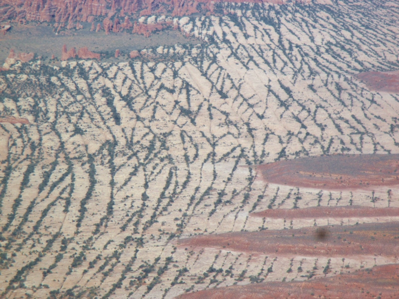
Then we started seeing some of the famous arches: Delicate Arch,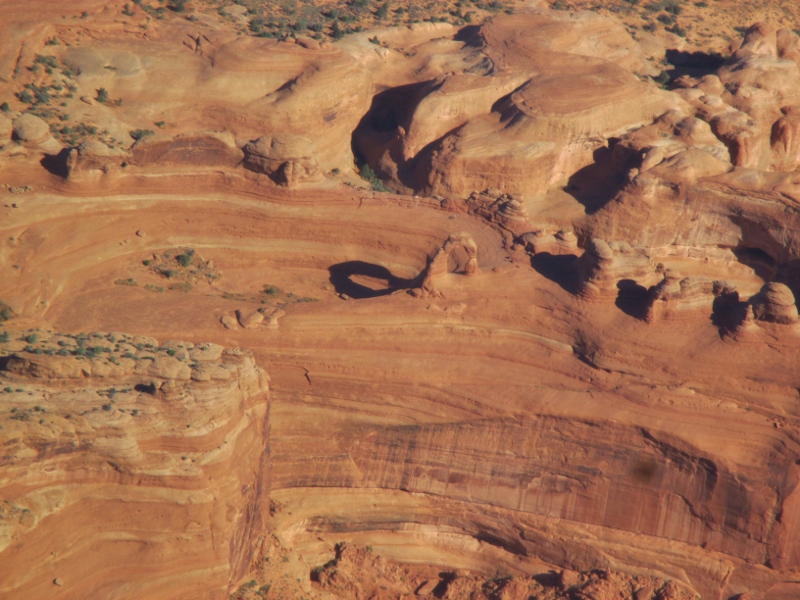
Landscape Arch,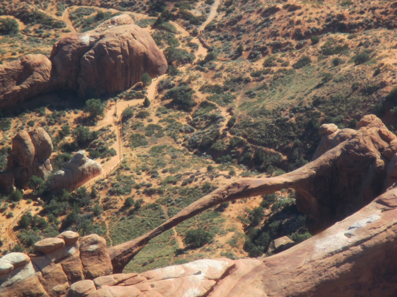
This was an unforgettable flight over an extraordinary place on the earth. We could never have seen so much or gotten such comprehension of and appreciation for Canyonlands in any other way.