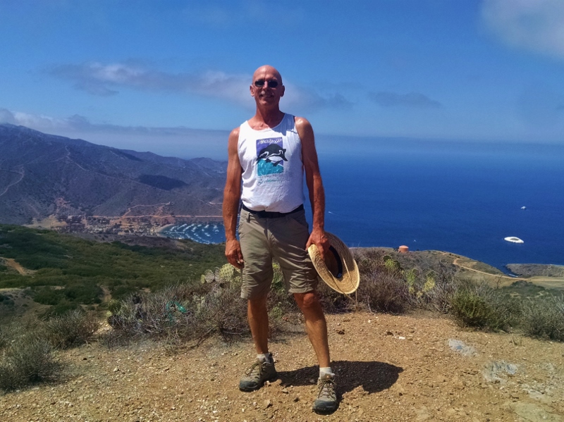
After the Dodger game on Sunday, we picked up Peps from Manhattan Beach and he spent that night with us at the beach, Cheryl having moved on to the home of other friends. Peps had just finished serving as support crew for his friend Todd in the Catalina Classic Paddleboard Race. This is the 39th consecutive year of the 32-mile marathon, which attracts paddlers from all over the world and is known as the ‘Grand-Daddy of all Paddleboard Races.’ It begins at Isthmus Cove, Catalina Island, and ends at the Manhattan Beach Pier, and Peps and his friends had been on Catalina for several days prepping for the race. Peps hiking on Catalina Island Out of a hundred competitors, Todd came in third!
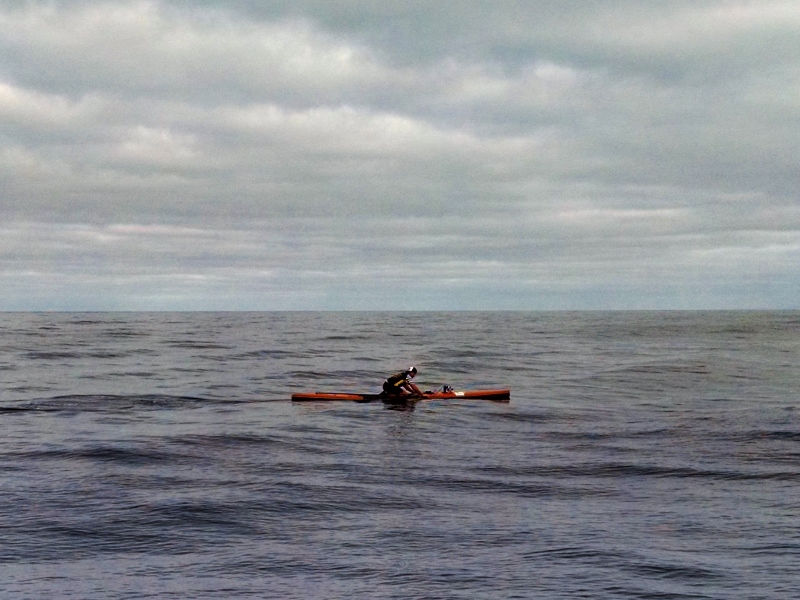
Todd paddling to Manhattan Beach PierOn Tuesday, we left Playa del Rey and headed south to San Diego. We are now camped at one of our favorite places, Fiddler’s Cove FamCamp just south of Coronado Island.
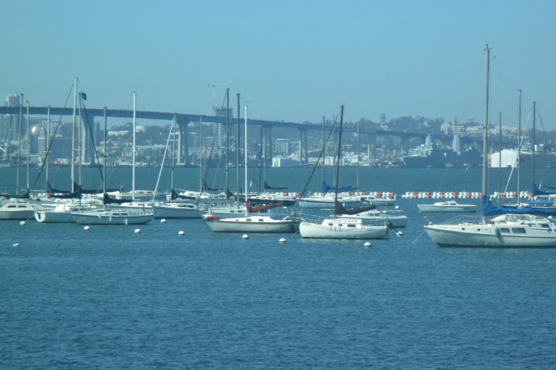
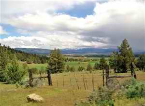
View of marina & Coronado Bridge from our RV site There are so many military installations in this area that I had assumed this ribbon of land that connects Coronado Island to Imperial Beach to the south was built for military purposes. But no. Coronado is what’s called a tied island, an island that is connected to land by a tombolo, a spit of beach materials connected to land at both ends.
Tombolos are formed by wave refraction: as waves near an island, they are slowed by the shallow water surrounding it. These waves then refract or bend around the island to the opposite side as they approach. The wave pattern created by this water movement causes a convergence of longshore drifting on the opposite side of the island, and the beach sediments that are moving by lateral transport on the lee side of the island will accumulate there. In other words, the waves sweep sediment together from both sides. Eventually, when enough sediment has built up, the beach shoreline, known as a spit, will connect with the island and form a tombolo. (Until 2007, Martha’s Vineyard and Chappaquiddick Island were connected by a tambolo called Norton Point Beach. In April 2007, a strong storm breached the beach and the two islands became separated by a 300-yard channel.)
However, the connection between Coronado and North Island Naval Air Station IS man-made by the military: originally Coronado was separated from North Island by a shallow channel called the Spanish Bight. Development of North Island by the Navy during World War II led to the filling of the bight by July 1944, combining the land areas into a single body.
I started not feeling well on the drive down and spent a couple of days lying low on the couch, during which time we did laundry, bought groceries, and saw a couple of free movies at the base theater. Feeling better now.
I grew up near L.A. and went to hundreds of my brothers’ Little League and American Legion baseball games, learned how to score a baseball game at my mother’s knee, and love the game, but I’ve never been to a Dodger game at Chavez Ravine. Until today.
Of course when I was growing up, there was no money for professional entertainment. But a few times my dad got Dodger tickets at work from a vendor, and I know at least once he got four tickets and took my 3 brothers; Peps remembers that he may have gotten 2 tickets other times and took Mike, who was a huge fan of the Dodgers, especially Maury Wills. I don’t think it occurred to anyone that I might like to go, and it’s ironic that now I’m the only one in the family who follows baseball.
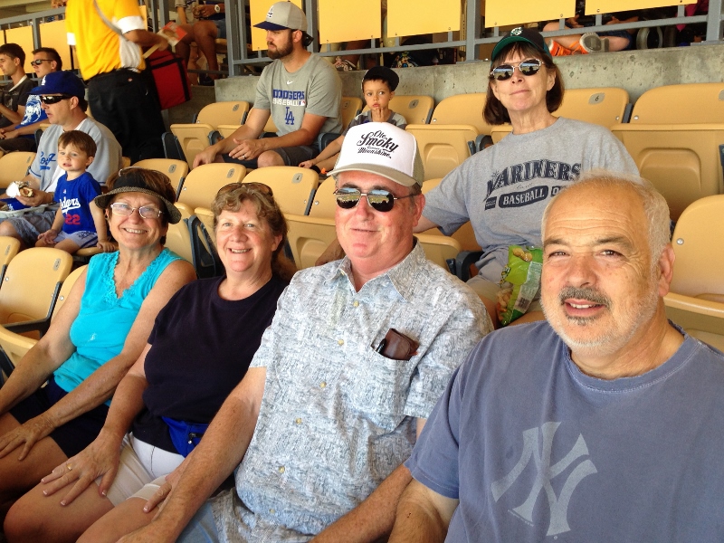
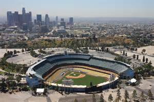
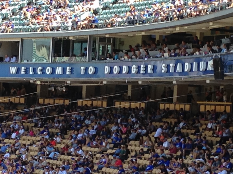
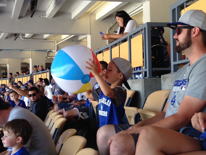
As a follow-on to the reunion, I organized a small group to go to a Dodger game the next day, six of us to be exact: Cheryl, Vonnie, Jim, Jim’s college friend John (whom we called the “player to be named later” until we met him today and learned his name), Patrick, and me. John is visiting all the major league ball parks, like we are, and is a good baseball guy; we graciously overlooked the fact that he’s a Yankee fan.Cheryl, Vonnie, Jim, John, and Carol behindDodger Stadium is now the third-oldest baseball park in the country (after Fenway and Wrigley), opened in 1962. Its setting is stunning, nestled into Chavez Ravine near downtown L.A.
Dodger Stadium in Chavez Ravine To construct the stadium, the tops of local ridges were removed and the soil was used to fill in two other ravines to provide a level surface for the stadium and the parking lot. An elementary school that had served the mostly Hispanic residents who were evicted to build the stadium was simply buried and sits beneath the parking lot northwest of third base. The way you get to the stadium is by way of a sort of corkscrew drive winding up the outside of the ravine; a unique terraced-earthworks parking lot behind the main stands allows fans to park at roughly the level of their seats, minimizing use of ramps once inside. The stadium was also designed to be earthquake-resistant, and it has withstood several serious earthquakes. The views of the field from the concourses are surprisingly fan-friendly for such an old park.
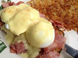
View from the concourseFood and drink report: the much-touted “Dodger dogs” are below average, and there’s almost nothing else to eat; hamburgers, pizza, and snacks were all we found, and we weren’t in the cheap seats. Vonnie, a long-time St. Louis fan, was disappointed not to find any brats. At Safeco Field we can choose from Asian food, clam chowder, salmon fish & chips, carved roast beef & turkey sandwiches, Shiskaberries (chocolate-dipped strawberries on a stick), healthy organic food, tacos & burritos etc., pasta, salad, numerous barbeque dishes, cheesesteak sandwiches, hamburgers, dogs of many kinds, pizza, and of course various snacks like pretzels, ice cream, wine, nuts, candy, and espresso; in addition there’s the sit-down Hit It Here Café in right field, where you can sit for a short time or for the whole game, dining from a chef-prepared menu. I would rate the food at Dodger Stadium as lame.
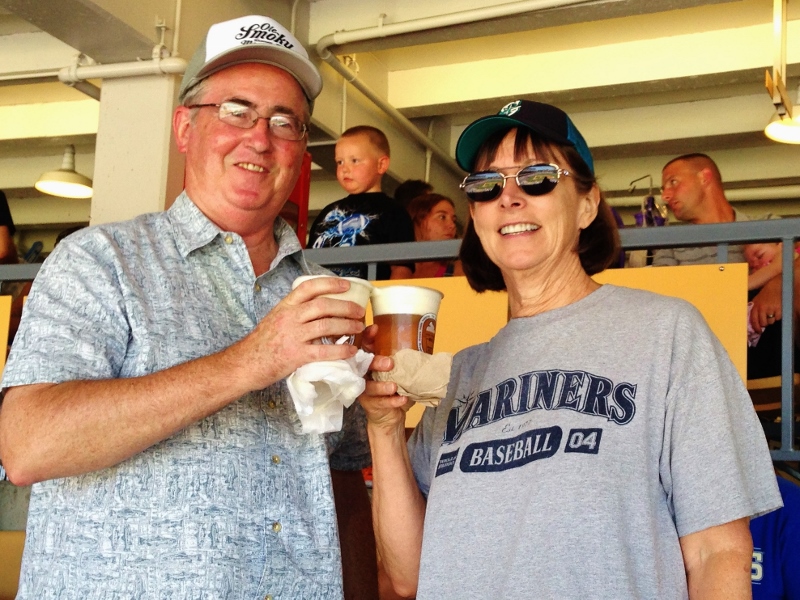
But there was one drink option that we had heard of and sought out: frozen-foam-topped Kirin beer. A plastic cup of ice-cold beer is topped with a swirl of frozen beer foam, which seeps into the beer below, keeping your brew cold. The foam is beer, pure beer, agitated in a machine and flash-frozen to 23 degrees to act as insulation, designed to keep the liquid beneath cool on a hot day at the ballpark. I can attest that it was a hot day and that my beer stayed absolutely cold down to the bottom, and then there was this nice, cold beer foam to suck up. I thought it was great! but at $11 a cup, I don’t expect to drink another one soon. I think Jim, being more of a beer aficionado than I am, was less enthusiastic. A toast to frozen beerThis being a California ballpark, there were beach balls loose in the stands for much of the game.
Beachball in the stands Somewhat annoying, but not as bad as those incessant Jedi-light-sabre-like clackers at the Oakland Coliseum.
Oh, and the game? The Dodgers lost 3-11 to the Mets. Too bad for the fans, but the Dodgers are still in first place in the National League West and we didn’t care much anyway; none of us has a dog in that hunt.
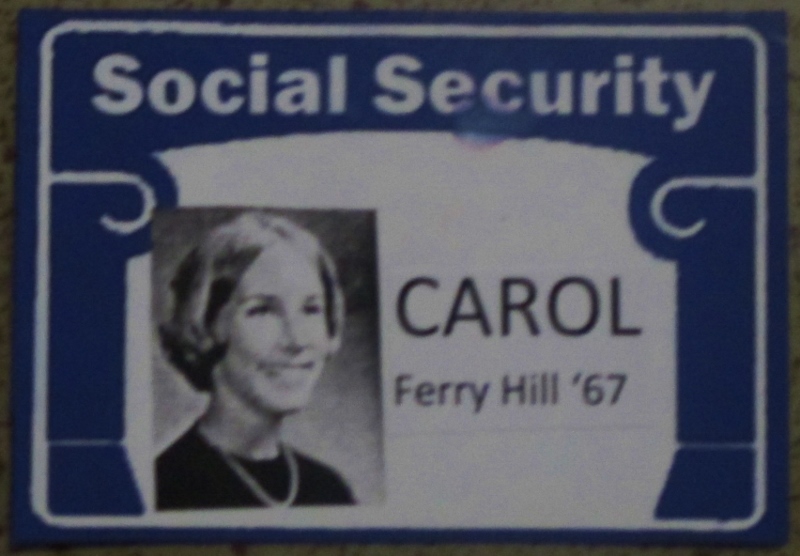
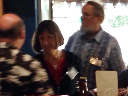
Tonight was the raison d’être for our being in El Segundo this week: my high school “Medicare Eligible” Reunion, held at the El Segundo Fish Company (yet another of the 129 restaurants that now grace the town, according to TripAdvisor). Patrick, Cheryl, and I arrived shortly after 6pm and got our name tags: Medicare-Eligible Reunion Name TagI’ve been to 3 or 4 previous reunions, and I am always surprised by how easy it is to recognize my classmates, given how much we’ve changed physically in almost 50 years. Some I know instantly, like Lynne & Chris.
Lynne & Chris Others I can observe for a moment and then know by the tilt of a head or a laugh or the smile, like Susan.
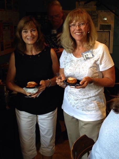
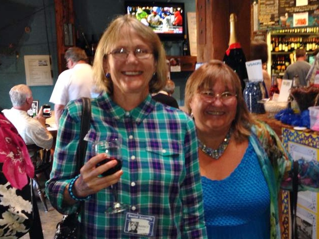
Carol & Susan Some I see regularly, like Nancy.
Nancy & MargaretAnd then there are some whom I can’t place until I glance at the name tag, but then immediately the 17-year-old emerges from and melds with the older person in front of me, and then I know that person too.
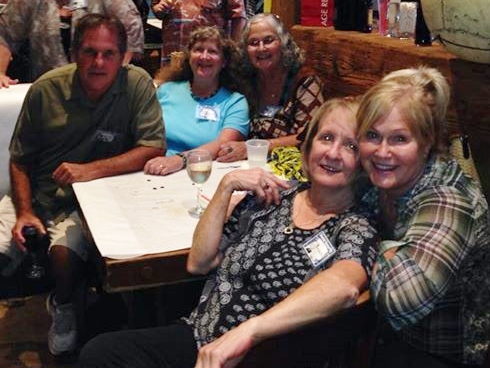
Lots of friends to talk to!It helps that there were just over 200 in our graduating class, and that, after joining from 3 elementary schools, we were all together in junior high and high school for six years. Not only that but, being baby boomers, most of us came from families of 3, 4, or more kids, and our families were known to one another through PTA, Little League, scouts, church, etc. I went through school as “Steve-I-mean-Mike-I-mean-Carol.” No offense meant, none taken – it was the water we swam in.
Like I suppose at all reunions, we mostly talked and drank and ate for hours. At one point I realized that I was feeling bashful about talking to one certain person, who was the boy I liked from 4th grade up until high school. It seemed to me that there was a sort of understanding between us at least for several years in elementary school – based mainly on the fact that when we went to the cafeteria for square dancing, he would pick me for his partner, and that when we did classroom projects, we would team up. I’m pretty sure we never actually held any sort of personal conversation (rendering unlikely my fantasy that he would ask me to go steady), but still I thought there was something special there.
So to get rid of this annoying bashful feeling, I went up to him and said: this is really awkward for me, but I have to ask you – I’ve always been under the impression that when we were kids, there was a sort of a thing between us. Did I imagine that, or was there something going on on your side as well? He said: no, you didn’t imagine it at all, it was entirely mutual. I’ve always wondered, and now I know. How satisfying! Later I sat with him and his wife and we ruminated a bit about why we never did anything about it when we were old enough to date. He said that we just started dating other people, and I think what actually happened was that I was dating older boys and he was dating younger girls, as so often happens.Talking to my elementary school heartthrobVery excellent reunion in all respects!
I’ve been under the weather for a few days, so I have a lot of catching up to do on my blog. Heat doesn’t agree with me, and by heat I mean any ambient temperature over about 75 degrees. Just can’t do it. We’ve been so hot in so many places (including Seattle) in the past year, I’m thinking we may have to move to Canada. I looked up the symptoms of heat-related illness, and I have been feeling most of them: fatigue, nausea, headaches, excessive thirst, muscle aches and cramps, weakness, confusion or anxiety, drenching sweats often accompanied by cold, clammy skin, slowed or weakened heartbeat, dizziness, agitation. On the other hand, it could have been a bug.
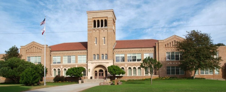
Anyway, back to events. Coincident with our high school reunion was the annual car show on Main Street. Cheryl was staying with us in the RV, so Saturday morning she and I drove the mile or so from the beach to El Segundo and parked near the high school, across from the library (where I used to spend many, many happy hours). Ours is, in my opinion, the most beautiful high school ever: El Segundo High SchoolWe found Cathie, Jeannie, Vonnie, and Dan eating breakfast at the Main Street Café.
Eggs Benedict in El Segundo!So odd to be eating at a restaurant in downtown El Segundo, a restaurant with reviews on Yelp and TripAdvisor, no less! When we were growing up, there were almost no restaurants in town because who needed them? Everyone’s mom cooked dinner every night, so who would be eating dinner in a restaurant, let alone breakfast? Inconceivable.
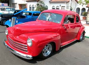
We commenced meandering through the car show, where all up and down Main Street, from Mariposa to past Grand Ave, were parked pre-1975 custom classic street rods, antique sports cars, race cars and special interest cars. Cars on Main Street This was the 17 Annual Main Street Car Show, sponsored by the El Segundo Police Officers Association. (Side note: Cathie, who lives in ES, mentioned that a police officer once told her that the most common crime in ES is passing bad checks.)
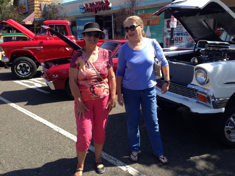
Cheryl & Cathie at the Car ShowI know little about cars and care less, and the sun was beating down, but the people-watching was good, and we ran into a few old friends.
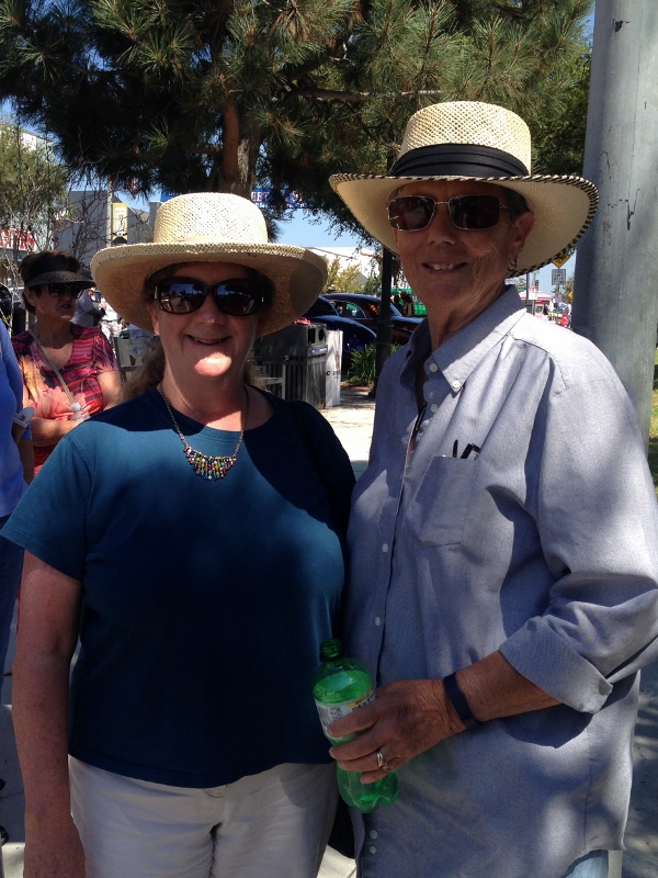
Vonnie & Jeannie with newly purchased hats against the sun I was impressed with the care that some people bestow on their old cars. Southern California in particular has given rise to a car culture that I suspect is unmatched anywhere. To me, a car is a thing that gets you from here to there, and if it can do so with good gas mileage, some degree of comfort, and the ability to carry 4×8 sheets of plywood on its roof, so much the better. But it seems I’m in the minority.
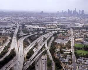
The car culture in SoCal pervades casual conversation. While doing laundry back in China Lake, I chatted briefly with a guy from Carlsbad. When he learned where we were headed, immediately he began giving me advice on which highways and freeways to take and to avoid, and at what times of the day. I’ve heard this sort of thing again and again: Whatever you do, don’t take the (freeway no.) between (location) and (location) between (time) and (time) – my brother got stuck there for 4 hours last week; or, Be sure to take the (freeway no.) to get to (location) but then switch to the (freeway no.) before you get to (location). Route management consulting seems to be a pervasive and constant preoccupation here, at least a hobby, maybe even an art form.Ubiquitous freeways
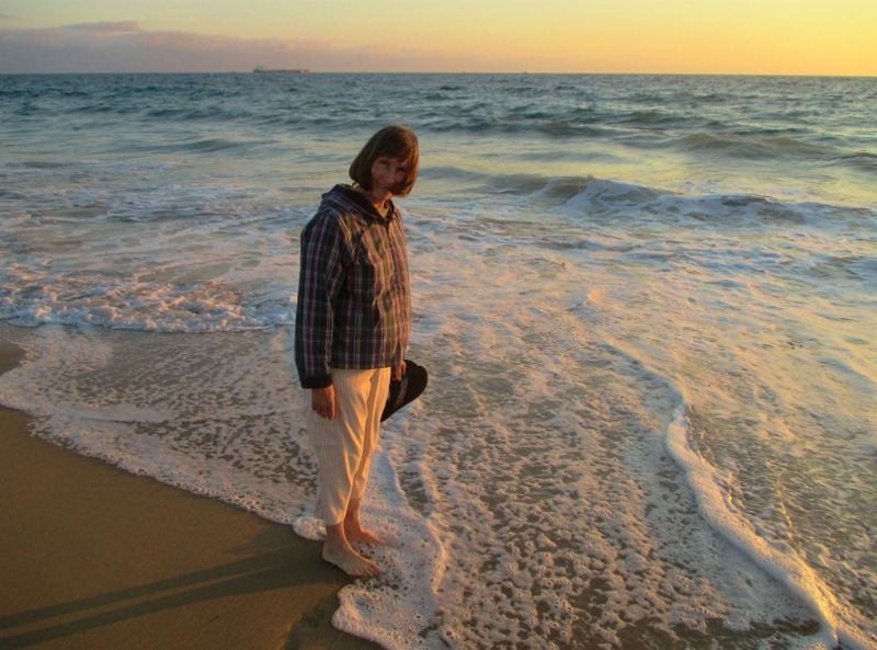
Have I ever mentioned how much I love the beach? Probably. We’re now camped at the beach just west of El Segundo CA, where I grew up and spent many, many – too many – hours baking in the sun on the beach, body surfing, hanging out with friends. The sand is the perfect texture and color, and the water is the perfect temperature, with ideal waves for body surfing, and the breeze is just strong and cool enough without being too strong or cool, and the culture on the beach is as familiar to me as my own family. This is the place on earth where all my molecules are at home and I feel the best.Carol on the beachWe’re here for my high school class reunion tomorrow night. This is not the 40th or the 50th or anything like that. No, our class in general had a good time in high school and still likes to get together, and we’re blessed to have two, well, party girls – Patty and April – who do the work to make the arrangements and get us together, as well as a larger group of helpers who support them. This one is our “Medicare-Eligible Reunion” – we’re all turning 65 this year.
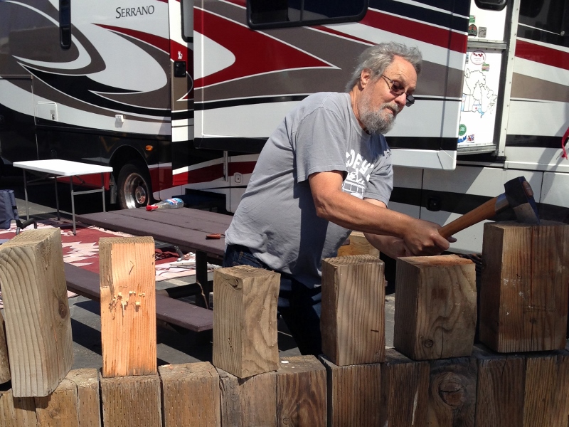
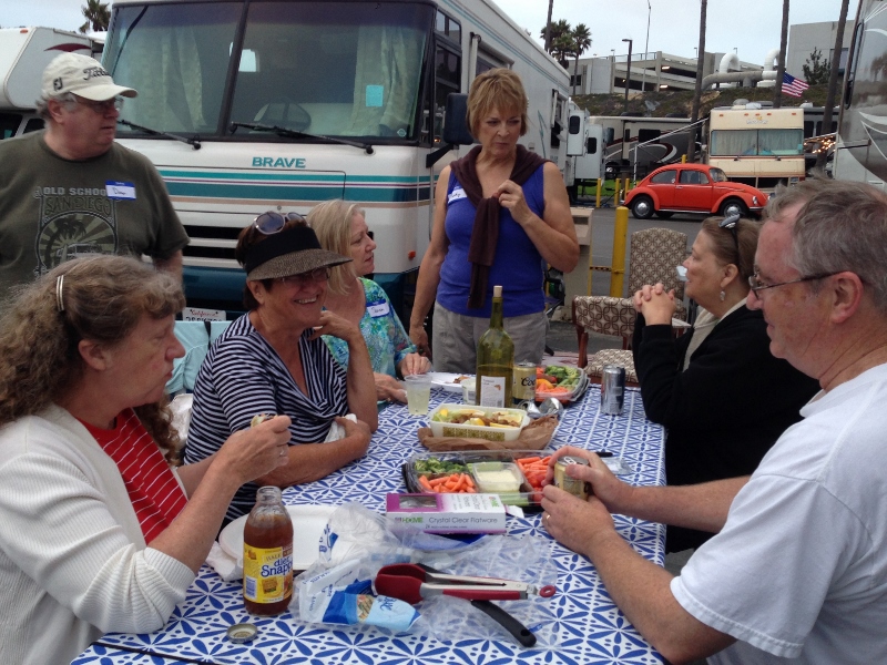
So as a pre-party to the reunion tomorrow, we invited the class to come out to where we’re camped on the beach and join us for a cook-out and later a bonfire on the beach. We picked up lots of wood from Cheryl’s when we stopped in Reno, and she brought more when she drove down. Fortuitously, just before we left Bellevue our friend Mike gifted us with a beautiful Gränsfors Splitting Hatchet for the RV that Patrick put to good use chopping wood for the barbeque as well as kindling for the bonfire. Patrick chopping wood from RenoSo good to see everyone! and talk as though 47 years have not passed since graduation, except that now we’re more comfortable with our own selves.
LONG-time friends enjoying barbequeAs it began getting dark, Patrick built a huge fire in one of the firepits on the beach, where we used to come with our families as kids and later with our friends as teenagers.
Beach bonfireWe roasted marshmallows and ate S’mores – yum! Such a good time, in spite of one narrow escape: in the dark Cyd bumped into the outer edge of the firepit and lost her balance and would have gone right into the fire if Patrick hadn’t leaped across and pushed her away. Thank God for his quick thinking and action – that could have been a horrible tragedy.
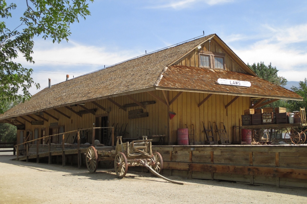
Yesterday we continued south on U.S. 395, same spectacular Sierra Nevada scenery, same hot weather (around 90 degrees), moving more and more into desert. We made an early stop in Bishop to visit the Laws Railroad and Historical Museum. (Anything with the word “railroad” in it causes the RV to detour.)
The railroad town of Laws CA was built in the early 1880s in anticipation of the arrival of the Carson and Colorado narrow gauge railroad, the first train of which arrived in April of 1883. Laws StationHomes, barns, two general stores, a rooming house, eating house, hotel, pool hall, dance hall, blacksmith shop, post office, doctor’s office, and barber shop sprang up. Ranches surrounding Laws used the railroad to ship their crops, and a number of mining operations in the area shipped out their ore.
The decline and demise of Laws and the railroad in the early 1900s were the result of the local mines closing, trucking becoming cheaper than rail freight, and the City of Los Angeles buying most of the valley for the water rights to build the Owens Valley Aqueduct, which put an end to farming and turned fertile farmland into desert. Eventually all that was left were the depot, agent’s house, oil and water tanks, and turntable.
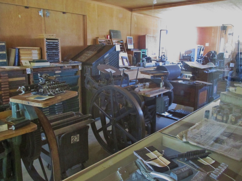
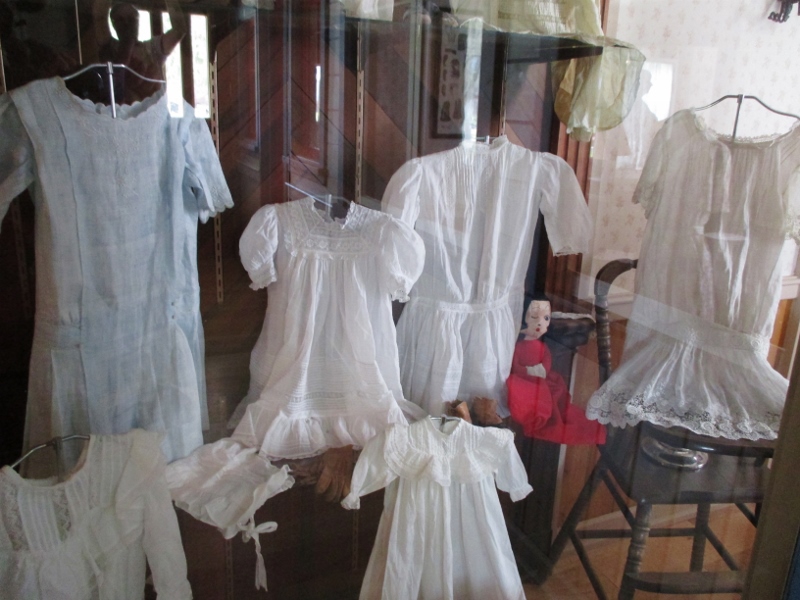
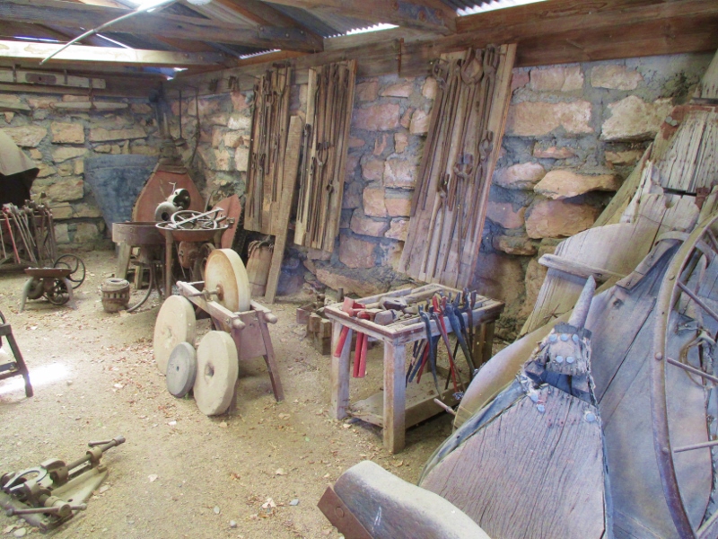
The Museum was begun in 1964, and local period buildings were relocated to this site to rebuild a replica of the town as it had existed in the 1880s. The number of buildings and quality of their exhibits is astounding! We’ve been to a lot of historical museums all over the country, and Laws is definitely one of the best! Building after building has been lovingly and expertly restored and stocked with quantities of period artifacts. Among our favorites were the print shop (with more interesting equipment than the famous one at Sturbridge Village), Print shopthe dressmaker’s shop (exquisite pin tucking, lace, and drawn thread embroidery on those little dresses),
Hand-sewn girls’ dresses
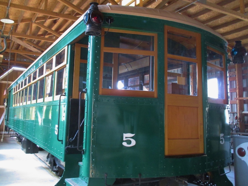
and the blacksmith shop (built of stone to avoid fires): SmithyOh, and the trains. We were able to go into the train barn, where repairs and restorations are done. There we found a fully restored green trolley car. The volunteer working there showed us photos of the car as they had found it years ago – what a mess! The restored car is beautiful and is regularly taken out to give people rides.
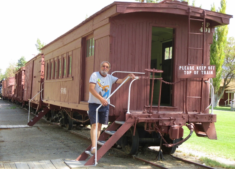
Green train This photo shows Patrick on the steps of a very old caboose:
Train carIn pride of place was a liquid (not coal or wood) -fueled steam engine:
Diesel-powered steam engineWe walked through in only about an hour but could have spent all day there, poring over all the exhibits. Highly recommend! Like!
Back on U.S. 395, we continued south to our destination, the FamCamp RV park at the China Lake Naval Weapons Center. We had debated stopping there, because we knew it would be hot, but there was no better location to stop and we didn’t want to drive all the way to L.A. and arrive at rush hour. The further south we went, the hotter and more deserty it got. In hot weather we hang a quilt behind our seats as a barrier to keep the cooled air from the air conditioner in the front rather than letting it go to the back of the motorhome, but even so we were pretty ragged by the time we got to China Lake.
Opening the RV door was like opening an oven door. We hooked up and started both air conditioners. I went to do laundry while Patrick took a nap. By the time we went to bed, we had gotten the motorhome cooled down to about 80 degrees. Have I ever mentioned that I HATE being hot? Enough said.
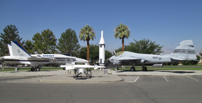
Before we left China Lake this morning, we spent an hour at the China Lake U.S. Naval Museum of Armament and Technology on base. The museum houses a large variety of present and past US Navy aircraft, weapons (missiles and bombs) and technology developed at its test ranges there in the desert. As one of the exhibits states, everyone knows about the pilots, but no one thinks about the ordnance people who arm and load the weapons, nor the technical people who develop and test the weapons systems. It’s true, I never thought about them.
Besides two jet fighters in front of the museum, U.S. Marine & Navy jet fightersthere were lots of bombs and missiles
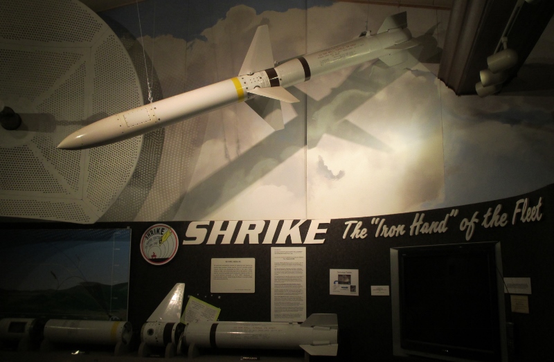
Shrike anti-radar missile and pictures of explosions and tests.
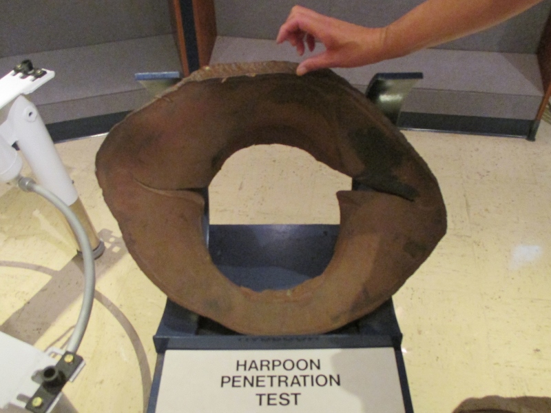
Harpoon missile penetration testPatrick had his Geiger counter in hand but was disappointed to find that the guts of the ordnance had been removed so he wasn’t able to pick up any radiation. I guess they didn’t want the museum to blow up accidentally.
“Mammoth” conjures in my mind images of rich kids whose families went skiing during Christmas vacation, and I’m sure it’s a glorious place in winter for wealthy skiers, with 400 inches of average annual snowfall, 28 lifts, and lots of swanky shopping, condos, and restaurants. But there’s a lot to see and do in summer as well.
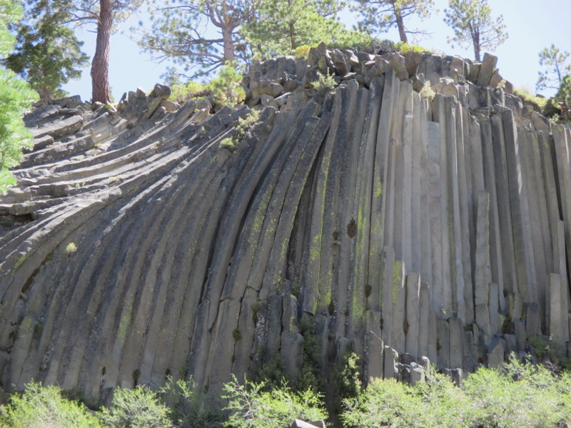
Like so many beautiful places in California, the Reds Meadow Valley on the back side of Mammoth Mountain (adjacent to the Ansel Adams Wilderness and the Pacific Crest Trail) had been loved to death by summer tourists, so now no cars are allowed and a shuttle bus takes visitors down into valley to begin backpacking trips and to see several interesting sights, including the “Devil’s Postpile.” We took the shuttle bus down and walked the short hike to the foot of the Postpile. Amazing! The Devil’s Postpile About 82,000 years ago, basalt lava flowed here from an unknown source. Columnar jointing occurs when certain types of lava contract while cooling. Because the flow was very thick in this location, much of the mass of pooled lava cooled slowly and evenly, which is why the columns are so long and so symmetrical. Then around 20,000-12,000 years ago, a glacier pushed down the middle fork of the nearby San Joaquin River and carved away one side of the Postpile, exposing a sheer wall of columns 60 feet high. Erosion and earthquakes later knocked down some of the columns, which now lie in a broken heap at the foot of the Postpile.
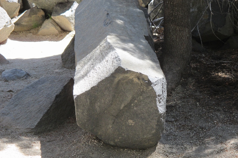
Basalt columnIf the lava had cooled perfectly evenly, all of the columns would have been exactly hexagonal, but some of the columns have 7, 5, or 4 sides due to variations in cooling. We didn’t hike to the top, but I found a picture that shows what the columns look like at their top end:
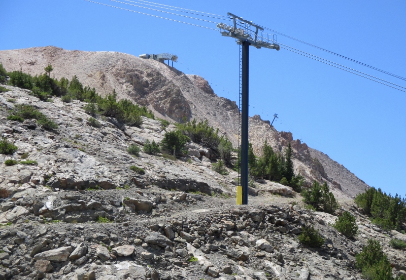
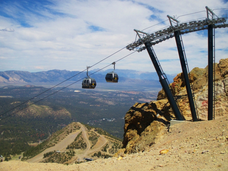
Top view of the PostpileAfter we came back up out of the valley, we took a gondola to the top of Mammoth Mountain.
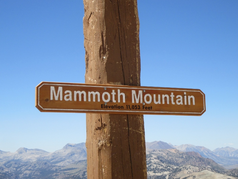
Going up Mammoth MountainAt the summit we were at 11,053 feet!
Literally breath-takingI could definitely feel the altitude, like a hand pressing against my chest. I’ve never been that high before.
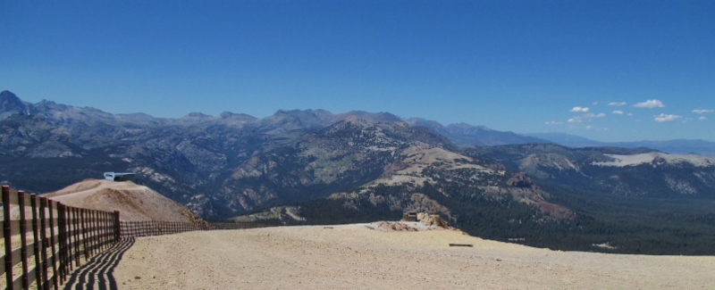
The views out over the Sierras were just stunning.
Looking west-northwest, toward YosemiteLooking eastMany of our fellow travelers brought mountain bikes up with them on the gondola, to ride more than 3,000 feet down the mountain over the 100 miles of mountain bike trails that zigzag across the ski slopes. It looked very fun! for someone else. Not me.
On Saturday we continued south on U.S. 395 to the southern edge of the Modoc Plateau at Susanville. Again, all the rocks and mountains are volcanic. Some of the basalt is flood basalt that erupted around 16 million years ago, as well as rhyolite. Most of the volcanic rocks erupted since that time, from small volcanoes that comprise most of the landscape on both sides of the road.
The Warner Range loomed on our left (east) all morning. The Warner Range Most interesting were some road cuts that exposed a lumpy black basalt flow that poured over an earlier bed of smooth hardened rhyolite ash, which was white to pinkish gray in color. Unfortunately no photos, but take my word for it, it was super to see!
We ate lunch in Susanville and cruised on to Reno, where we hit Costco and then parked in the driveway of our dear friend Cheryl’s home. Patrick grilled us up some fabulous ribeyes, and we had a relaxing evening talking and watching TV. We’ll see Cheryl again later in the week at the class reunion.
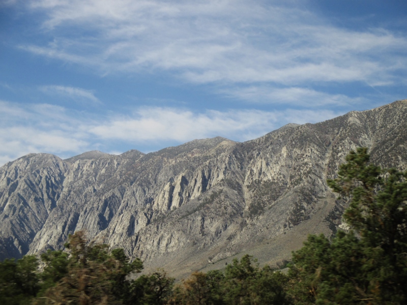
Back on U.S. 395 the next morning, 185 miles south to Mammoth Lakes. We’ve driven this road south to north before, but this was our first time driving south. We were already at 4500 feet in elevation in Reno and never went any lower; we drove over several passes at over 8,000 feet, and when we got to Mammoth Lakes we were at 7800 feet. The Sierra Nevadas rose spectacularly on our right the whole way, and it’s simply not possible to describe how beautiful are the mountains of this granite batholith. The east side of the Sierra NevadasThe Sierras are moving west on a fault, which split off the oldest, eastern edge of the mountains, creating extreme steepness of this side of the mountains, the separate range of the White Mountains to the east, and the Owens Valley in between that we were driving through.
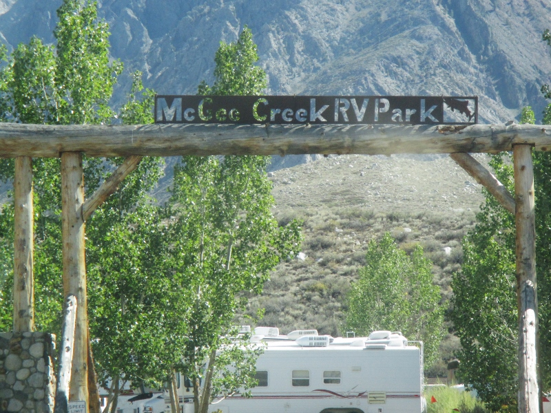
We arrived midafternoon at our RV park at the foot of the Sierras, just south of the Mammoth Lakes area which we plan to explore tomorrow. McGee Creek RV Park
So where are we going on this trip? The itinerary took shape around two events: a reunion of my high school class and the annual “muster” of the retired military RV group that we went to Alaska with last summer. The reunion is August 23 in El Segundo CA, a beach town near Los Angeles, and the muster takes place a month later in Hemet CA, 100 miles southeast of El Segundo.
We decided not to drive south down the coast, which we did last fall, or down I-5, which we’ve done many times, but to go east of the Cascades down central Oregon, across the northeastern corner of California, through Reno where our friend Cheryl lives, and down the gorgeous eastern side of the Sierra Nevada Mountains, coming into the Los Angeles area from the east. After the reunion and before the muster, we’ll spend three weeks in one of our favorite places, Coronado Island, San Diego. After the muster, around the end of September, we’re going to drive east to Utah and spend as much time in the national parks there as we can before weather prompts us to return home, which we’ll do via Salt Lake City and Boise.
From Bend, the first leg of our route took us south-southeast on Oregon Hwy 31, a road so lonely that there’s no gas for a hundred miles, and for hours we saw only a few cars. Every rock along the way is volcanic. Does that mean the scenery is boring and lacking in variety? Not at all! We saw some of the most extraordinary rocks and landscapes in Oregon along this road.
About 17 million years ago, an enormous center of volcanic activity appeared in southeastern Oregon. Its edges probably reached into Idaho and Nevada and out to the Pacific coast at Astoria. Something caused enormous floods of molten basalt, more than 100 cubic miles of lava, to flow across the landscape within a day, or even hours. Was it a huge mass of especially hot rock rising through a weak spot in the earth’s mantle? Or was it an asteroid or comet that struck the earth’s surface and punched through it? No one knows for sure – those passionate geologists are still duking it out on behalf of their theories.
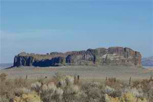
Fort Rock, southeast of La Pine, is one of the artifacts.
Fort Rock
Today it looks like a ruined castle. It was created when basalt magma seeped from vents into the wet mud of a shallow lake that flooded the valley during the last ice age. Hot (1200 degree) magma hitting lake water powered a jet of steam that blew molten basalt into the air in a cloud of tiny rock shreds, like an enormous geyser. The basalt settled around the vent to make a ring of volcanic ash, an island in the lake, and then lake waves eroded the outside of the ring, leaving steep cliffs that look like a castle.
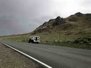
Hwy 31 near Summer Lake
At the end of Hwy 31 we met Hwy 395, which will be our constant travel companion for some days now. We continued on into the northeast corner of CA, near the Nevada line, still in the volcanic Modoc Plateau, and spent the night in a nice little RV park in the nice little town of Alturas.
Alturas, CA
We visited the interesting little local historic museum and were sorry, although of course not surprised, to learn that the indigenous Modoc people were defeated and sent from this lovely if somewhat austere land to live in Oklahoma.
Leaving on an RV trip is like simultaneously preparing for house guests (our housesitter), moving (getting our motorhome ready for extended occupation), and going on vacation (stopping the newspaper & forwarding the mail, cleaning out the fridge, arranging for lawn care, packing, etc). Most of it has to be done just before we leave, so by the time we actually get on the road we’re always exhausted. Note to selfs: next time, plan for short mileage on the first driving day, not 350 miles like we did this time.
So our first stop was Bend, OR, in the high Cascades, where we spent 3 nights and recovered our energy.
View of Deschutes River from Bend
It’s a beautiful area but can be hot in August. Luckily for us a cold front was moving through, and we had cool temperatures and thunderstorms on Wednesday. Such a relief from the ridiculously hot summer we’ve been having in the Seattle area.
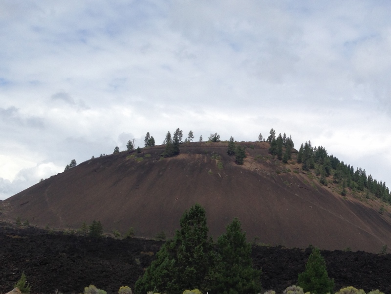
On Thursday we drove up to Lava Butte and began to learn about the extraordinary geologic history of central and south-central Oregon. Lava Butte is one of many cinder cones that erupted quite recently, about 7,000 years ago, from a fissure system nearly 17 miles long known as the NW Rift Zone.
Lava Butte
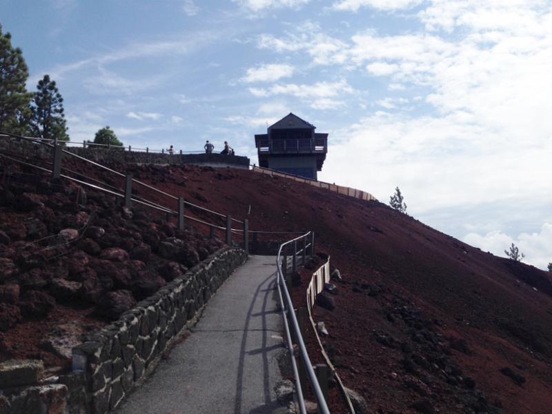
One of the really cool things about this cinder cone is that you can drive to the top of it, which we did. There are long views in every direction, including up to Mt Adams in WA, so It’s no wonder Lava Butte has been used as a fire lookout for many decades.
Lookout Tower on Lava Butte
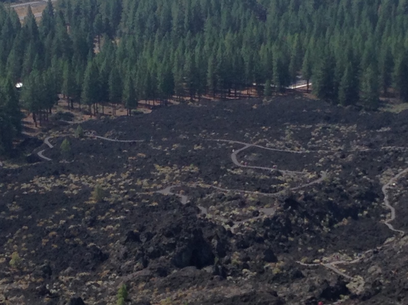
Cinder cones erupt from volcanic vents in this manner: rock fragments called scoria or cinders, which contain numerous gas bubbles, explode into the air and cool quickly. As their gas content diminishes, the cinder magma stops fountaining and instead hot basalt oozes from below the nicely rounded cone that was already formed, surrounding the cone with a river of molten basalt. There is some vegetation on Lava Butte, but there’s almost no plant life in the surrounding lava flow, which reaches to the Deschutes River about 2.5 miles to the west.
Lava flow surrounding Lava Butte
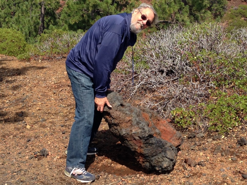
At the Visitor Center, we had learned about the different types of rock that result from volcanic eruptions of various kinds: andesite, basalt, scoria, obsidian, rhyolite, perlite (a form of rhyolite – yes, it’s the white dots in potting soil), pumice (another variety of rhyolite). We hiked around the concavity in the center of the dome, and Patrick was able to lift a large volcanic rock – either he’s stronger than we thought! or it was rhyolite.