Our next two national parks have us stair-stepping down through southwest Utah. Scenic Highway 12 south from Capitol Reef to Bryce Canyon goes up, up, up and over Boulder Mountain (from whence came the lava rocks we saw in Capitol Reef). Before long we were in trees, mostly pine but with some deciduous trees shifting into their Fall colors,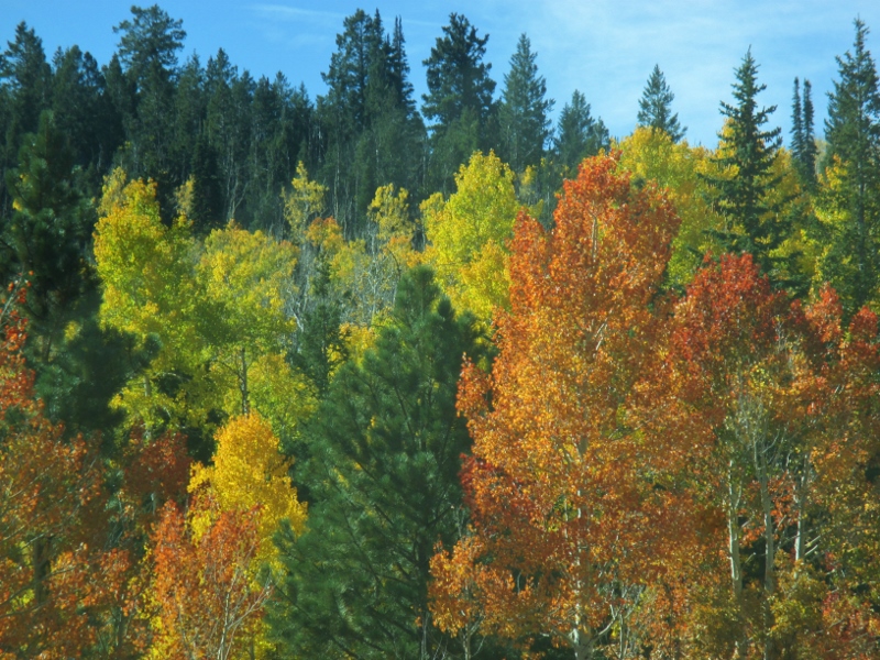
and then startling groves of gorgeous aspens, turned neon yellow.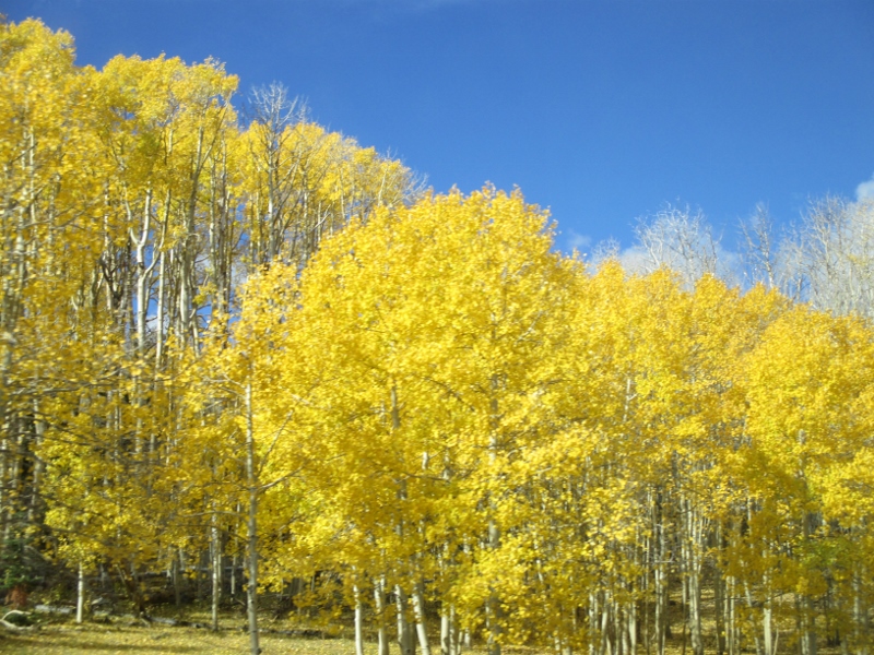
Usually roads look for mountain passes to cross through, but this one really does go almost over the top of Boulder Mountain (el. 11,124 feet), probably because of rock and flash floods below. At our summit (9,600 feet) the mountainside fell away to both sides, and Patrick threaded the motorhome along a narrow plateau, while I assisted by shutting my eyes and not grabbing his sleeve.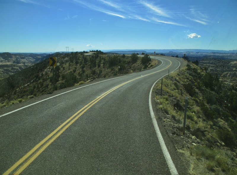
Then we went down, down, down,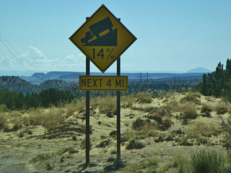
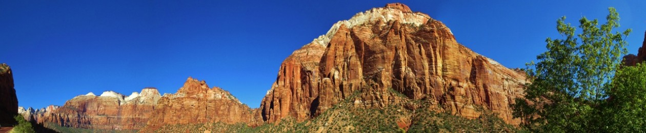
through a vast ocean of Navajo sandstone, then turned west to find ourselves in a pleasant agricultural valley from which we caught a glimpse of “The Blues”: the gray badlands that are composed of upper Cretaceous Kaiparowits Formation, thick layers of muddy sandstone containing one of the richest deposits in the country of fossils of sharks, crocodiles, lizards, turtles, mammals, and dinosaurs.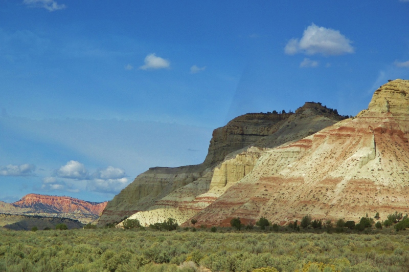
Yesterday we took a narrated National Parks shuttle ride to some of the outstanding view points in Bryce Canyon – which is not actually a canyon (because it was not formed from erosion initiated from a central stream), but rather is a collection of giant amphitheaters stretching 20 miles along the eastern side of the 7-9,000-foot-high Paunsaugunt (PAWN-sa-gunt) Plateau.
The rock layers exposed here are much younger than the ones at Capitol Reef. Whereas the oldest layers there were Permian White Rim Sandstone (laid down 290 million years ago) up to Cretaceous Mesaverde Formation (65 MYA), the oldest rock here is Dakota Sandstone (120 MYA) and most of what you see is Claron Formation, from a mere 40-65 MYA. The top layer of the Claron is white limestone,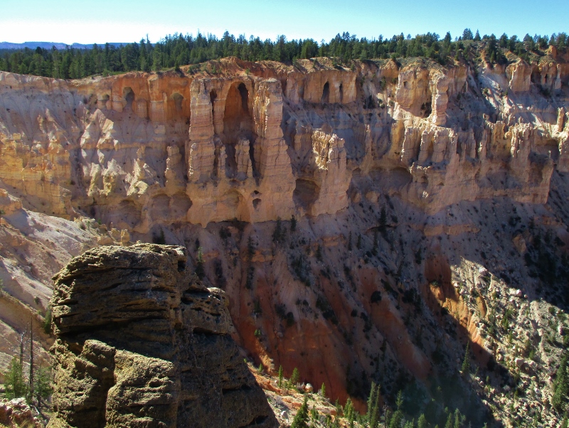
and below that is pink siltstone and sandstone.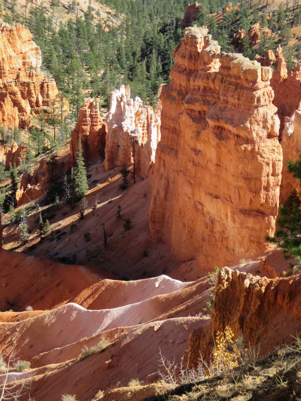
The amphitheaters were excavated by the same kind of erosion that we’ve seen in the other parks of the uplifted Colorado Plateau.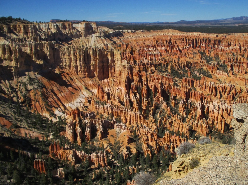
The uplift created vertical joints which over time were preferentially eroded, and the soft sandstone and siltstone winnowed into the delicate and colorful freestanding pinnacles called “hoodoos” that Bryce Canyon is famous for. The primary weathering force at Bryce Canyon is frost wedging. These hoodoos experience over 200 freeze/ thaw cycles each year. In the winter, melting snow seeps into the cracks and then freezes at night, prying open the cracks bit by bit, making them even wider, much like the way a pothole forms in a paved road. In addition to frost wedging, slightly acidic rainwater also sculpts by slowly dissolving limestone grain by grain, giving the hoodoos their lumpy and bulging profiles.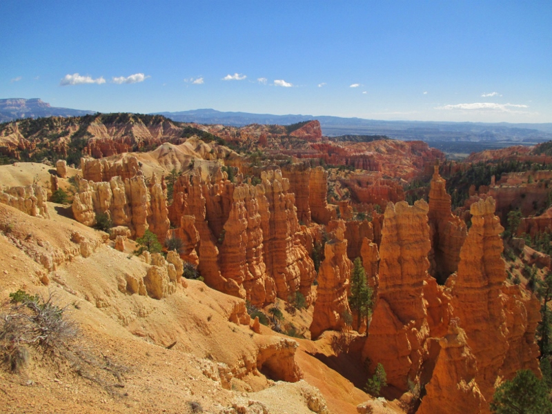
We stopped at several different lookouts along the 9,000-foot-high canyon rim and saw the lovely formations, ranging in size from human scale to as much as 200 feet, from different angles.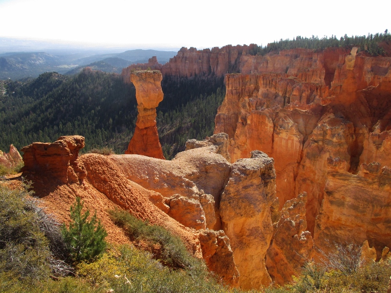
They were especially beautiful with the sun glowing on them.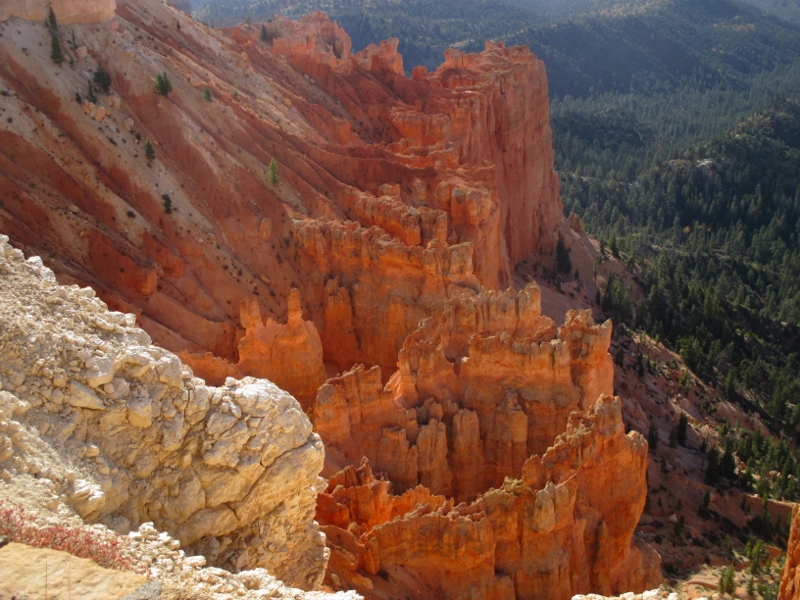
“Natural Bridge” is actually not a bridge but an arch, for technical reasons. Those geologists are so persnickety!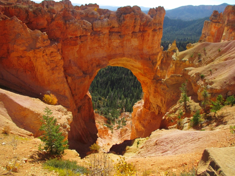
Unfortunately for our tour, there was a storm front moving in up around Salt Lake City, the effect of which for us was a ferocious freezing wind at every viewpoint stop. So we jumped out, snapped photos, then bundled back into the bus. The driver said we were the quickest tour he’s ever driven!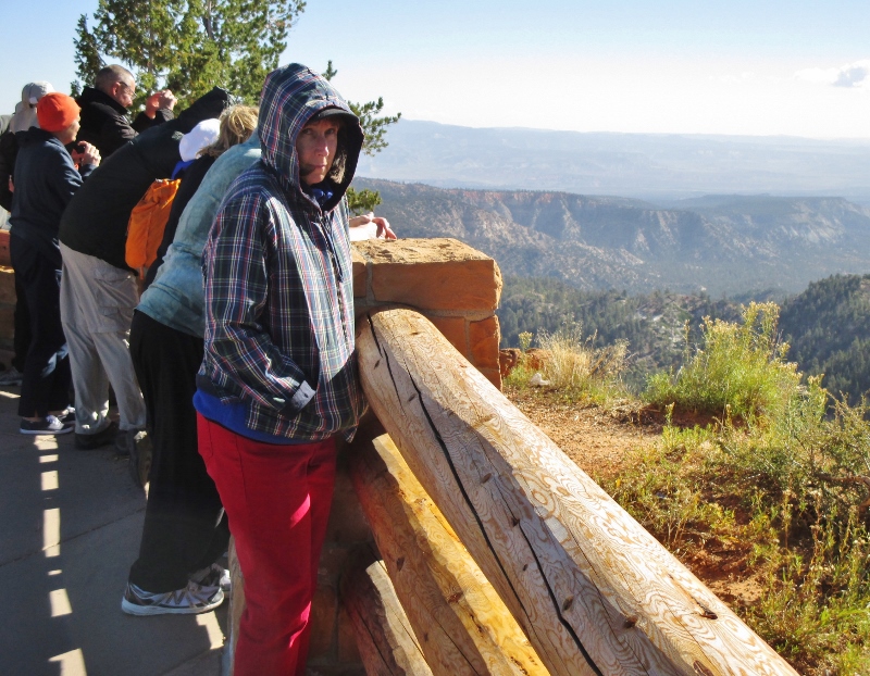
This park also has a 7.4 magnitude night sky, making it one of the darkest in North America, and on certain nights park rangers host evening programs on astronomy, nocturnal animals, and night sky protection. However, we aren’t here on a day when there’s a program, and honestly, it’s so cold we probably wouldn’t do it anyway. The first night we were here our water pipe froze a little, so last night Patrick disconnected it before we went to bed.
I have to describe the place we’re staying, Bryce Canyon City. It’s a commercial district just outside the park, at 7,000 feet, all of which is owned by Ruby’s Inn: in 1916, Reuben C. “Ruby” Syrett built a lodge and cabins at this location that has expanded over the years to include several restaurants, many hotel rooms for busloads of tourists from Las Vegas, an ATV rental place, a rock shop, a Subway, a gas station, and of course an RV park. Seven years ago the Utah legislature passed a law that allowed the descendants of Ruby Syrett to incorporate the location as “Bryce Canyon City”; soon after, the law was rescinded, but the “town” remains. At incorporation, the population was 138. A majority of the residents are members of the Syrett family, and nearly all of the adults are employees of Ruby’s Inn. Now “Bryce Canyon City,” consisting solely of the property of Ruby’s Inn and the Syrett family, gets 10 percent of the county budget. Rod Syrett, the company’s board president, is the mayor.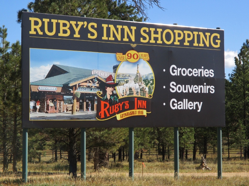
Bryce Canyon is beautiful in its way, but I have to say I’ve found it not as interesting as the other parks we’ve been to in the past several weeks: the rock is all kind of the same, so each viewpoint is pretty much a variation on a theme that doesn’t alter much. Also, we’ve been no lower than 5,000 feet for several weeks now, and we’re getting tired of it. There are trails along the rim of the canyon, but even today when it wasn’t windy, we didn’t hike because even walking on level ground at this elevation is somewhat strenuous. As Patrick says, just being alive is enough at 7,000 feet.