From Moab we drove north, then west about 35 miles on Interstate 70, then south and then west on scenic Utah Hwy 24 to Capitol Reef National Park. I had never heard of Capitol Reef until we started researching the national parks for this trip, but it’s one of the “Big 5” (which is actually a Utah marketing slogan to get people to visit the parks and spend $$).
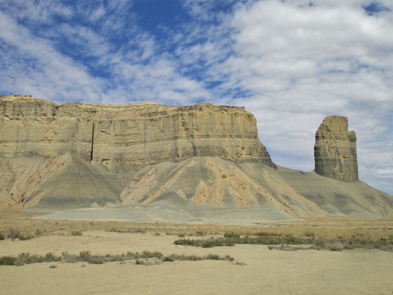
But we’re so glad we came here. This park is just staggeringly awesome if you like geology, which obviously we do. On Hwy 24 we approached the San Rafael Reef, the distinctive and seemingly impassible eastern edge of the San Rafael Swell, a section of crust that was pushed up with the Rockies around 60 million years ago.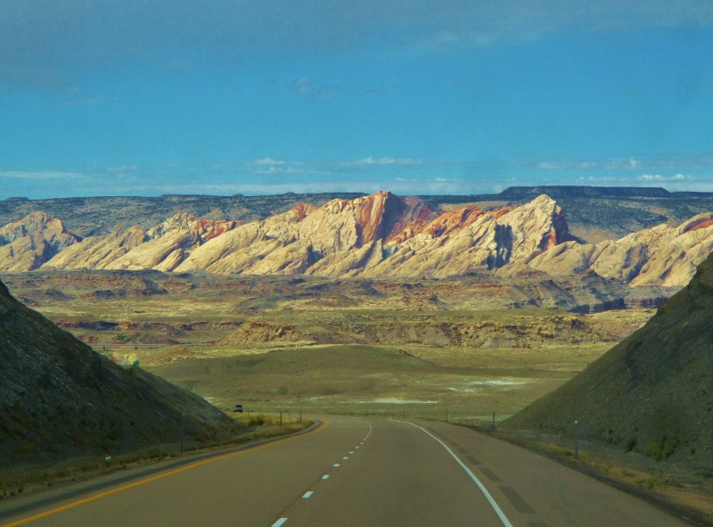
Beyond the reef we began seeing shapes and colors that we had not seen before in Arches and Canyonlands: Factory Butte, with its hogback ridge created by differential erosion of outcropping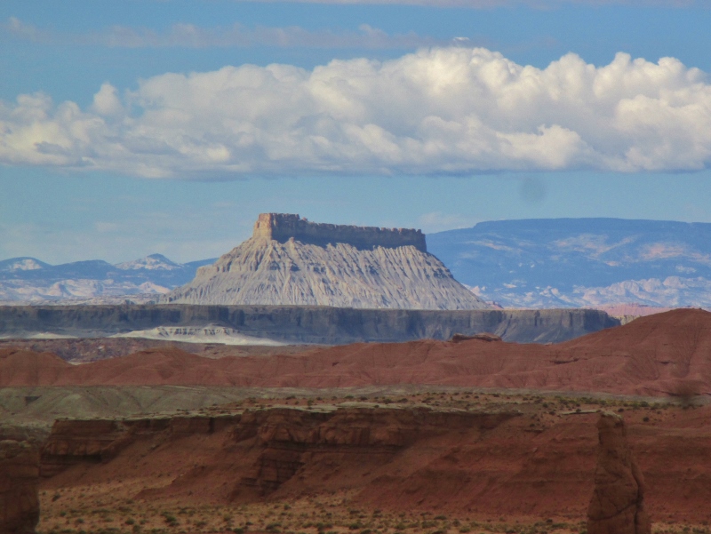
and weird shapes of Entrada Sandstone in Goblin Valley.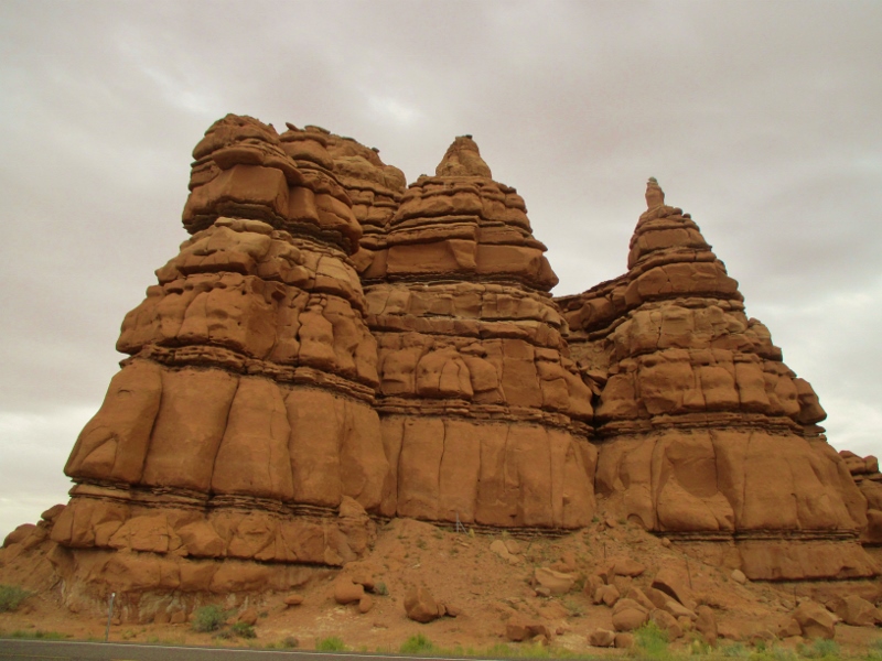
We drove through more and more fascinating eroded formations:
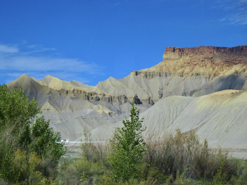
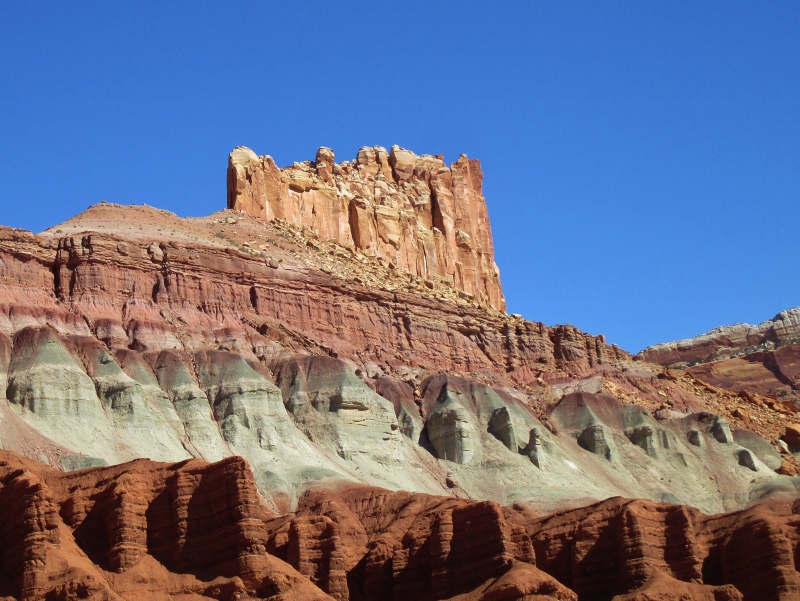
and began to see the white domes of Navajo sandstone that look like the old dome of the U.S. Capitol building, for which the park was named. (“Reef” around here means a rocky barrier to travel.)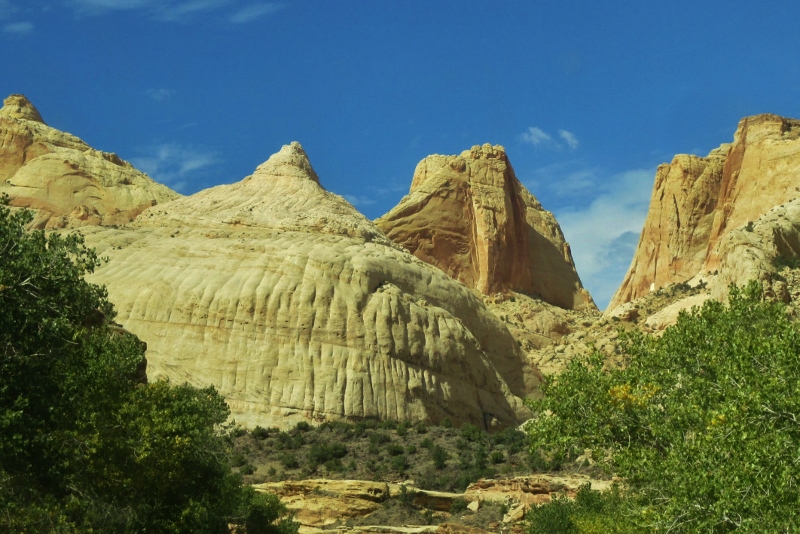
As we approached the park, we came to some petroglyphs carved by what archeologists call the Fremont people who lived in this area from about 700 to 1300 AD, roughly contemporaneous with and possibly a splinter group of the Ancestral Puebloan people.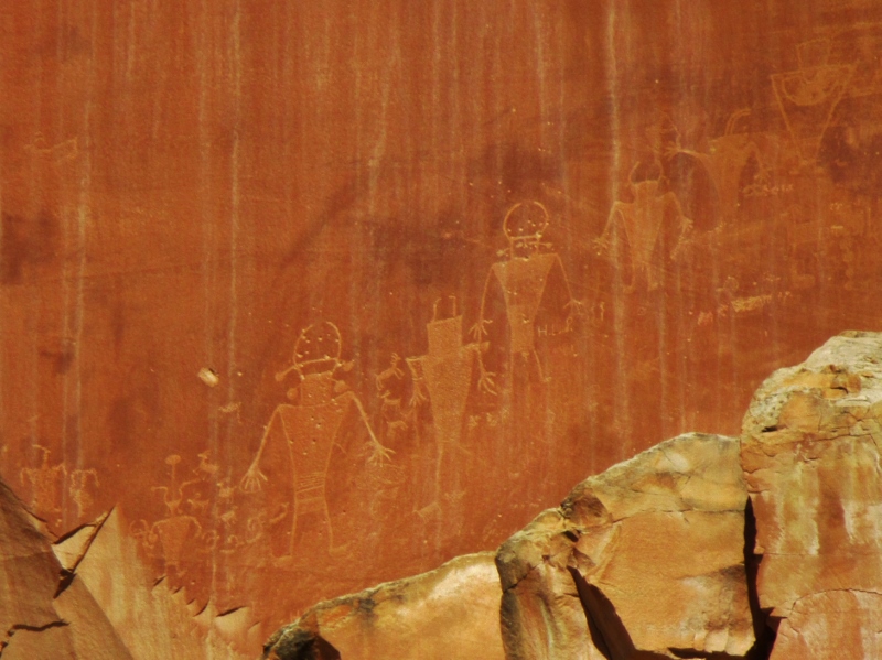
This morning we went to the Visitor Center for a ranger lecture that was extremely valuable in opening our eyes to what we would be seeing. 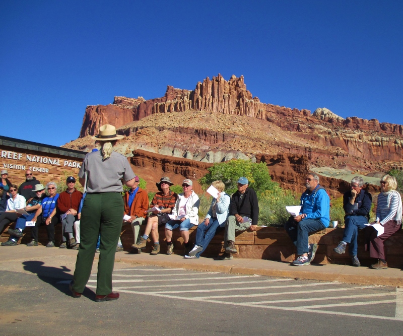
She described how for about 250 million years, during the time all the continents were joined in Pangaea, “deposition” took place; that is, inland seas came and went again and again and each time left behind layers of fossils, minerals, soils, that created a very thick blanket of surface materials. She gave us a handout that showed all the different layers of deposition and their dates: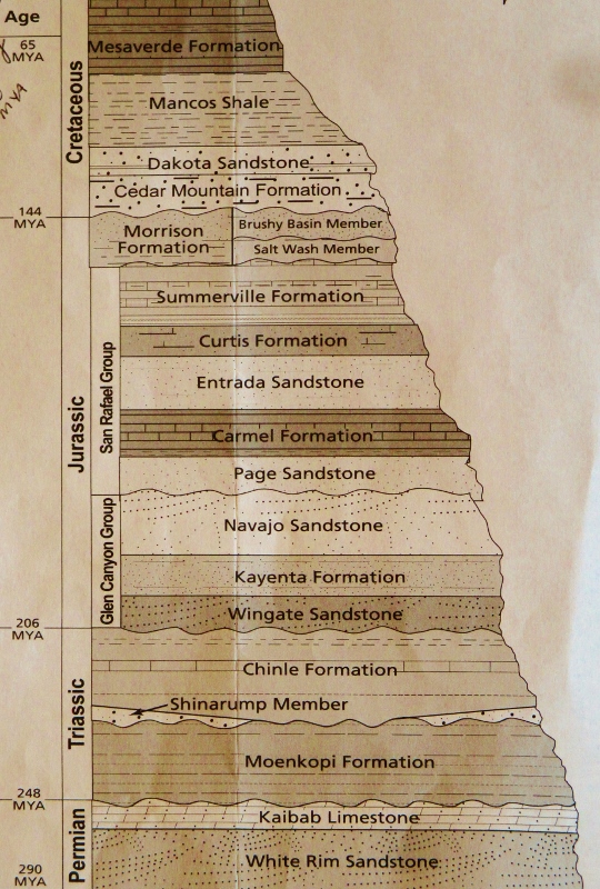
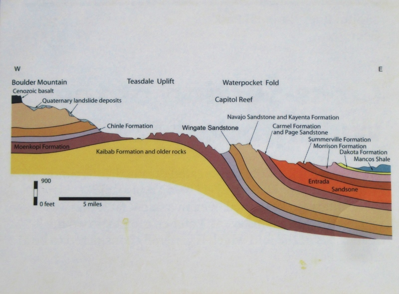
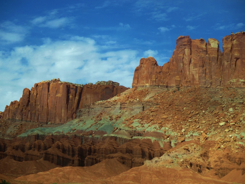
Then about 70-80 million years ago, lots of movement started happening: the continents moved apart as tectonic plates collided and subducted; the Kula and Fallalon Plates slid shallowly under the North American plate, which caused the Laramide Orogeny (mountain-building) that created the Rocky Mountains and the major land feature of Capitol Reef, the 100-mile-long Waterpocket Fold that forms the monocline backbone of the long, skinny park.
10-15 million years ago the entire region was uplifted several thousand more feet by the creation of the Colorado Plateau (southeastern UT, northeastern AZ, southwestern CO, and northwestern NM). The rock layers on the west side of the Waterpocket Fold have been lifted more than 7,000 feet higher than the layers on the east, and now erosion has exposed the older rocks on the western side of the fold. A total of 7,000 feet of overlying Mesozoic and Cenozoic sediment has been removed by erosion, which is still taking place today. Even in this desert climate, it is water that is most responsible for the carving of the landscape: infrequent but slightly acidic and occasionally torrential rain, water leaking into cracks and then freezing and thawing, breaking apart the rock. So the story here is: deposition-uplift-erosion.
The ranger showed us a schematic of how the layers have been exposed by erosion
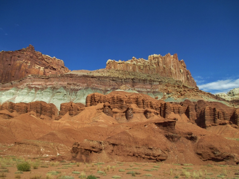
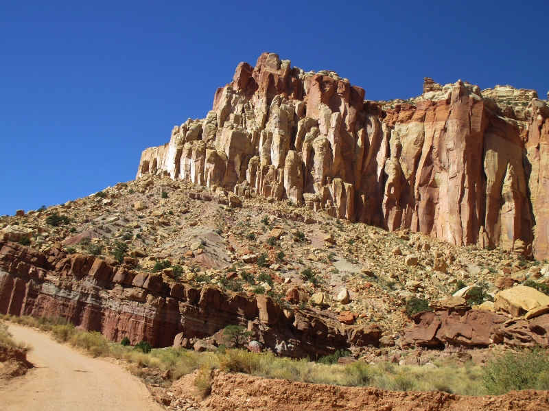
and then, pointing to the cliffs right behind us, pointed out layer by layer what we were looking at. It’s the first time I’ve really grasped the passage of time in the rock layers. We could just turn around and look at the Moenkopi Formation on the bottom (dark red, sort of furry-looking iron-rich siltstone), up through the Chinle (CHEEN-lay) Formation (light greenish sandstone because the iron was less oxidized at the time of deposition), the whitish-grey Navajo Sandstone, the ledge of red Page Sandstone, then Entrada Sandstone & gypsum mixed, the Morrison Formation, then the Dakota Sandstone (tan with oyster shell fossils), Mancos shale (dark grey), and Mesaverde Formation at the top. Seeing the schematic and having the list of layers was like having a Rosetta Stone to the language of the rock!
After the lecture we drove south into the park, which includes a historic district of the town of Fruita, settled by Mormon pioneers. The major attraction there is the Gifford Farmhouse that now sells homey items such as preserves and pies, of which we gladly partook.

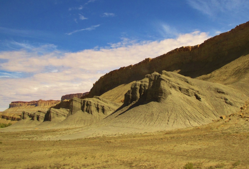
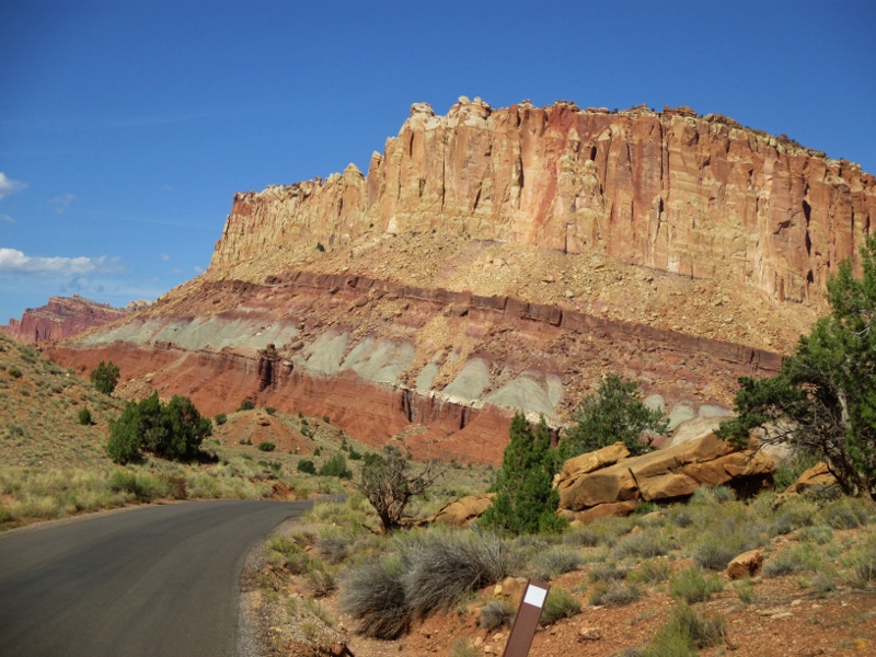
We drove down the only 8 miles of road into the 241,904-acre park. Our experience of this area is that it’s incredibly raw, massive, and overwhelming. Every turn of the road revealed another colossal multi-layered wall of rock
made comprehensible to us only by our understanding of the deposition-uplift-erosion story.
The road narrowed,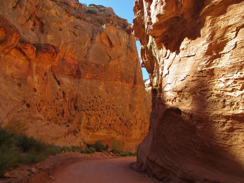
and several times we turned off onto rough gravel roads (sorry, little Smart car!), on one of which we found a disused uranium mine; uranium was deposited in the Chinle Formation layer, which extends from here east and accounts for the many uranium mines in Utah.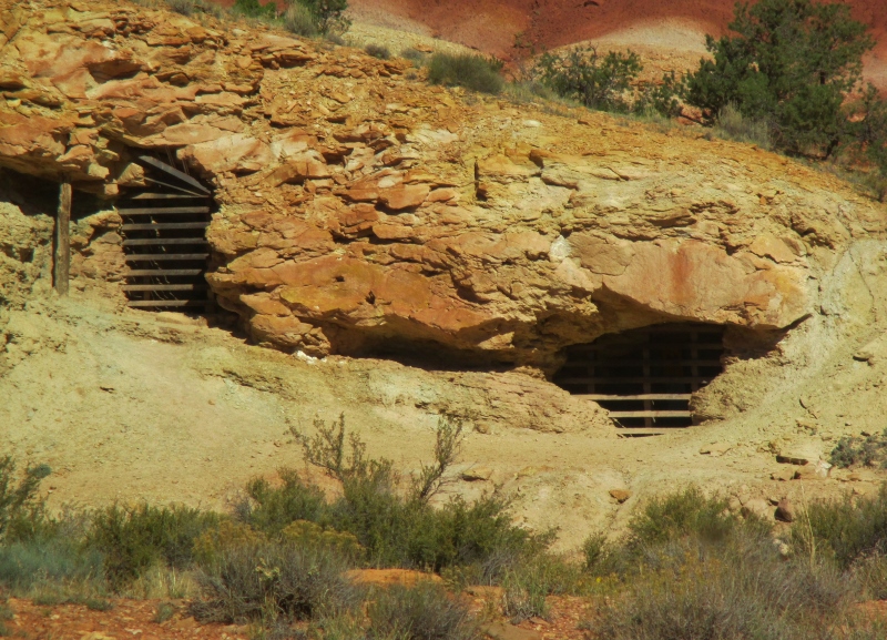
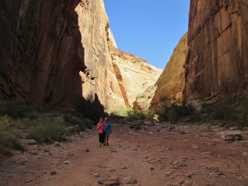
We also hiked from the end of the gravel roads into the washes that extended on beyond. These narrow washes become death traps in storms, as water 20 feet high can rush through – fortunately, we had a clear, cool, sunny day.
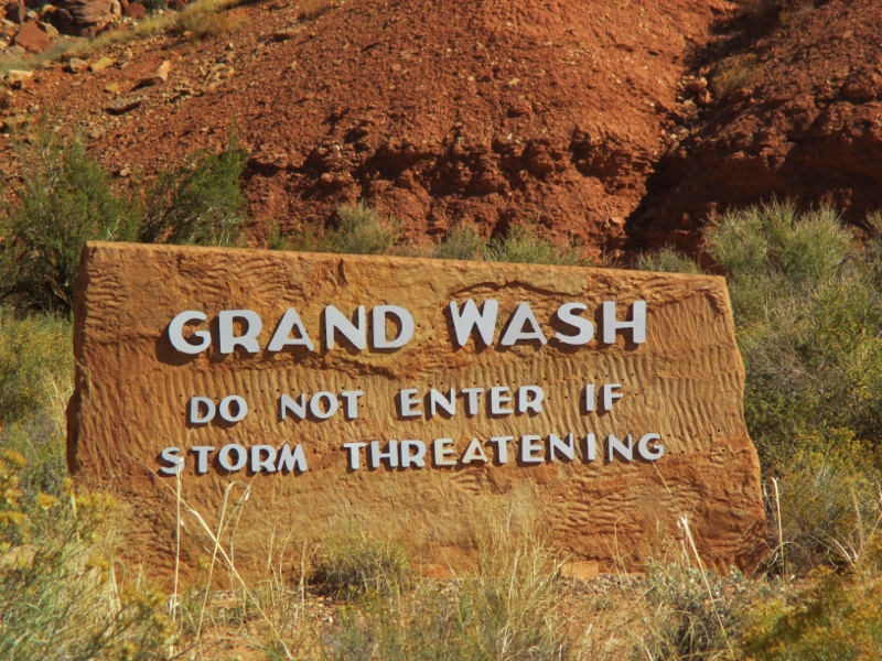
Walking down the washes is kind of eerie, with towering cliffs on both sides and massive boulder wanna-be’s just waiting to crash down and squash you.
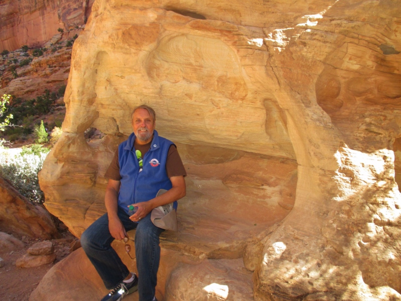
I had a very intense, emotional reaction to being here. Nothing in this park is human scale. If the rock weren’t so dazzlingly beautiful, it would feel menacing. It’s impossible to forget that every rock you see by the side of the path would have crushed you like a bug if you had been here when it fell, which of course they do.
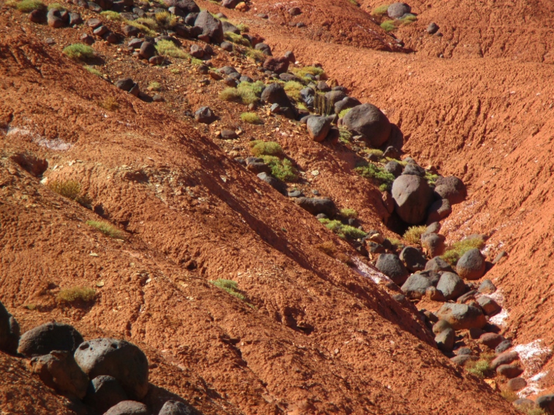
We thought we had seen everything it is possible to see in different kinds of rock here – but wait, there’s more! At the side of the road near the Visitor Center are piles of black volcanic boulders! Everything else around here is sedimentary; where did these lava rocks come from? Turns out the two mountains in the area, Boulder Mountain (aptly named) and Thousand Lake Mountain, were formed by magma buildups that never erupted but at times oozed magma from their tops that formed these boulders that rain, wind, and small earthquakes have sent down into the plateaus below.
After our dizzying day among the rock behemoths, we returned to our RV park at the base of some Moenkopi Formation cliffs and started a little campfire. Our elevation is only around 5,000 feet now, and the weather is a little cooler as we get further into autumn. A neighbor to the west stopped to chat, and our neighbors to the south (a couple from the Bay Area) brought over some wine and cheese & crackers and chairs, and we chatted until dinnertime.
We went for the “cowboy dinner” that the RV park offered, then came back to our campsite and revived the fire. Our Bay Area neighbors returned, and two fishermen from Salt Lake City joined our group as well. As night fell we sat out under the Milky Way, clearly visible, and swapped stories until late in the evening.