We woke up in Tuba City yesterday to a cool, crisp morning – yay! We have been hot for months, and we don’t like hot. At all. What a blessed relief. Finally!
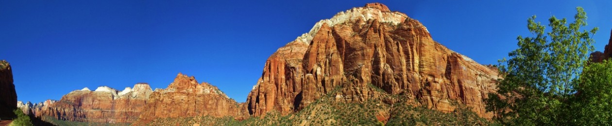
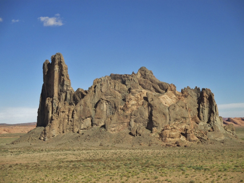
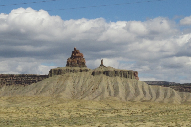
Continuing northeast through the Navajo reservation, geologic history continued to unfold in the tiers of sandstone layer-caked in bands of red, bright orange-red, pink, and greyish-white, Baby Rocks with weirdly formed monadnocks dotting the landscape (monadnock: an isolated rock hill, knob, ridge, or small mountain that rises abruptly from a gently sloping or level surrounding plain).
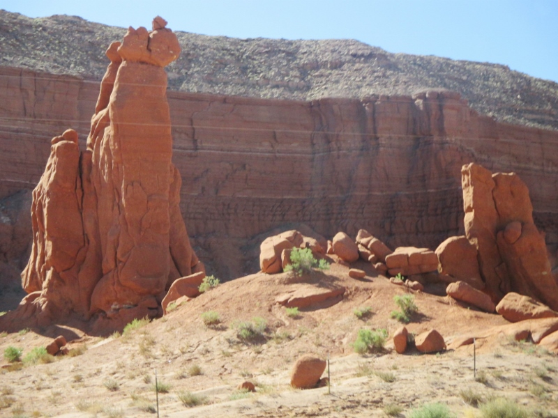
Elephant ToesErosion reduces plateaus to mesas, mesas to buttes, and buttes to pinnacles. Every formation was interesting,
More rocks – I really like rocks!with the stories of mud, dinosaurs, inland seas and lagoons, wind, sea creatures, and sand dunes told in the structures left behind.
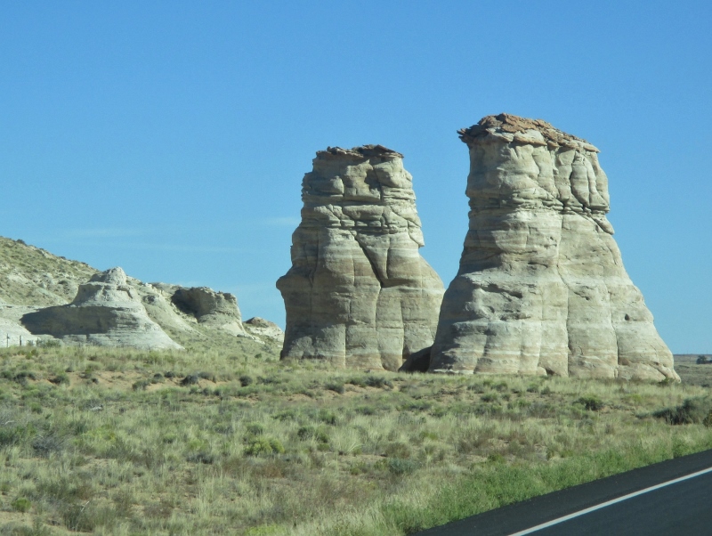
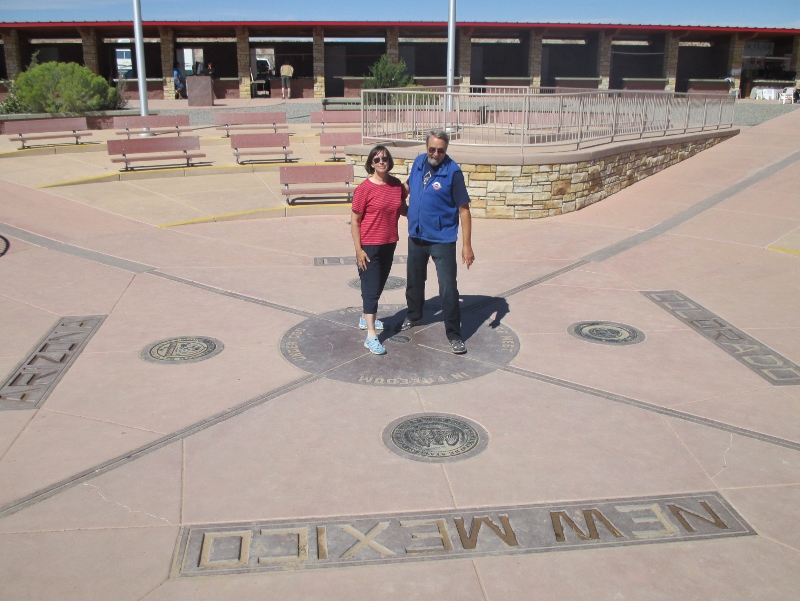
PinnaclesBy lunchtime we reached Four Corners, the point where the states of Arizona, Colorado, New Mexico, and Utah meet. It is the only point in the United States shared by four states, and in addition it marks the boundary between two Native American governments, the Navajo Nation to the south (which maintains the monument and charges for entrance as a tourist attraction) and the Ute Mountain Ute Tribe Reservation. Like everyone else there, we had our photo taken:
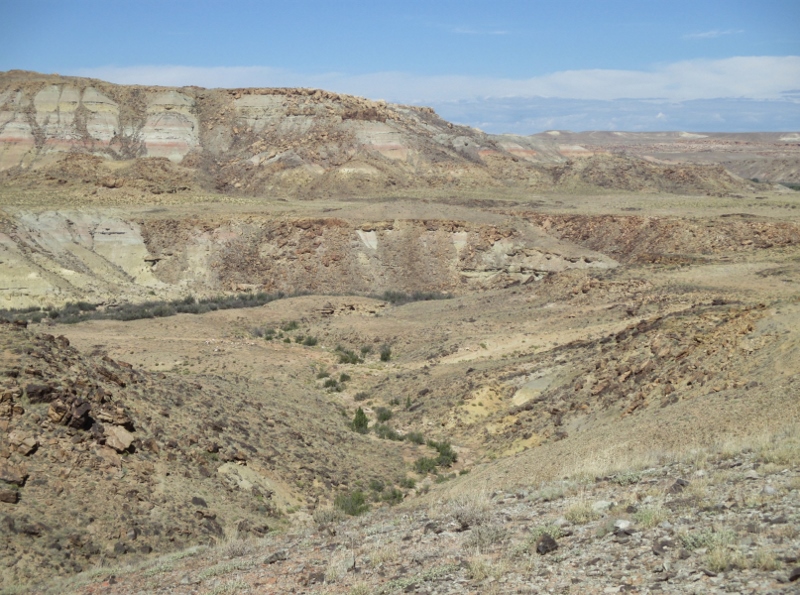
Us at Four Corners The rock here changed from mostly red to mostly grey sandstone,
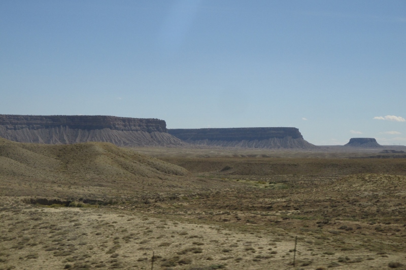
Looking toward Utah, Dakota sandstoneand as we drove into southwestern Colorado we found broad sweeps of mesas
Colorado mesasand fewer of the bizarre monadnocks.
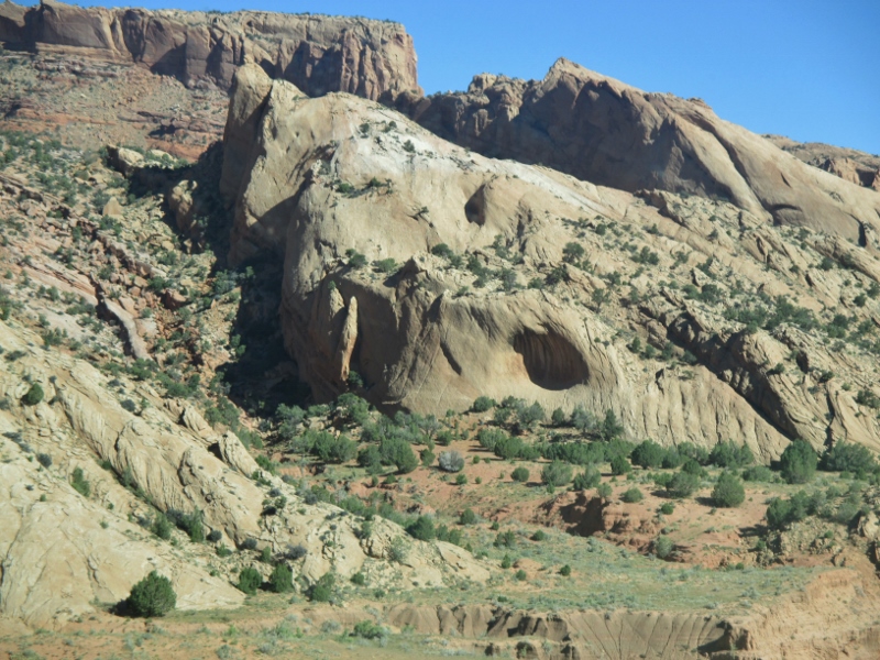
Monadnock
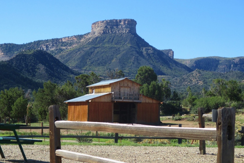
Our RV park is located just outside the entrance to Mesa Verde National Park, and from our site we have a stunning view of the eponymous mesa.
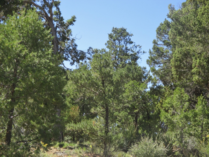
Mesa VerdeThis morning we took a bus excursion called The 700 Years Tour to learn about the Ancestral Pueblo people who lived here. We had an excellent guide, an anthropologist/ biologist recently retired from 30 years with the National Parks System and equally conversant in the geology, archeology, flora and fauna of the park. We drove to and along the top of the mesa, carpeted with a dwarf juniper-piñon forest.
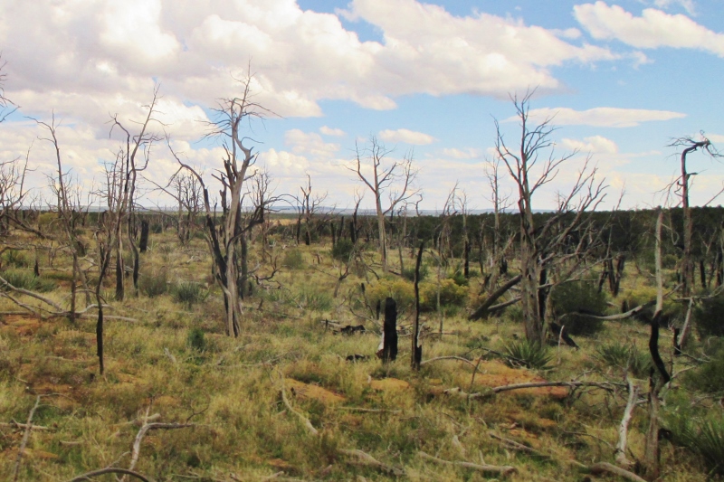
Dwarf juniper-piñon forestUnfortunately this part of Colorado has suffered drought for all but one of the past 17 years, which caused lightning-struck fires through two-thirds of the forest, so most of it now looks like this:
Dead dwarf juniper-piñon forestBecause both juniper and piñon trees branch out immediately above the ground, a forest fire doesn’t just burn the needles or leaves at the treetops, it scorches everything down into the ground, including all the microbes and worms and everything. They estimate it will take 300-400 years for these forests to recover.
The mesa is not actually a mesa but a cuesta – an important distinction because a cuesta is not level, it slopes to one end. This cuesta slopes to the south, providing ideal growing conditions for the Puebloans as they transitioned from hunter-gatherers to farmers. You’d think that would be a good thing, right? But actually hunter-gatherers were healthier and had life easier: because they ate basically meat and veggies (the “paleo” diet), they were taller and healthier, had better teeth and fewer children (average two) because the women had so little body fat they rarely ovulated, and worked only about 19 hours a week to sustain themselves. As corn, beans, and squash (carbs) were introduced and became staples, women gained body fat and gave birth every year from the onset of menses until a young death – they have not yet found a female skeleton over the age of 30.
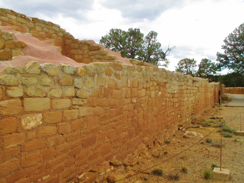
The Mesa Verde area was settled by 400 AD, and we saw evidence of early semi-subterranean “pit” houses with walls and roofs of mud, clay and grasses. Later they started building masonry walls and integrated villages rather than scattered homes. They developed pottery and replaced spears with bows and arrows.
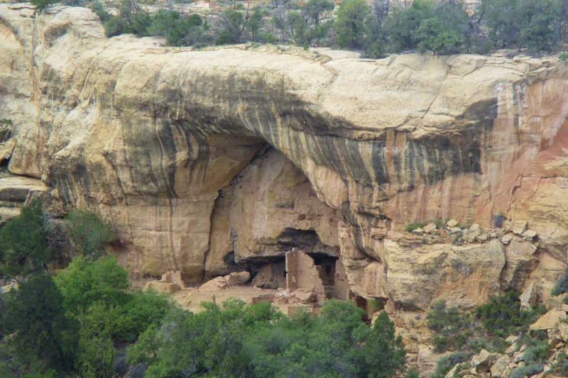
We visited a structure called the Sun Temple, built over a period of some 20 years around 1200 AD and never finished. It’s large and finely crafted, obviously a ceremonial center.Sun Temple The theory is that some change was taking place for the Pueblo people and maybe they were appealing to their gods for assistance or relief. Around this time they all started moving from the top of the cuesta to alcoves in the rock sides, spaces created by sandstone sitting on a shale (hardened ocean bottom) shelf where water had accumulated to carve out the alcoves from the softer sandstone.
Sandstone alcove with cliff dwellingsWhy did they move? Unknown. Because the population had grown so large that all the top of the cuesta was needed for crops, or for better protection from the elements, or for defense? Whatever the reason, they brought their masonry skills to the construction of complicated and elaborate pueblos in these alcoves, not just a few but many, many pueblos in many alcoves.
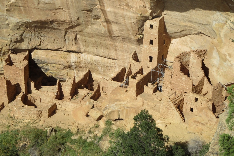
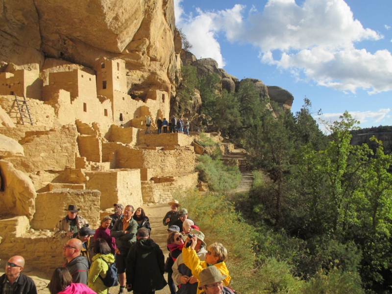
Square Tower House Our last stop was Cliff Palace, and there we climbed down the cliff to see it up close.
Cliff PalaceGoing down was steep and precarious – no OSHA rules here! (Our guide told us they were grandfathered in.) In the picture above, it looks like a dollhouse – here’s one with people to show the scale:
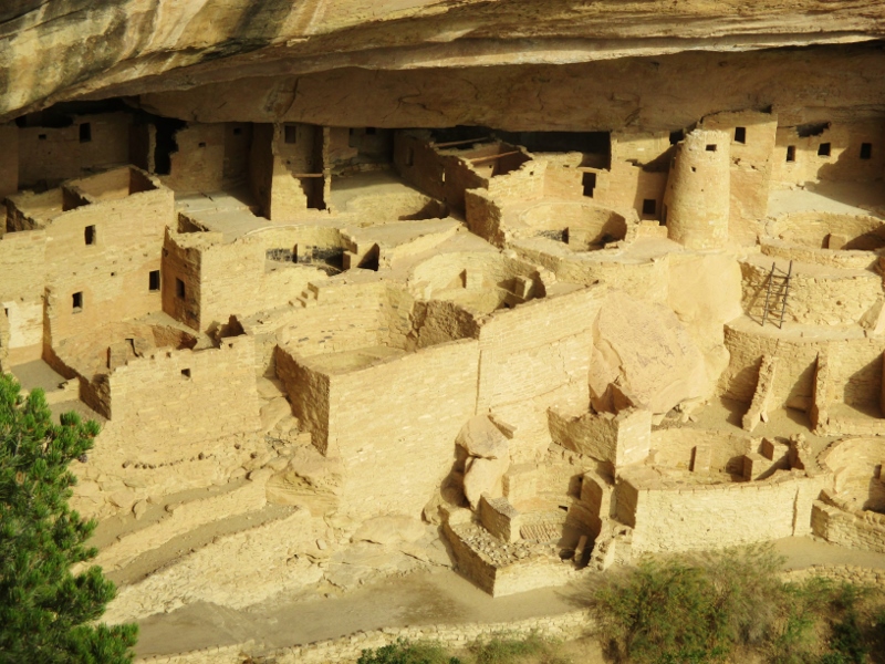
Cliff Palace with peopleThis multi-storied pueblo is south- and southwest-facing, providing greater warmth from the sun in the winter, had 200 rooms, including storage rooms, open courts, walkways, and 23 kivas (round, below-ground ceremonial and communal gathering rooms). Many of the rooms had been plastered and brightly painted, with art on the walls. Standing right next to where these people lived a thousand years ago was mind boggling.
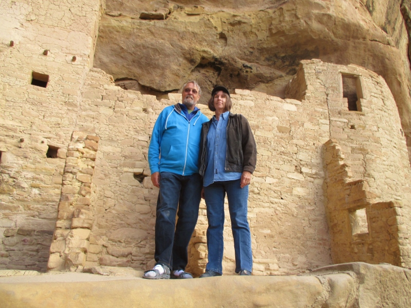
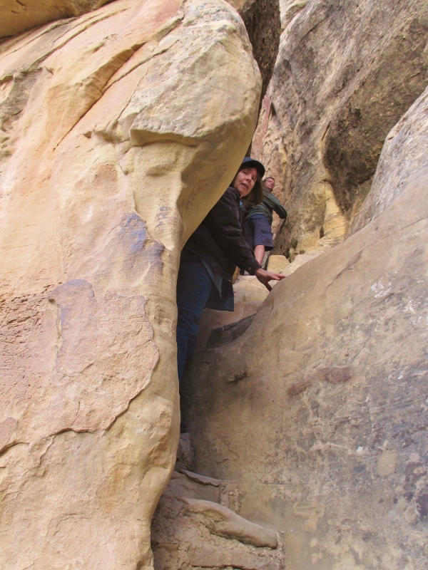
Patrick & Carol in the Cliff PalaceThen we climbed back up, and the way out was even more perilous than the trail down.
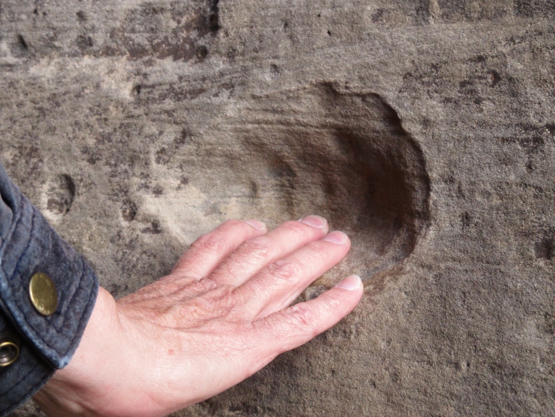
The exitWe used the same handholds that the Puebloans had carved out of the rock and worn with their fingertips when they went up and down the cliffs even before they moved into the alcoves.
1000+ year-old handholdsThey lived in these cliff dwellings for only about 80 years; by 1300 all the people were gone – no one knows why. The last quarter of the 13th century was dry, but they had survived droughts before. It was also unusually cold; this was the time of the mini-ice age in Europe. They probably went south to New Mexico and Arizona and became or merged with today’s Zuni, Laguna, and Acoma people. Our guide told us that when he has asked people from those tribes what their traditions tell them about why their ancestors left, they say: It was time to go.